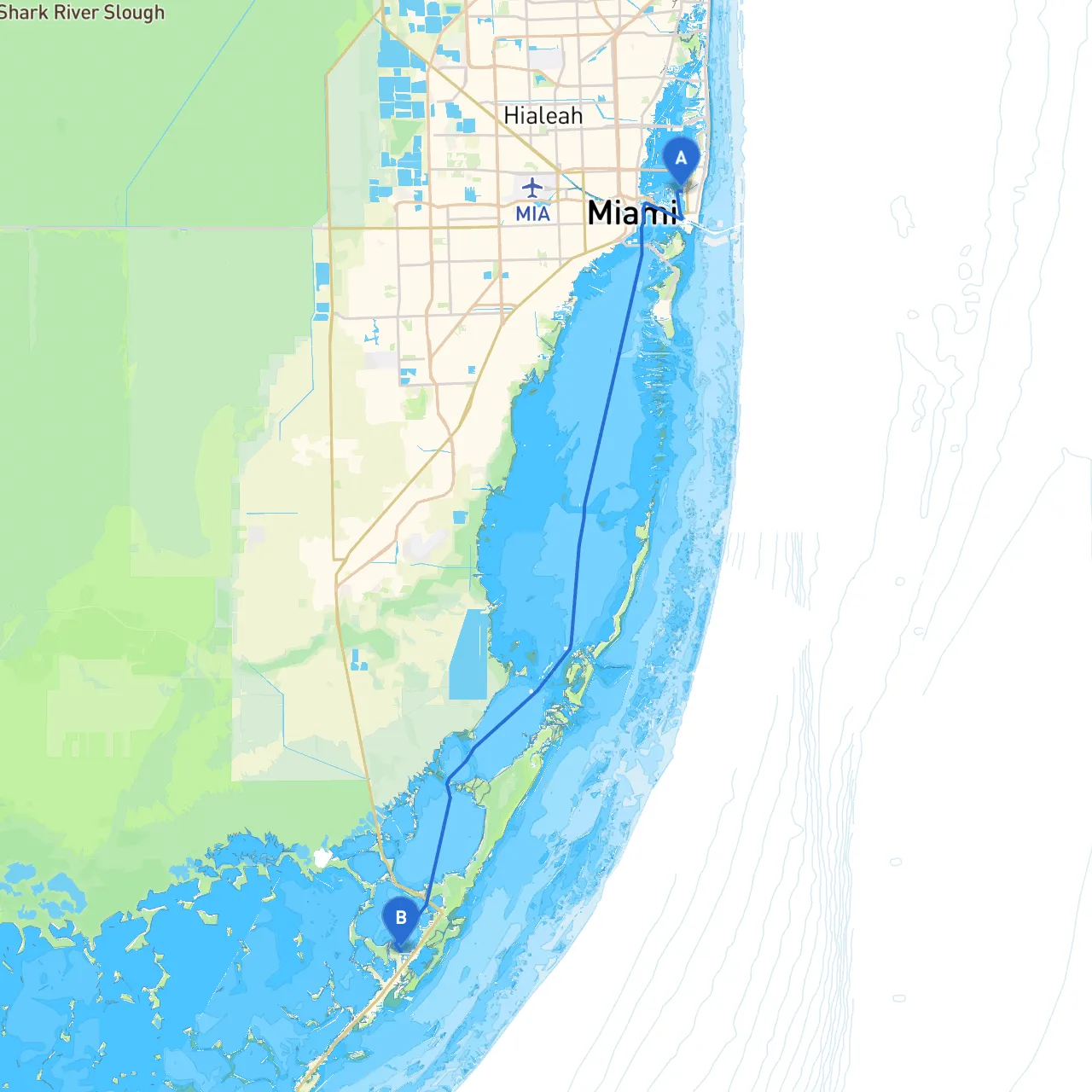
Pilotage Plan: Miami Beach, Florida to Key Largo, Florida
Overview This beautiful boating journey from Miami Beach to Key Largo offers a scenic exploration of the Florida Keys, replete with stunning views, diverse marine life, and engaging activities. Ideal for cruisers and recreational boaters with some experience, this route incorporates both open water and shallow areas, demanding attention to navigation and safety.
Route Description
Starting Point: Miami Beach, FL Coordinates: (Long: -80.14695, Lat: 25.792617)
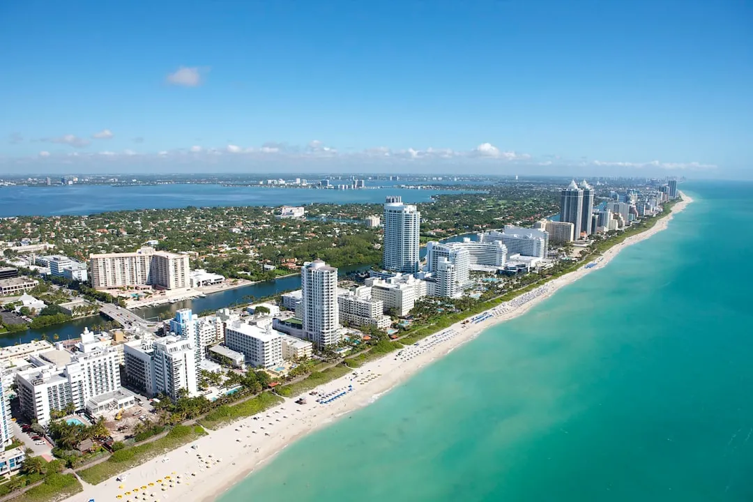
Your adventure begins at Miami Beach, a vibrant and trendy destination known for its beaches and cultural diversity. Before setting off, make sure to check weather conditions and local tides, as they can significantly influence your journey.
Leg 1: Miami Beach to Biscayne Bay Distance: Approximately 5 nautical miles
Leaving Miami Beach, head south and trace the coastline along Collins Avenue. Keep an eye out for the prominent markers near Government Cut, which serves as an entry point to the Port of Miami. As you glide past, take in views of the Magic City skyline.
Once through Government Cut, make your way into Biscayne Bay. This area is known for its shallow waters and occasional strong currents, so proceed with caution. Noteworthy landmarks include Star Island and the Biscayne National Park entrance. You can anchor or stop in various spots along Biscayne Bay for swimming, exploring, or even enjoying a picnic on nearby islands like Stiltsville.
Shelter Option: If the weather turns unfavorable, head to the north end of Biscayne Bay near Matheson Hammock Park, where you’ll find good shelter from winds.
Leg 2: Biscayne Bay to Card Sound Distance: Approximately 12 nautical miles
As you continue into Card Sound, position yourself to make your way through the striking waters of the Florida Keys. The navigation here becomes vital; be mindful of the charted paths to avoid areas where the depth drops dramatically. Watch for local fishing boats as you navigate, especially near the mangroves which are full of life.
During this leg, glide past some of the stunning waterfront estates and keep a lookout for the iconic Florida fauna, such as dolphins and sea turtles.
Points of Interest: Consider stopping at the Harry Harris Park for a quick swim or a stroll on the beach. This local gem is also a great refuge should you need a break from cruising.
Leg 3: Card Sound to Key Largo Distance: Approximately 10 nautical miles
Now, approach the final stretch toward Key Largo. Be vigilant as you navigate between the markers, particularly at the James and Lignumvitae Keys. The waters are generally calmer here, but good seamanship is still essential.
As you near Key Largo, you will see the stunning coral reefs right off the coast, an attraction for snorkelers and divers alike. Key Largo is known as the "Diving Capital of the World," so you might consider joining a dive charter or simply dropping anchor to enjoy the underwater beauty.
Final Approach and Destination: Key Largo, FL Coordinates: (Long: -80.4132, Lat: 25.140667)
Arriving in Key Largo, you’ll find a plethora of dining options and marinas. The area is famous for John Pennekamp Coral Reef State Park, where you can explore vibrant marine ecosystems.
Shelter Options: Should inclement weather arise while anchoring at Key Largo, several marinas and yacht clubs can offer safe harbor.
Navigational Aids and Safety Considerations
This route from Miami Beach to Key Largo embodies scenic beauty while prioritizing safety and navigational sensibility. As you embark on this journey, be prepared, stay vigilant, and savor the unique charm that the Florida Keys have to offer! Enjoy your trip!