
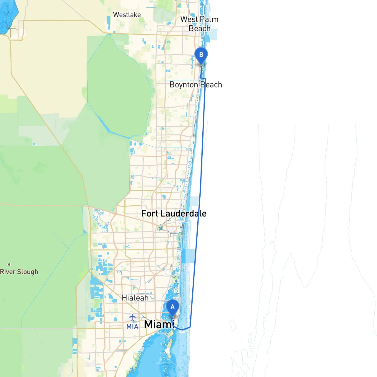
This cruising itinerary will guide you from the vibrant shores of Miami Beach to the serene coastal town of Lantana. Stretching over approximately 30 nautical miles along one of Florida's most stunning coastlines, this route is best suited for intermediate to advanced boaters due to the potential for changing weather conditions and the navigation challenges in busy waters. The journey presents a blend of coastal beauty, intriguing landmarks, and vital safety considerations, making it an unforgettable adventure.
Starting Point: Miami Beach, FL Coordinates: Long/Lat -80.14695, 25.7926166667
As you set sail at Miami Beach, take a moment to appreciate the bustling cityscape and the beautiful beaches. Before leaving, ensure you have all your safety equipment onboard, including life jackets, a first aid kit, a VHF radio, and a fire extinguisher.
Navigational Considerations:
As you head north, make your way through Biscayne Bay, a scenic gem that offers several sheltered islands and inlets.
Points of Interest:
Shelter Locations:
Navigational Tips:
After enjoying the sights of Biscayne Bay, continue your journey toward Lake Worth Inlet. This area marks the transition from the bay to the more open Atlantic waters.
Approach Considerations:
Once you're through Lake Worth Inlet, the open Atlantic Ocean greets you. This stretch involves a solid 10 nautical miles of coastal cruising.
Navigational Landmarks:
Important Navigational Aids:
Local Restrictions:
Destination: Lantana, FL Coordinates: Long/Lat -80.04745, 26.5825666666667
As you approach Lantana, the tranquil vibe of this cozy town welcomes you. The Lantana Municipal Beach is a fantastic place to relax, enjoy a meal, or take part in local activities.
Post Arrival Tips:
Throughout your journey, always prioritize safety: stay aware of weather updates, keep your navigation devices handy, and communicate your plans with someone on land. Make sure to check tide charts and pay attention to the local marine radio channels for updates.
In terms of navigation tools, consider using navigation apps like Savvy Navvy, Navionics, or Windy. These will provide you with real-time updates on tides, weather, and navigation aids.
Embarking on this journey not only leads you to new destinations filled with natural beauty but also fosters invaluable boating skills and experiences. Enjoy the trip and always stay vigilant out on the water!