
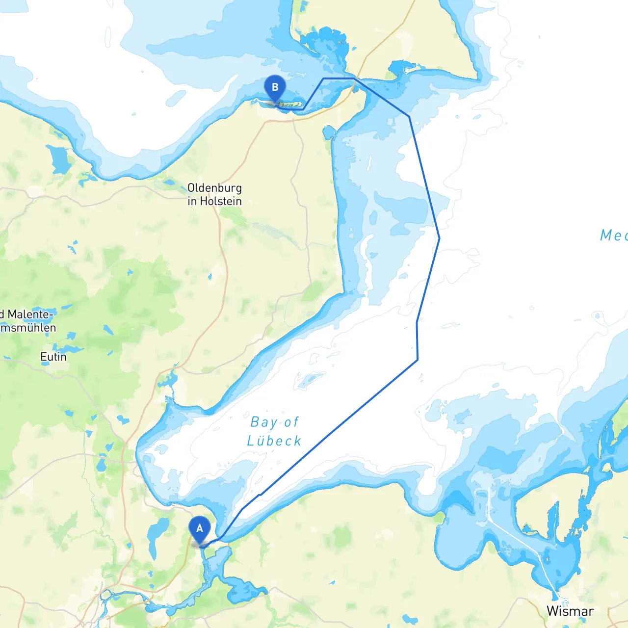
This route from Lübeck to Heiligenhafen offers a delightful mix of scenic landscapes, navigational challenges, and points of interest. It is particularly suited for sailors and powerboaters with an intermediate skill level, as it combines open water navigation and some sheltered inland passageways.
Lübeck, located at 10.856518596410751 long/lat 53.95265748406335, is a captivating city famed for its Hanseatic history. Ensure that your vessel is prepared for departure, checking equipment such as life jackets, radio, and navigation aids.
Upon leaving Lübeck, navigate through the Trave River, keeping a lookout for the vessels returning from the Baltic Sea. The river can be busy with commercial traffic, so be prepared for some maneuvering. The main hazard here is sizable river currents, especially during ebb tide; it's advisable to plan your departure around slack water. Pay attention to local traffic rules and respect any right-of-way situations with larger vessels.
1. Lighthouse at Travemünde: This is a crucial landmark, guiding boaters safely out of the Elbe-Lübeck Canal and into the open sea. It marks the entrance to the Lübecker Bucht.
2. Navigational Buoys: Follow the designated buoyage systems carefully, especially in the busy shipping lanes. Always maintain a safe distance from the buoys and respect their associated waters to avoid grounding.
3. Depth Charts: Keep an eye on the depth and ensure you have updated charts. There are shallow spots as you approach the inland passages, particularly around the islands in the area.
Arriving at Heiligenhafen, positioned at 10.979949831962585 long/lat 54.376423803039835, offers a vibrant harbor town enriched with culture and activities. Enjoy the local seafood offerings and the scenic walks along the promenade after securing your vessel at the marina.
For navigation and planning, consider using apps like Savvy Navvy for easy route planning, as well as Navionics and iNavX for detailed charts and navigational tools.
Choosing this route not only guarantees a safe passage with plenty of opportunities to take refuge, but it also immerses you in the stunning natural beauty of the Baltic coast. Whether you are in a sailboat enjoying the wind in your sails or a powerboat gliding smoothly along the surface, this trip elegantly combines adventure and relaxation on the water.