
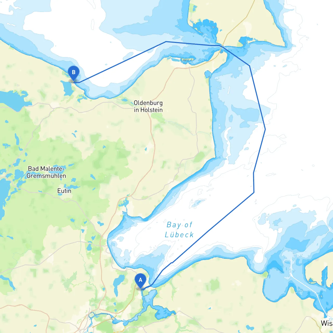
Embarking on a journey from Lübeck to Behrensdorf offers an enchanting experience along the picturesque western shore of the Baltic Sea. The trip spans approximately 35 nautical miles, and while the route is primarily confined within protected waters, it does present navigational challenges and opportunities for exploration. This itinerary is best suited for experienced cruisers keen on scenic routes while prioritizing safety and diligence in navigation.
Navigational Notes:Starting from Lübeck, head southeast toward Travemünde, navigating the Trave River. The river mouth can be swift, so maintain a close watch on currents and local shipping traffic. As you approach the harbor, familiarize yourself with the local pilotage practices, as they regulate significant shipping traffic.
Points of Interest:
Navigational Notes:Leaving Travemünde, set your course north along the coast. Look out for navigational aids like buoys marking safe channels to guide your way. Be attentive in areas with fishing vessels and recreational boaters, especially during weekends.
Shelter Options:
Activities:
Navigational Notes:As you depart Neustadt, maritime markers will guide you through the shallow waters of the Bay of Lübeck. Be vigilant, as the water depth can change and underwater obstacles may exist. Utilize updated charts or apps like Savvy Navvy that can offer optimal routing insights.
Stopovers:
Navigational Notes:Your final leg takes you northwest to Behrensdorf. The landscape becomes increasingly idyllic as you approach the destination. The depth remains a crucial factor as you near the shorelines, with sandbars present in some areas. Utilize coastal points and landmarks to keep your bearings accurate.
Final Destination:
This cruise from Lübeck to Behrensdorf encapsulates the charm of the Baltic coastline while remaining mindful of safety protocols and navigational precision. It is perfect for seasoned boaters looking for a blend of adventure, scenic beauty, and peace, with the potential for local cultural engagement at each stop. A vigilant approach to the route ensures a memorable journey while enjoying the diverse offerings of this coastal route. Happy cruising!