
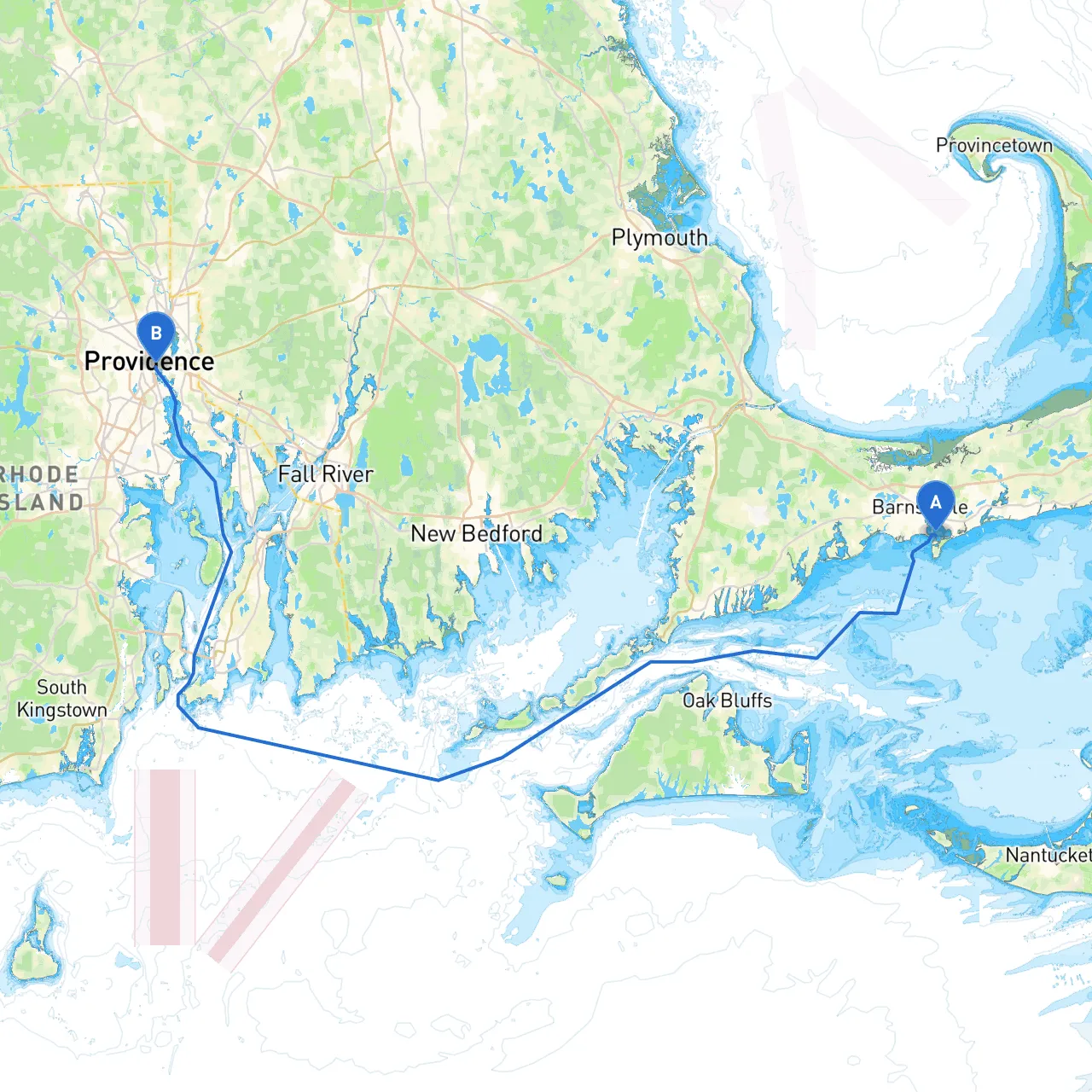
Route Overview:This journey from Hyannis to Providence offers a blend of scenic beauty and coastal navigation, ideal for the experienced cruiser who appreciates both the thrill of the water and the security of well-charted routes. The approximately 30 nautical mile trip takes you along the Cape Cod coast, across picturesque bays, and up the Rhode Island shoreline, providing numerous opportunities for safe harbors and eye-catching landmarks.
As you set sail from Hyannis, you'll be surrounded by the vibrant atmosphere known for its bustling ferry terminal and the picturesque views of the port. Before leaving, familiarize yourself with the local NOAA charts and verify your vessel's readiness for the journey ahead.
The final stretch involves careful navigation up Narragansett Bay, a bustling waterway known for recreational boat traffic and occasional commercial shipping. As you approach Providence, pay attention to the Bristol and Warren Points, which are crucial navigational waypoints.
1. Use of Charts: Always refer to the latest editions of NOAA charts and local information. Apps like Savvy Navvy can assist in route plotting and provide real-time updates.2. Markers and Buoys: Abide by all local navigational aids, which are well-placed and easy to follow. Be particularly vigilant in crowded areas.3. Speed Limitations: Respect the speed limits posted in certain areas such as near harbors, as they are often strictly enforced.4. Visibility and Tides: Monitor the weather conditions as visibility can change rapidly along this route. Check the tidal charts beforehand to time your entry into the Providence River appropriately.
This route is particularly suitable for cruising enthusiasts who relish the idea of both exploration and concentrating on safety. From beautiful harbors and cultural hot spots to expansive bays with ample cruising space, this trip has it all. While the journey includes potential hazards, with keen navigation and respect for local regulations, you're set for a memorable experience that balances the thrill of the open water with the safety of well-marked routes.
By ensuring preparation, employing reliable navigation tools like Savvy Navvy, and understanding local waters, this trip can be one of the highlights of your boating adventures. Enjoy the journey, and safe sailing!