
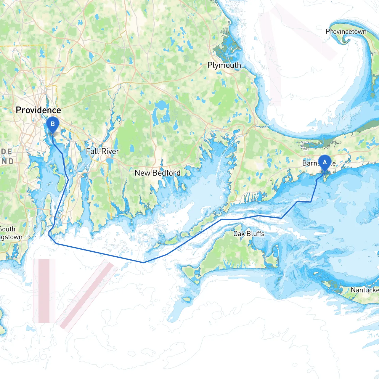
This route from Hyannis to East Providence offers a delightful blend of beautiful coastal scenery, protected bays, and a handful of engaging local attractions along the way. It’s well-suited for leisure boaters looking to enjoy the New England coastline while ensuring safety is paramount.
Hyannis is bustling with activity and serves as a perfect launch point. Before you set out, it's worth exploring the charming shops, restaurants, and the iconic Cape Cod Maritime Museum. Make sure to check the weather conditions, local tides, and ensure your navigational equipment is functionally sound.
After leaving Hyannis, head west toward Barnstable Harbor, keeping a lookout for the navigational aids along the way. The harbor is an excellent shelter in case of adverse weather; its relatively deep waters provide comfort in rough conditions.
Notable Features: Barnstable Harbor is bustling with the activity of fishing boats and pleasure crafts. Stop at nearby Hyannis Port for a walk, where you can take in the beautiful beach views and grab a bite to eat at a local seafood restaurant.
Continue heading west, ensuring you follow the buoys carefully, as this stretch can be affected by shifting sandbars. Navigational Aids: Pay attention to the red and green markers signaling safe passage through the various channels.
Points of Interest: Sandwich Town Marina offers docking facilities where you could take a break and visit the Sandwich Glass Museum. The charming historic district is a short bike ride away, perfect for an afternoon of exploration.
As you navigate through Scorton Creek, be vigilant of the tides, particularly at low tide when depths can change quickly. This is a highly scenic route, and the creek provides wonderful spots to anchor and unwind.
Sheltering Options: If conditions worsen, Scorton Creek offers relatively calm waters where you can safely wait it out.
Transit to Sage Lot Pond can be a serene experience away from more crowded areas. Still, ensure you're following the prescribed channels.
Local Appeal: Sage Lot Lagoon offers tranquil spots to grab lunch or a quick swim. It’s a great place to recharge before continuing your journey.
This leg takes you into more open waters, where it's crucial to maintain a keen watch for larger vessels and ensure safe passing distances. Important Aids: Watch for the formidable Newport Bridge; it's a notable landmark to guide your approach. Be mindful of the prevailing currents and wind patterns, as they can affect your heading significantly.
Newport Attractions: If time allows, Newport offers an array of activities, from touring the famous mansions to enjoying live music at local venues. It’s a worthwhile stop!
As you approach the entrance to the Seekonk River, prepare to adjust your course according to local traffic and navigational signage. East Providence is on the opposite side of the bridge and should present a scenic final approach as you pass by lush landscapes.
By adhering to this pilotage plan, you’ll embark on an enriching journey that balances safety with scenic exploration. Enjoy the voyage!