
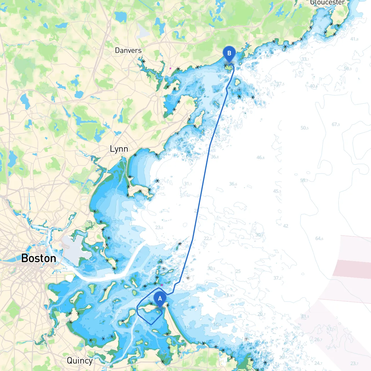
Embarking on this delightful cruising journey from Hull, Massachusetts to Salem not only sets the stage for a beautiful day on the water but also presents an opportunity to experience the scenic coastline and historic landmarks of the area. This trip is well-suited for a cruising boater, ranging from experienced to moderately skilled, ensuring safety with proper planning and awareness of navigational aids and weather conditions.
You’ll start your adventure in Hull, known for its charming beaches and the picturesque Hull Gut. Ensure your vessel is well-equipped and check the weather for any impending changes. Set your course to head towards the open waters of Massachusetts Bay.
1. The Hull Gut - As you leave Hull, navigate through the Hull Gut, a channel that separates Hull from the mainland. Be aware of the tidal currents here; a flowing current can create choppy seas.
2. Boston Harbor - Venturing into Boston Harbor offers busy but organized navigation through various sailing vessels, ferries, and barges. Maintain vigilant watch for commercial traffic and be mindful of navigational aids like buoys and markers, particularly the green and red can-buoys marking the channel's edges.
3. Point Allerton Lighthouse - On your way to Salem, make sure to note Point Allerton Lighthouse, standing proudly to your starboard. It’s an iconic navigation point and offers a picturesque backdrop for photos.
4. Bayside Shelters - Should weather conditions change, Marblehead Harbor or Salem Harbor can provide safe haven. Marblehead Harbor, in particular, is a favored spot due to its sheltered surroundings and quaint coastal village vibe.
5. Topsail Ponds - As you continue, consider making a brief stop at Topsail Ponds if conditions permit. This area is less frequented, offering serene water and a chance to unwind or explore the adjacent islands.
6. Arriving in Salem, MA - Approaching Salem, follow the buoys carefully as you enter the harbor. The waters here can be busy, especially near the popular Peabody Essex Museum and the historic waterfront.
- Upon arriving in Salem, you’re directly in the heart of Witch City. You can explore historic sites like the Salem Witch Museum, the House of the Seven Gables, or take a coastal walk along Derby Wharf.
This boat trip combines the allure of Massachusetts’ coastal beauty with safe navigation practices, cultural experiences, and natural wonders. By following this pilotage plan, boater will not only ensure a fun and relaxed outing but also prioritize safety and enjoyment throughout this stunning maritime journey. Before setting sail, make sure all crew members are briefed on safety protocols, and have a fantastic time on the water!