
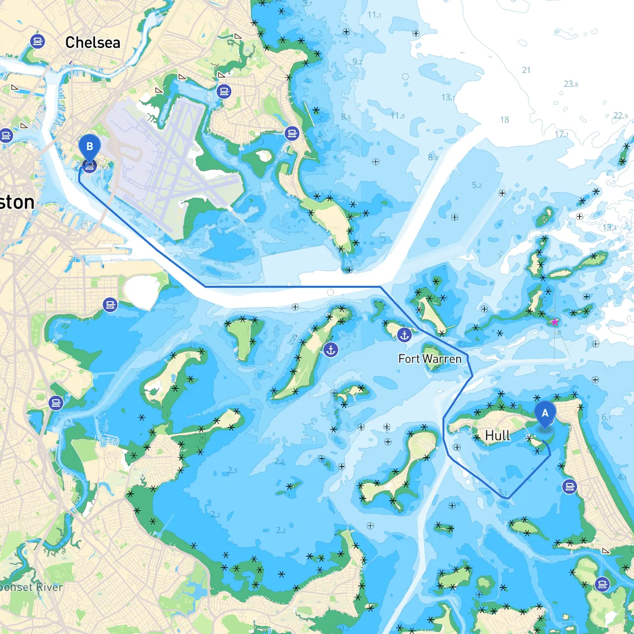
Setting sail from Hull, Massachusetts, a picturesque coastal town rich with maritime history and natural beauty, your journey to East Boston, MA, will take you through the beautiful coastal waters of Massachusetts Bay. This route is ideal for recreational boaters looking to enjoy a mix of serene landscapes, notable landmarks, and urban harbor navigation while prioritizing safety throughout the trip.
The distance from Hull to East Boston by water is approximately 13 nautical miles, which, depending on your vessel’s speed, may take around 2 to 3 hours under good conditions. Always allow extra time for possible delays, navigational challenges, or unpredicted weather changes.
As you embark on your journey, you will encounter several navigational aids essential for safe passage:
1. Hull Gut: Begin your departure from Hull Gut, navigating carefully through the channel as you exit. Watch for the buoys marking the route.2. Hingham Bay: You may consider a slight detour into Hingham Bay for shelter. The bay offers safe anchorages and is a great place to visit the local beaches or grab a bite.3. Nantasket Point: Keep Nantasket Point to your starboard as you pass; it is a recognizable landmark here. The area around is often busy; so maintain vigilance for other boats and swimmers.4. Buoy Markers: Pay close attention to the channel markers along the way, such as the bell buoy at the entrance to the Fore River, ensuring you remain within marked areas.
Prioritize safety by ensuring all onboard adhere to regulations regarding PFDs, carry appropriate safety equipment (like flares, a first aid kit, and a fire extinguisher), and maintain communication with other vessels using VHF radio channels.
To enhance your navigation experience, consider using savvy navvy alongside other trusted navigation apps, such as Navionics and NOAA’s Chart Viewer. These tools can provide you with real-time weather updates, tides, and crucial navigational data, ensuring a smoother and safer journey.
This route is perfect for boater types ranging from families enjoying a peaceful day on the water to experienced cruisers soaking in the views of Boston’s vibrant coastline, always mindful of safety and preparation. Enjoy your adventure!