
This route from Hull to Chelsea offers a beautiful combination of coastal scenery and urban landscapes. It is rich in points of interest and provides opportunities for safe refuge should the weather become inclement. This journey is particularly suitable for recreational boaters and day sailors seeking to explore the Massachusetts coastline while being mindful of safety and navigation.
Hull is a picturesque seaside town known for its beautiful beaches and, most notably, Nantasket Beach. Before departure, it’s wise to check the weather forecast and tide tables to optimize your trip. The Hull Lifesaving Museum is a lovely spot if time allows for a visit before you set sail.
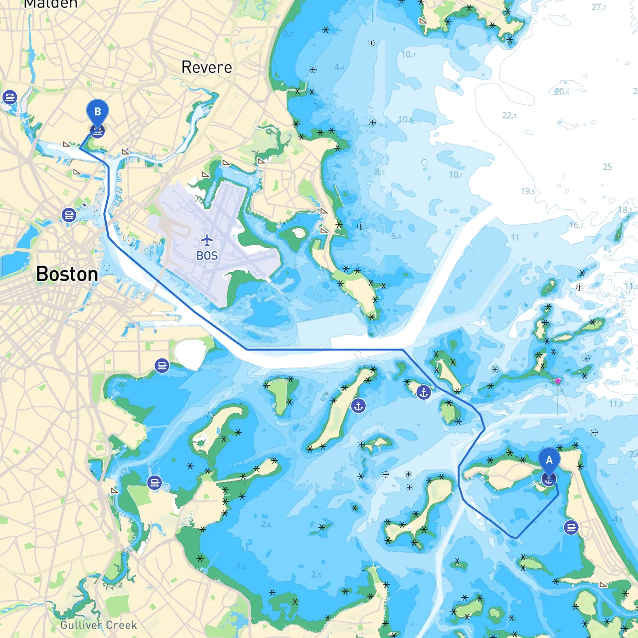
Your journey will primarily navigate through the calmer waters of Massachusetts Bay. The track from Hull to Chelsea is approximately 10 nautical miles and presents a stimulating range of sights from coastal wildlife to historical landmarks.
As you head out of Hull, you’ll pass by the iconic Hull Lighthouse on your starboard side. Maintain a close watch for recreational ship traffic, especially near popular areas like Nantasket Beach. Ensure you monitor your depth sounder as you navigate through areas with shifting sands and shallows.
While heading toward Hingham, keep an eye on the Hingham Shipyard, a notable landmark with various dining and shopping opportunities. This area can provide a place to dock and refuel both your vessel and your crew if you choose to stop. Make sure to respect local speed limits and keep a lookout for moored boats in the vicinity.
Hingham Harbor is a great backup in case of sudden weather changes. This harbor can provide a safe anchorage with good shelter from prevailing winds. If you're looking for a fun diversion, consider taking a brief land excursion to explore the nearby Derby Street Shoppes or the historic downtown area.
Leaving Hingham, continue your journey past the scenic Quincy Bay. This stretch of water can be quite picturesque, particularly as you look back at the horizon where the skyline of Boston begins to emerge. Monitor your navigational aids closely as you enter the more congested naval waters around the Fore River area.
The Fore River is an important navigational point where ship traffic may increase due to industrial shipping. Look out for navigational markers and give way to larger vessels. Should weather conditions worsen, you can tuck into nearby Anchor Cove for shelter.
As you make your way closer to Chelsea, keep following the Charles River channel towards your destination. The skyline continues to rise, creating a stunning backdrop. Be vigilant of commercial traffic and adjust your course accordingly.
Upon arrival in Chelsea, you’ll dock in a bustling urban area surrounded by accessible amenities and cultural sites. The Chelsea Waterfront offers beautiful views of the Boston skyline and is a perfect spot to unwind.
1. Navigational Aids: Throughout your journey, pay close attention to buoys and markers that define safe passage through channels, especially in busing waters near Hingham and Quincy. Familiarize yourself with the U.S. Coast Guard chart for this region—charts are indispensable in helping you locate potential hazards and navigational aids.
2. Local Regulations: Be mindful of local speed limits, including those near residential areas and wildlife sanctuaries, as these are strictly enforced.
3. Weather Monitoring: Utilize apps such as Savvy Navvy to keep track of real-time weather conditions, tide schedules, and more. Other helpful apps for navigation and marine information include Navionics and Windy.
This journey from Hull to Chelsea, while primarily straightforward, requires careful planning and adherence to safety practices. Approach it with a sense of adventure while remaining vigilant, and you will create lasting memories on this scenic maritime route. With numerous options for shelter and points of interest, it's a wonderful trip for sailors of all types to enjoy.