
Pilotage Plan: Hingham, Massachusetts to Plymouth, Massachusetts
Embarking on a nautical adventure from Hingham to Plymouth is a fantastic choice for both seasoned sailors and recreational boaters alike. This route traverses picturesque waters, rich in maritime history and natural beauty, while allowing for numerous opportunities to take refuge should the weather turn inclement.
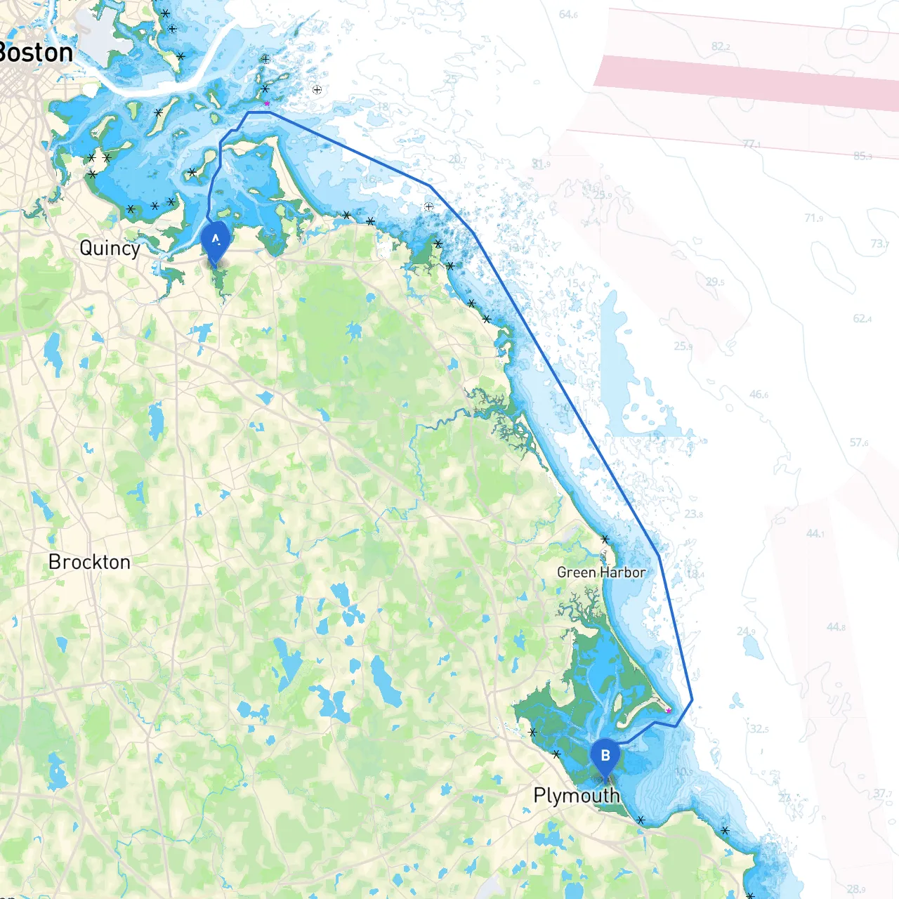
Starting Point: Hingham, MA (Coordinates: -70.9273, 42.2407) Hingham is well known for its charming harbor and is a fantastic starting point. Before heading out, ensure that your vessel is equipped with appropriate safety gear, including life jackets, flares, and a functioning VHF radio.
As you depart Hingham, it's crucial to navigate the local waters cautiously. Hingham Harbor is a busy area, so be on the lookout for nearby boats and commercial traffic.
Navigational Aids:
Following the coastline southward, you’ll round Hull, passing through the Hull Gut, a narrow channel that leads into Massachusetts Bay. Visibility can be limited at times due to traffic, so keep a lookout for marked navigation channels and pay attention to the tide.
Navigational Aids:
Once safely into Massachusetts Bay, your voyage to Plymouth becomes open and dramatic. This open water section can experience weather changes, so it’s essential to continuously monitor marine forecasts and listen to local weather updates.
Points of Interest:
As you approach your destination, begin to look for Plymouth Harbor — home to historical significance and natural beauty.
Navigational Aids:
Upon entering Plymouth, you will have a range of options for docking. The harbor is usually bustling with activity, so expect to adhere to boat traffic regulations and be mindful of the local boating community.
This route from Hingham to Plymouth is ideally suited for boaters who appreciate a blend of scenic beauty and historical landmarks while emphasizing safe navigation practices. The included resources, like savvy navvy, can be invaluable for route planning, dealing with any potential hazards, and keeping up with weather conditions.
Always ensure that you have updated charts and are aware of local restrictions, including any mooring and anchoring regulations, to preserve the pristine beauty of these waters. With the right preparation, your journey promises to be a memorable and safe experience on the water. Enjoy the adventure!