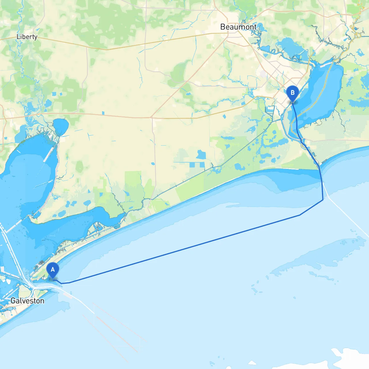
Pilotage Plan: Galveston, Texas to Port Arthur, Texas
IntroductionEmbarking on a boat trip from Galveston to Port Arthur offers an exhilarating opportunity to explore the Gulf Coast while navigating a relatively sheltered route filled with breathtaking sights and promising shelter from unpredictable weather. This plan is especially suitable for experienced boaters looking for a blend of natural beauty and safe navigation.
Route OverviewYour journey will roughly follow a path through the Galveston Bay and towards the Sabine Pass— a vital point for safe passage into the Intracoastal Waterway, eventually leading you to Port Arthur. The trip covers approximately 65 nautical miles and offers plenty of opportunities for both safety and exploration.
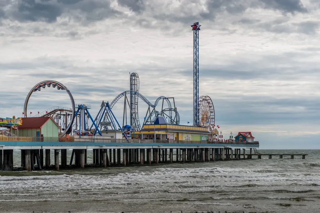
Leg 1: Departing Galveston Starting Point: Galveston, Texas (coordinates: -94.710291, 29.362187) As you leave Galveston, activate your charts with clear views of navigation aids like buoys and channel markers guarding the entrance to Galveston Bay. The bay can get busy, so keep a sharp lookout for commercial traffic, especially ferries.
Points of Interest:
Leg 2: Navigating Galveston Bay After departing Galveston, steer your vessel towards the North Pass buoy (GP1). The bay extends out with many shallows and channels, so using a quality nautical chart (digital or paper) is essential here.
Shelter Spot:
Leg 3: Heading Toward Sabine Lake Transition over to the shallow waters of the Intracoastal Waterway once you pass through the North Pass. Watch for the signs at the intersections of waterways; they can be deceptively confusing at times.
Important Navigational Aids: Pay close attention to the numbers of the ICW buoys. They help you navigate safely along the shorelines and avoid unmarked hazards. Look out for the Texaco Oil Tank Farm; steer past cautiously and maintain a safe distance from industrial areas.
Leg 4: Entering Sabine Lake After cruising through the Intracoastal Waterway, you'll enter Sabine Lake. This vast expanse is both beautiful and functional; the area is a rich ecosystem teeming with wildlife.
Shelter Spot:
Points of Interest:
Leg 5: Arrival at Port Arthur As you navigate towards the end of your journey, the waters will narrow, but they transition smoothly into the Port Arthur Canal. The Port Arthur area is bustling with industrial activity but remains a welcoming destination for boaters.
Local Regulations: You must adhere to the local shipping regulations upon entering the Port Arthur area. Watch for labor boats and commercial traffic. Maintaining VHF radio contact with the local coast guard is advisable, especially in this busy shipping area.
End Point: Port Arthur, Texas (coordinates: -93.923, 29.866833) Arriving at Port Arthur, you’ll find various facilities for boaters, from docking areas to fuel stations.
Safety Considerations As with any boating trip, safety first: always wear life jackets, check your equipment before departure, and stay updated with weather patterns. Familiarize yourself with the navigation aids along your route, as they are crucial for ensuring safe passage.
Recommended Applications For a smoother journey, consider using navigation apps such as Navionics, Aqua Map, and Savvy Navvy to assist with real-time navigation and sharing information with other boaters.
This boater-friendly route, through scenic waters and strategic pauses, offers an adventure filled with beauty and safety in mind. Happy sailing!