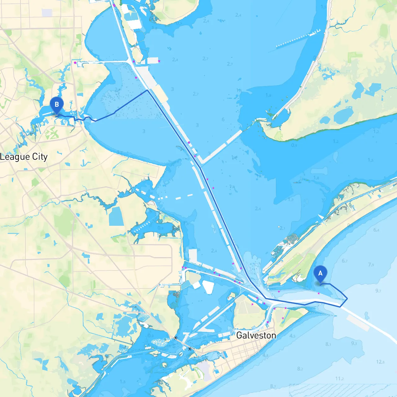
Pilotage Plan from Galveston, Texas to Kemah, Texas
Overview:This trip spans approximately 30 nautical miles and is ideal for intermediate to experienced boaters. The route primarily navigates through Galveston Bay, known for its scenic vistas and varied marine life, providing a safe harbor and views of local wildlife. Due to potential weather changes and waterway traffic, key attention will be on navigational aids, possible hazards, and suitable shelter bays along the way.
Starting from Galveston, the journey kicks off at the bustling Galveston Harbor, home to commercial vessels and leisure boats. Before setting off, it’s vital to check the latest weather updates and tide tables for current conditions. Galveston’s drawbridge can pose timing challenges, so be aware of the schedule to avoid waits.
Points of Interest:
As you leave Galveston, heading northward into Galveston Bay, pay close attention to the navigation markers. The bay is well-marked with daybeacons; however, the waters can get congested with both pleasure and commercial vessels.
Navigational Aids:
Cruise across Galveston Bay while observing the stunning views of the surrounding flora and fauna. Maintain a watchful eye for wildlife — dolphins and various bird species are common sights.
Important Hazards:
As you navigate through the bay, always have planned detour options in case the weather worsens. Offatts Bayou is a perfect sheltering spot with its calm waters, should winds intensify or storms approach.
Alternate Shelter Options:
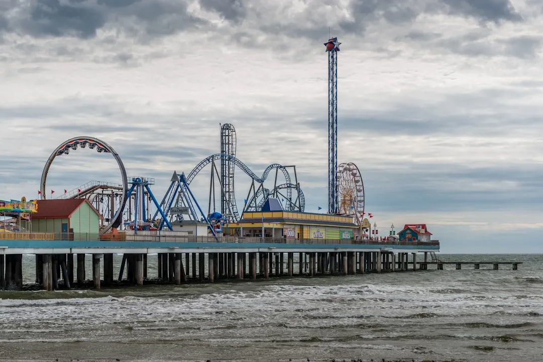
On approaching Kemah, you will be greeted by the iconic Kemah Boardwalk, a vibrant entertainment district by the water. As you enter the channel leading to Kemah, watch for marine traffic due to nearby fishing and yacht clubs. The Kemah Channel can be narrow and busy; exercising caution here is essential.
Local Attractions:
For a smooth sailing experience, utilizing navigation apps such as Savvy Navvy can enhance your trip, providing real-time navigational data, weather updates, and tide information. Other helpful apps include Navionics for charting your course and Windy for weather tracking.
This route from Galveston to Kemah combines the thrill of navigation with the tranquility of nature, making it an unforgettable experience infused with both safety and adventure. Enjoy your journey!