
Pilotage Plan: Galveston, Texas to Baytown, Texas
Introduction
Set sail from the lively shores of Galveston and chart a course to the charming city of Baytown. This cruise offers a scenic, safe route ideal for recreational boaters, both new and experienced. You'll glide along the Texas coastline and through intriguing waterways while keeping an eye out for notable landmarks, potential shelter bays, and navigational aids.
Route Overview
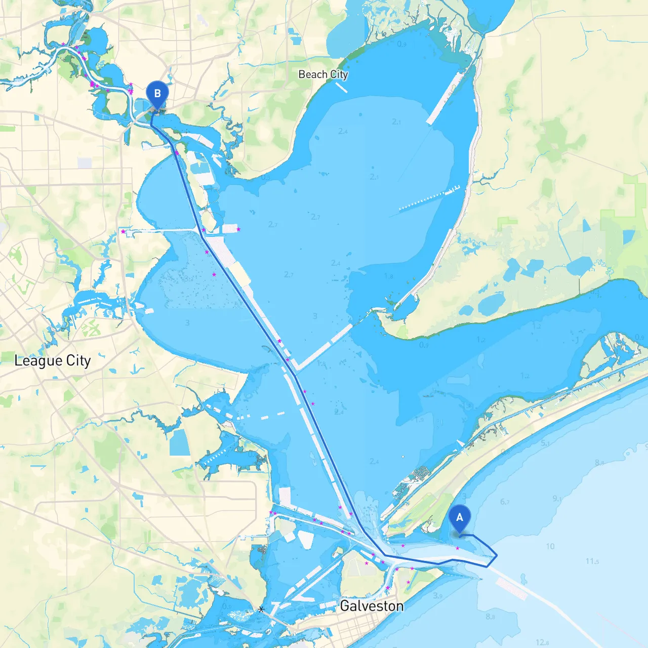
The journey from Galveston to Baytown spans approximately 36 nautical miles. The route generally follows the Texas coastline with portions through Galveston Bay and the Houston Ship Channel. Conditions can vary, and while the waterway can be serene, it bears navigational challenges such as commercial shipping traffic and changing weather patterns.
Leg 1: Galveston to the Houston Ship Channel Entrance
Begin your adventure at Galveston, a bustling port city known for its rich maritime history. Before you leave, check the local tide reports and weather conditions. As you make your way towards the mouth of the Houston Ship Channel, keep an alert eye on navigational markers; they are vital given the busy maritime traffic in this area. The entrance to the channel is denoted by marker buoys that provide both direction and warning of nearby vessels.
Point of Interest: Pelican Island
Just to the north, Pelican Island offers a quick detour for any interested boaters. Here, you can witness myriad bird species, making it a delightful spot for wildlife enthusiasts. If time permits, consider a short stop to stretch your legs and enjoy the views of Galveston from the water.
Leg 2: Navigating the Houston Ship Channel
As you enter the Houston Ship Channel, exercise caution. This section can be busy with large ships maneuvering, so maintain monitoring VHF radio Channel 13 (the working channel for vessel traffic) to stay informed about vessel movements. Watch for the lit buoys that mark the channel's edges and follow the established paths to avoid sandbars and shallow spots.
This part of the trip is highly suitable for experienced boaters who can handle busy waters, but remember to respect maritime traffic rules and give way to larger vessels.
Shelter Bay: Clear Lake
If the weather turns, head towards Clear Lake to the north along your route, which serves as an excellent place to take shelter. It is large enough to accommodate several vessels and provides a calm anchorage during unexpected storms.
Leg 3: From the Houston Ship Channel to Baytown
Once you pass through the Houston Ship Channel, it’s time to navigate toward Baytown. The waters are generally calm, but pay attention to the convergence of the Channel and local yacht traffic near the Baytown area. You will begin to see more recreational boats, making the scenery lively but also necessitating a heightened sense of awareness.
Navigational Considerations
Key navigational aids along the way include:
Local Restrictions
Before heading out, check for any local fishing regulations if you plan to cast a line along the route. Additionally, be aware of any speed limits in the residential areas of Baytown, where a no-wake zone may apply.
Points of Interest in Baytown
Once you reach Baytown, the attractions are aplenty. Check out the Baytown Nature Center, perfect for family activities with its trails and wildlife observation decks. The historic downtown area also offers quaint shops and local eateries to explore.
Closing Thoughts
This route is perfect for recreational boaters who enjoy the thrill of navigating through both serene and busy waters. It's a great way to experience the coastal beauty of Texas while staying safe. Always be prepared for sudden weather changes and have your safety gear readily available. For ease of navigation and updated route conditions, consider using savvy navvy and other boating apps designed to keep you informed.
Enjoy your time on the water, and may your journey bring you calm seas and favorable winds!