Pilotage Plan: Fort Myers Beach, Florida to Fort Myers, Florida
Route Overview
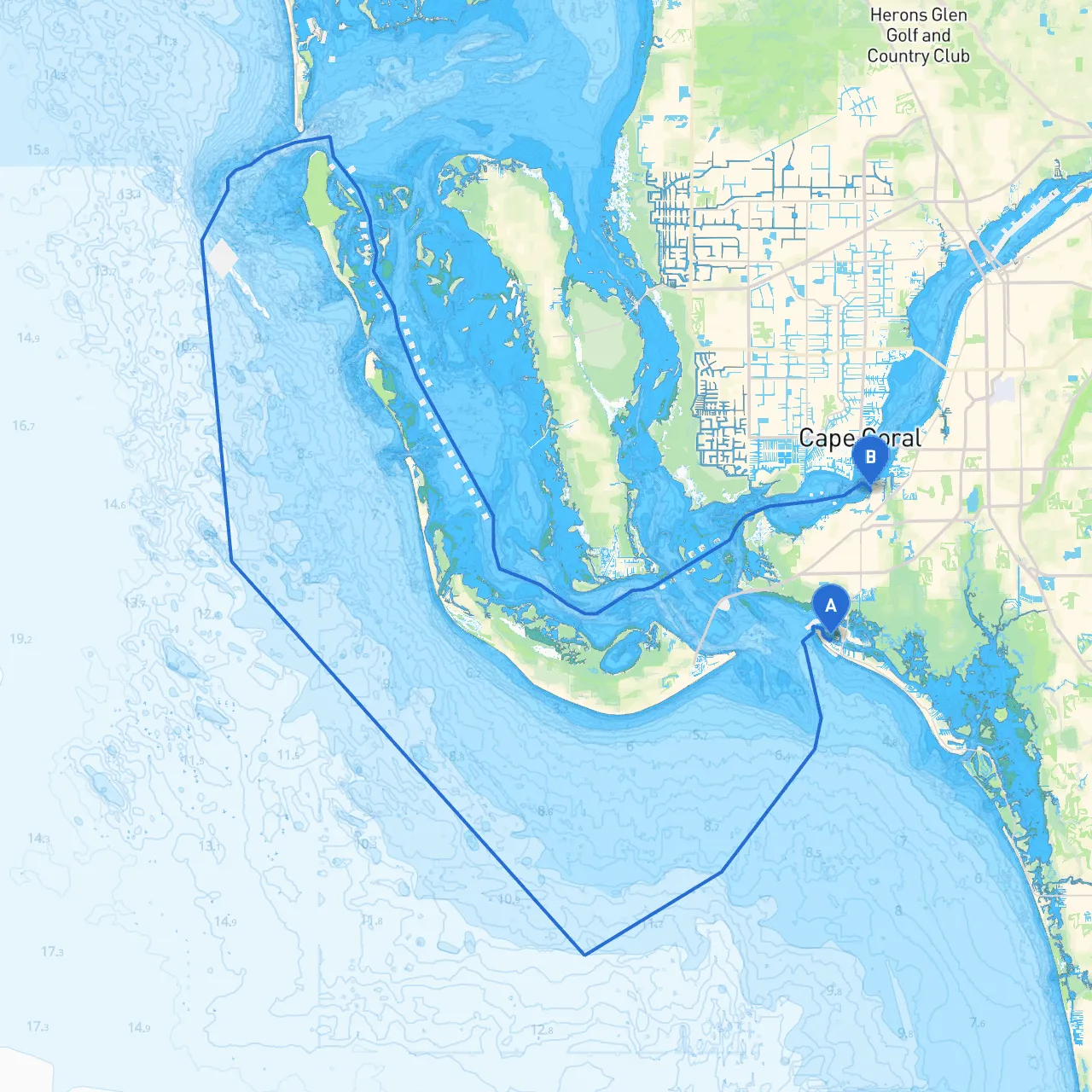
Embarking on a scenic boat trip from Fort Myers Beach to Fort Myers, this journey takes you through the tranquil waters of the Gulf of Mexico and the Intracoastal Waterway. The distance is approximately 5 nautical miles, making it a short yet visually captivating route, ideal for boaters of all experience levels. This easy passage offers a perfect blend of safety, relaxation, and opportunities for exploration, while keeping navigation straightforward.
Departure: Fort Myers Beach
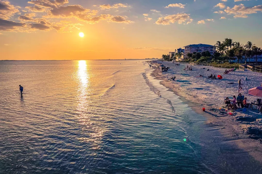
Starting from Fort Myers Beach at coordinates (longitude -81.960357373, latitude 26.460670452), you will set off from a vibrant area with a beautiful coastline, lined with restaurants and shops. The sands of Fort Myers Beach are often teeming with life, and this bustling beach town provides excellent amenities for your pre-voyage preparations.
Navigational Considerations
Before heading out, it is vital to check the local weather reports and ensure that your vessel is well-prepared. Always keep an eye on the marine forecasts, as conditions can change rapidly. Be sure to equip your boat with the necessary safety gear, including life jackets, flares, and a VHF radio to maintain communication with the Coast Guard or other vessels.
Route to Fort Myers
Leaving Fort Myers Beach, head northeast into the Gulf of Mexico. Keep a lookout for the following navigational aids:
1. Red and Green Markers: These markers help delineate the navigable channels. Be sure to adhere to the IALA buoyage system: red marks on your right when returning from sea (as in the US).
2. Gulf of Mexico: As you navigate through the Gulf, be aware of local boat traffic as this area is frequented by anglers, pleasure boats, and commercial vessels. Awareness of your surroundings is paramount.
3. Knowledge of Tidal Currents: Understanding tide changes can make a substantial difference in your speed and trajectory. Make note of the tides before leaving to plan for any current impacts during your trip.
Shelter and Points of Interest Along the Way
As you cruise along the route, you’ll pass through the following significant sites and potential shelter opportunities:
Arrival: Fort Myers
Upon approaching Fort Myers, navigate toward the Caloosahatchee River. Look out for distinctive landmarks such as the Edison Bridge, which serves as a guiding visual marker as you enter the mouth of the river. The coordinates (longitude -81.938, latitude 26.5356666667) will lead you right to the heart of Fort Myers, where you can disembark to explore local attractions, shops, and dining options.
Regulations and Local Guidelines
When navigating the waters around the Fort Myers area, adhere to all local boating regulations.
Safety First
Your safety is the priority. Keep your navigation lights on during dusk or dawn, maintain a lookout for changing weather conditions, and inform someone on land about your trip plans. For navigation assistance and route tracking, consider using helpful apps like Navionics, C-Map, or Savvy Navvy for real-time updates and charts.
This straightforward and enjoyable route from Fort Myers Beach to Fort Myers combines safety, ease, and scenic beauty, making it suitable for both novice and seasoned boaters alike. As you cruise along, there are ample opportunities to soak in the environment and perhaps even share your experiences with fellow water enthusiasts. Enjoy your voyage!