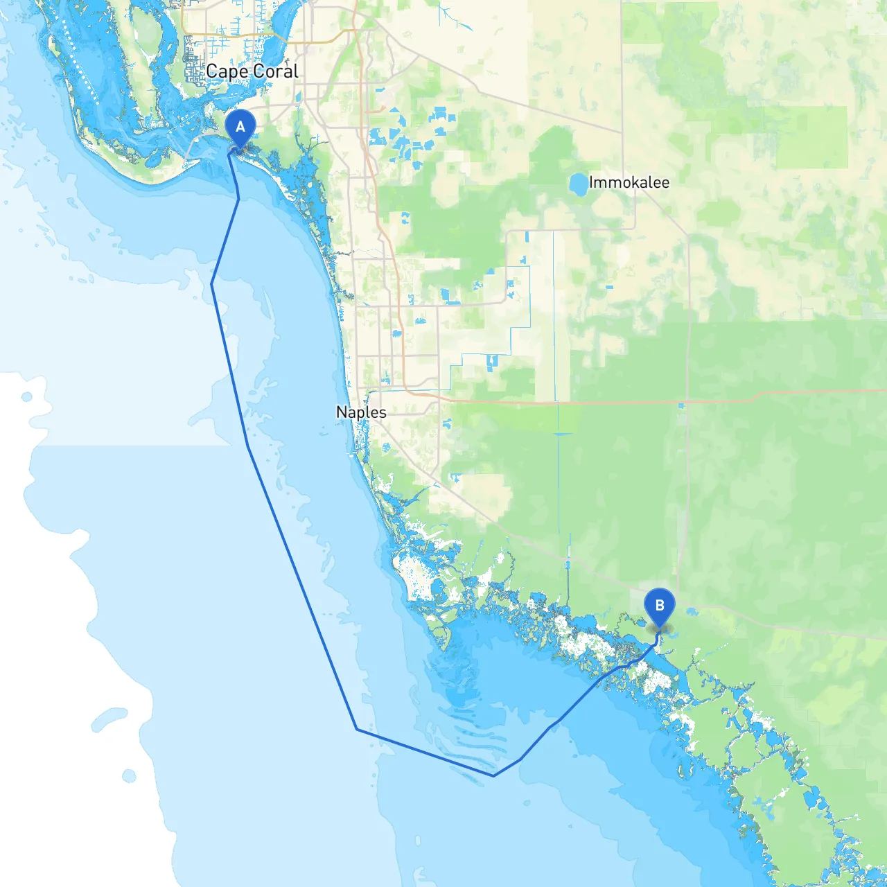
This route from Fort Myers Beach to Everglades City is a captivating journey through Florida's rich coastal waters, showcasing beautiful scenery, diverse wildlife, and unique landmarks. Ideal for capable boaters looking for a mix of adventure and safe navigation, this passage will highlight the natural beauty and picturesque settlements along Florida's Gulf Coast. As you embark on this trip, safety is our guiding principle, with a focus on smooth navigation and contingency plans for unexpected weather changes.
Departure: Fort Myers Beach, Florida Arrival: Everglades City, Florida Total Distance: Approximately 38 nautical miles (NM) Estimated Duration: Approximately 4-6 hours, depending on speed and conditions
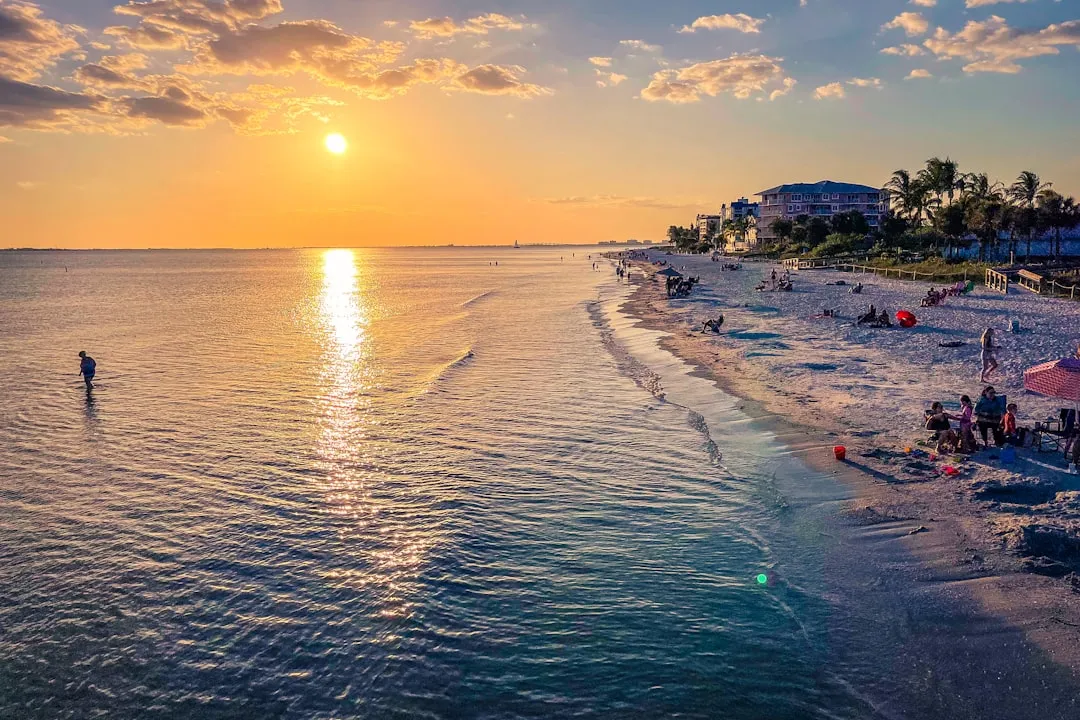
Departure Points of Interest: Before leaving, take a moment to explore the charming beachfront and local shops on Fort Myers Beach. Enjoy a morning coffee or breakfast at one of the waterfront cafés. The nearby Fort Myers Beach Pier is also a great spot for views and maybe some quick fishing off the pier.
Hazards & Navigation: As you navigate from Fort Myers Beach, be cautious of the shallow waters near the beach. It's advisable to maintain a distance from the shore to avoid sandbars, particularly at low tide. Keep an eye on local navigation aids like the Fort Myers Beach Channel Buoys to mark your path clearly.
Starting your journey, you will enter Estero Bay, a beautiful estuarine system perfect for exploration. The southern part of the bay offers a great sheltering option should the weather deteriorate unexpectedly.
Points of Interest:
Navigational Considerations: Stay attentive to channel markers as you make your way through Estero Bay. The local waters are typically well-marked, but strong current and tidal changes can impact your speed.
As you exit Estero Bay, you'll enter the Ten Thousand Islands region. This area is a maze of mangroves and tiny islands that can be both mesmerizing and tricky. Here you’ll want to use your charts expertly to navigate through the winding channels.
Shelter Options: Should the weather change, consider heading to the protected waters around the islands like White Horse Key or Chokoloskee Bay, which offer decent protection in rough seas.
Points of Interest:
Navigational Considerations: Be aware that the waters here are shallow and can be tricky. The use of GPS navigation apps is essential. Make sure to keep an eye out for the absence of markers—situations where you'll need to rely on charts and GPS.
As you make the final approach to Everglades City, you’ll navigate through Chokoloskee Bay. Expect more boat traffic as this area serves a variety of recreational and commercial vessels. Remember to maintain a conscientious speed as you enter this busier area.
Points of Interest:
Navigational Considerations: Pay attention to channel markers as you find your way into Everglades City. Watch out for shallow areas, particularly during low tide, as local navigation aids can be inconsistent. Being aware of local fishing regulations is also essential if you plan to fish.
It's crucial to check the weather before and during your trip. Any sudden changes can affect navigational conditions, particularly in the Ten Thousand Islands area. Here are a few apps that can help enhance your experience and safety on the water:
By following this pilotage plan and taking heed of the safety considerations, you're setting yourself and your crew up for a fantastic and safe journey through some of Florida's most beautiful waters. Enjoy the trip! Safe boating!