
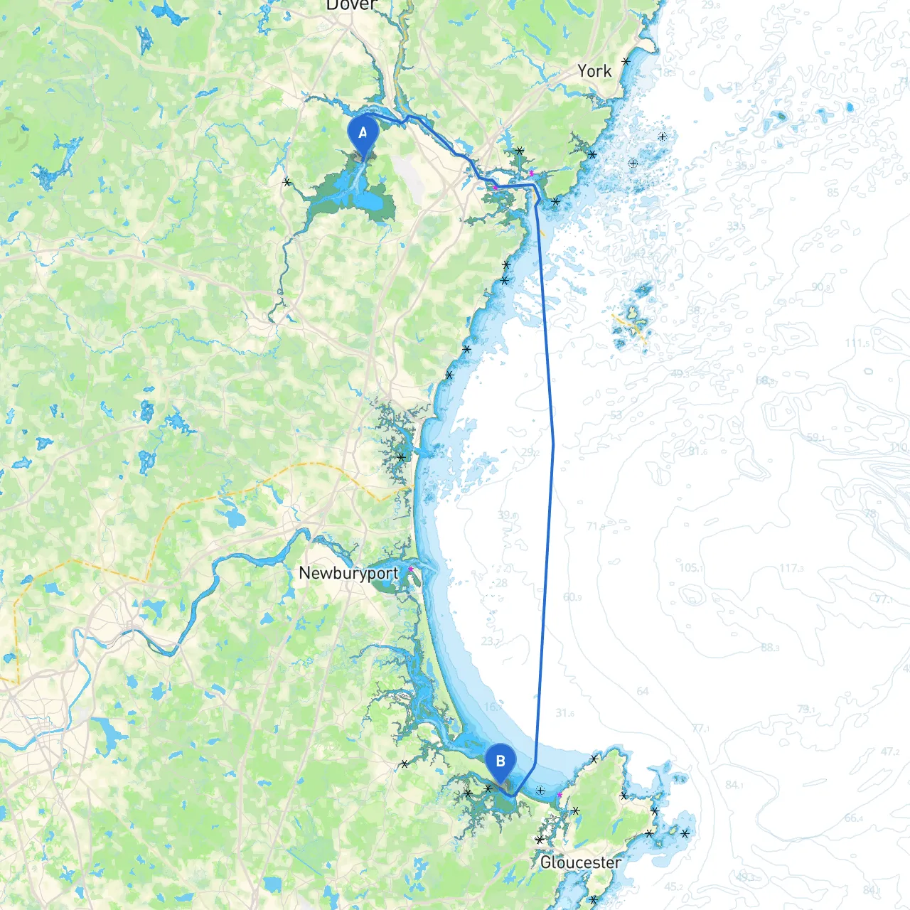
Pilotage Plan for the Voyage from Durham, New Hampshire to Ipswich, Massachusetts
Departure Point: Durham, New Hampshire Coordinates: Longitude -70.8635, Latitude 43.0913 Known for its beautiful rivers and lush landscapes, Durham offers a tranquil starting point. Before you set sail, ensure your vessel is well-equipped with safety gear, including life jackets, fire extinguishers, and flares. Prepare your navigation tools, and consider using savvy navvy for route plotting, which will enhance your navigation experience.
The journey from Durham to Ipswich is approximately 20 nautical miles, taking you through the beautiful landscape of the New England coastline. This route accommodates small to medium vessels and offers plenty of opportunities for both safe navigation and scenic enjoyment.
1. Little Bay: - Location: Just south of Durham - Shelter: Provides a good refuge if the winds pick up. - Highlight: Enjoy a peaceful stopover; the bay is surrounded by wildlife and has great spots for birdwatching.
2. Great Bay: - Location: Continuing southward from Little Bay - Shelter: Offers ample space for overnight anchoring. - Activities: Kayaking and paddleboarding are popular here, with stunning views across the bay.
3. Powder Point Bridge: - Navigation Note: As you approach, be mindful of the bridge's clearance. Watch for the tidal currents that can be strong in this area. - Landmark: This iconic bridge is a great photo opportunity and a local landmark that connects to the lovely waterfront community of Rowley.
4. Merrimack River Entrance: - Caution: The waters can be tricky with strong currents and shifting sandbars. - Navigational Aids: Keep an eye out for channel markers as you enter. It’s vital to stay within the designated channels to avoid grounding.
This route offers a balanced mix of scenic beauty, safe navigation, and opportunities for adventure while prioritizing safety and preparedness. It’s particularly suitable for recreational boaters and families looking to enjoy New England's coastal beauty without the stress of heavy traffic or tumultuous waters. With diligent attention to weather, tides, and navigation aids, your trip is poised to be both enjoyable and safe. Remember to use savvy navvy for route management and keep updated on local regulations to ensure a smooth sailing experience. Enjoy your voyage!