
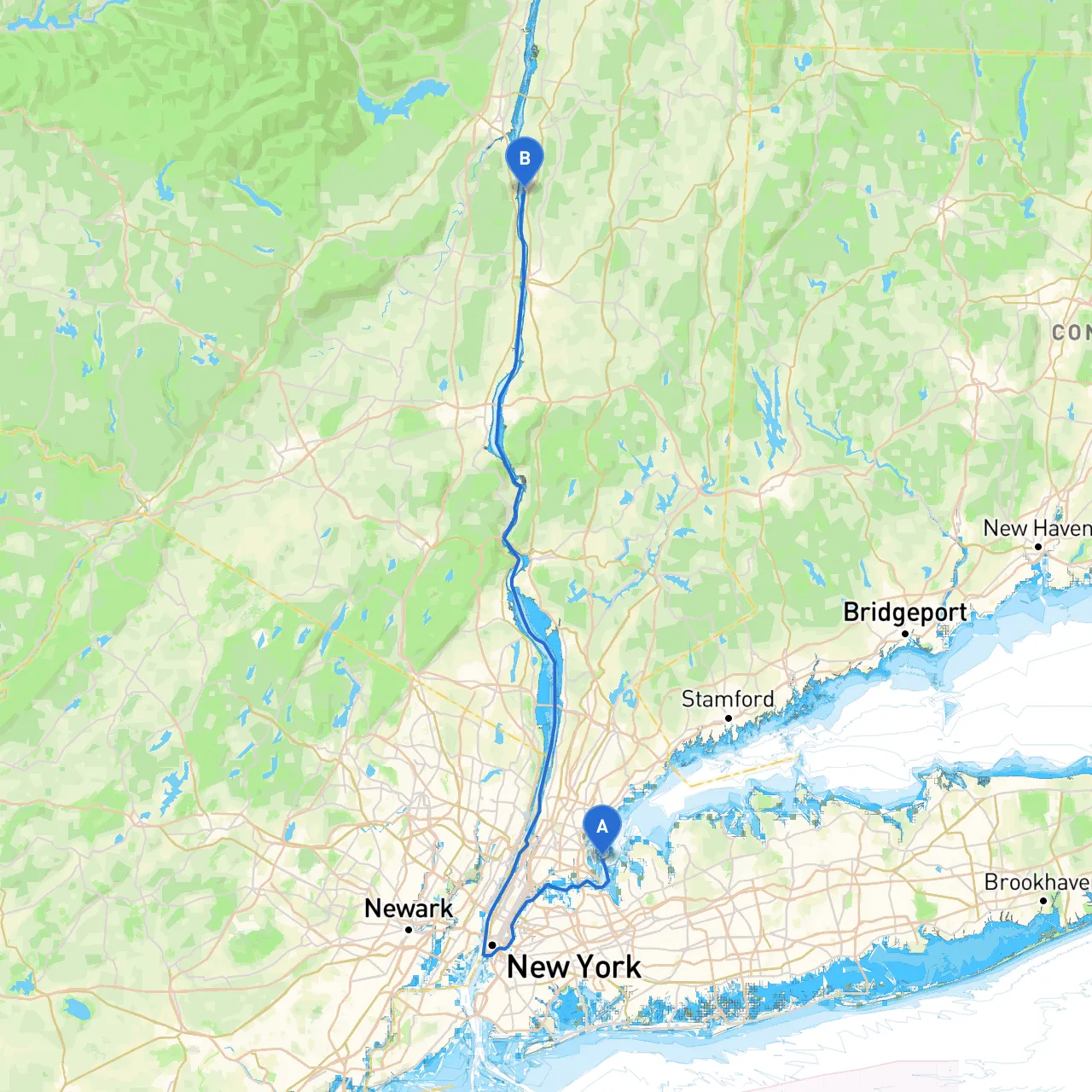
Embarking on a journey from City Island, nestled in the Bronx, to Staatsburg, across the Hudson River in Dutchess County, offers a splendid blend of scenic beauty and navigational challenges. This route is particularly suitable for intermediate to experienced boaters who are comfortable navigating both urban and rural waterways. The journey spans approximately 70 miles upriver and provides numerous opportunities for scenic stops and shelter along the way.
Location: City Island is at longitude -73.7883 and latitude 40.8407. A charming maritime community, it’s well-known for its vibrant boating culture and friendly atmosphere.
Considerations: Before setting out, check the local weather forecasts and ensure your vessel is equipped with necessary safety gear such as life jackets, flares, and a first-aid kit.
1. Pelham Bay Park (10 mins from City Island) - A quick detour into Pelham Bay Park provides stunning views and a chance to explore the park's natural beauty. - Shelter: If storms roll in, head into the protected waters of the park.
2. Westchester Creek (an hour in) - Navigate through Westchester Creek for a delightful glimpse of wildlife and lush surroundings. - Shelter: The creek offers calm waters and can be a good spot to wait out bad weather.
3. New Rochelle Harbor (1.5 hours in) - A vibrant harbor with the option to dock at various marinas. Stop for a meal at one of the harborside restaurants. - Shelter: The harbor provides ample safe docking options.
4. Dobbs Ferry and Hastings-on-Hudson (3 hours in) - These quaint towns along the river have lovely parks and opportunities to stretch your legs and grab a snack. - Shelter: Look for dockage options if the weather deteriorates.
5. Tarrytown Lighthouse (4 hours in) - A picturesque landmark worth viewing as you cruise by. This area is also a good stopping point for photography and a stretch. - Shelter: Nearby Tarrytown has several marinas to consider if conditions worsen.
6. Bear Mountain State Park (5 hours from departure) - A naturally stunning area for potential hiking and exploration. The park is accessible from the river and offers beautiful trails. - Shelter: The park has areas for protection against the wind and rough waves.
7. Cold Spring (6 hours in) - A charming village along the Hudson, Cold Spring has local shops and eateries. A perfect place to refuel your crew with food and fun. - Shelter: Several marinas in this area can provide safe harbor if needed.
8. Breakneck Ridge (7 hours in) - This notable hiking locale is known for its steep climbs and breathtaking vistas. Be sure to allow time for exploration. - Shelter: If conditions become challenging, head back downriver for safety.
9. Arrival at Staatsburg, NY - This quaint community is known for the beautiful Staatsburgh State Historic Site, a once-grand mansion that gives a glimpse into the past. - Docking facilities are available, making it convenient to visit local attractions.
The trip from City Island to Staatsburg requires attention to several key navigational aids:
For this journey, it’s essential to stay informed. Make sure to download apps like SavvyNavvy, which provides precise charts and routing information, along with weather updates. Other useful apps include MarineTraffic for tracking vessel movements and Navionics for detailed maps and sonar charts.
This route is not just a means to travel; it’s an opportunity to experience the beauty of New York’s waterways while ensuring a safe and enjoyable journey. Adhering to navigation principles, respecting local regulations, and being mindful of the weather will help you create memorable moments safely on the water. Happy cruising!