
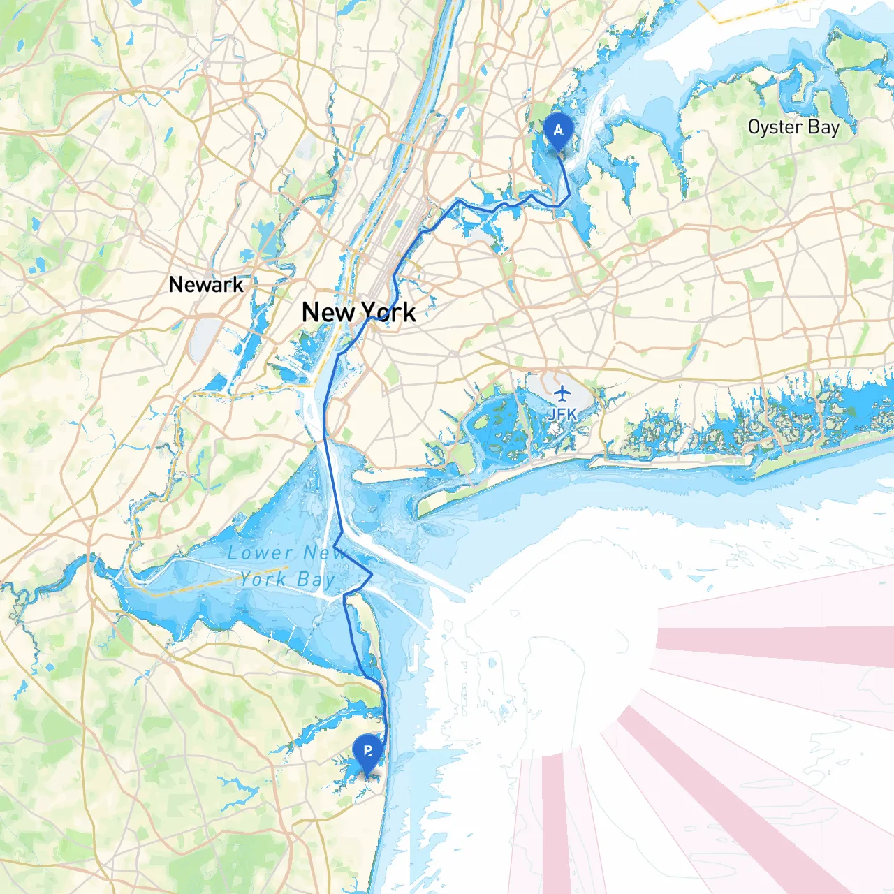
Departure Point: City Island, NY, USA Coordinates: Longitude -73.788333, Latitude 40.840667
Arrival Point: Long Branch, NJ, USA Coordinates: Longitude -73.995583, Latitude 40.326083
Embarking on a boat trip from City Island to Long Branch is both a beautiful and rewarding endeavor, offering nautical enthusiasts a blend of scenic waterways, coastal views, and potential challenges. This route is particularly well-suited for experienced cruisers who value safety while enjoying the nautical adventure of transitioning between states.
The journey covers approximately 20 nautical miles across the western Long Island Sound and into the open waters of the New Jersey coastline. As you navigate this path, be prepared for the convergence of urban and natural scenery, as rich maritime history meets the bustling energy of the shoreline.
1. Hazards to Watch For: - Fisherman’s Terminal: The waters around City Island and Hart Island can be congested with commercial and recreational fishing vessels. Keep a watchful eye for local boat traffic. - Rips and Tides: The East River flows tidal currents that can be strong; as you make your way towards New Jersey, be mindful of tidal rips near the narrows. Ensure to consult tide tables to plan your transit accordingly.
2. Navigational Aids: - Buoys and Markers: Follow the AIS and electronic charting systems to stay updated. The multitude of buoys around City Island and towards Sandy Hook will help guide your way. - Racon Stations: Look out for radar beacons that will assist you in positioning relative to land during low visibility.
3. Weather Considerations: - Always check the forecast before departure. The waters can become choppy with sudden squalls, especially when crossing from Long Island Sound into the more exposed sections off of the New Jersey coast. Alternative weather apps alongside savvy navvy will provide real-time updates.
The trip from City Island to Long Branch marries adventure with appreciation for maritime leisure and responsibility. While safety must always be the priority, the journey also offers splendid views and potential for exploration. With proper planning, clear weather, and a sturdy vessel, you are set to enjoy a wonderful day on the water. Don’t forget to utilize savvy navvy, which can simplify navigation and enhance your boating experience. Safe travels!