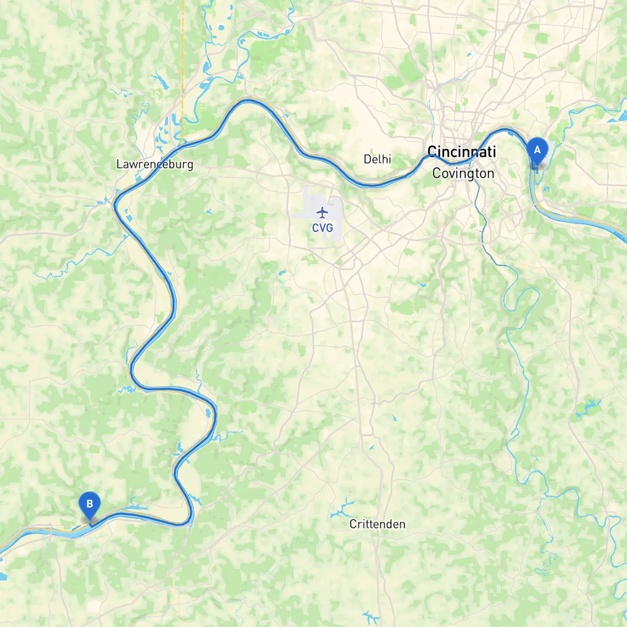
Route Overview:
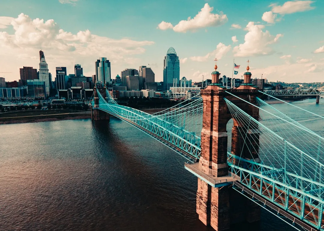
Your journey begins in Cincinnati, Ohio, a bustling city located on the banks of the Ohio River, stretching approximately 100 miles through the picturesque landscapes until you reach Florence, Indiana. This route offers a blend of navigational challenges and serene waters, making it suitable for experienced boaters who appreciate stunning scenery and historical landmarks.
Leg 1: Cincinnati to New Richmond (Approx. 20 miles)
Navigational Considerations:As you embark on your adventure, you'll start in Cincinnati's busy waterways. Keep an eye out for commercial traffic; the Ohio River accommodates significant shipping activity, so staying alert is key. Begin by following the river upstream, utilizing navigational aids along the way.
Points of Interest:
Shelter/Ports:In New Richmond, there are small marinas where you can dock if the weather turns unfavorable.
Leg 2: New Richmond to Aurora (Approx. 20 miles)
Navigational Considerations:As you continue, the river widens, offering a more relaxed cruising experience. Pay attention to the various bends in the river and the corresponding navigation signage. The speed limit is generally 40 mph, but remain cautious of low-floating debris and sandbars that may appear in shallow sections.
Points of Interest:
Shelter/Ports:Aurora has several marinas equipped to provide safe harbor, especially vital if storms are in the forecast.
Leg 3: Aurora to Rising Sun (Approx. 15 miles)
Navigational Considerations:This segment presents a diverse landscape marked by both serene stretches and potential obstacles. Be aware that the river may narrow at certain points. The navigation aids become crucial here, as sharp bends can suddenly alter conditions.
Points of Interest:
Shelter/Ports:There is a well-maintained dock and marina facility in Rising Sun where you can seek refuge in rough weather.
Leg 4: Rising Sun to Florence (Approx. 30 miles)
Navigational Considerations:As you approach Florence, keep watching for navigation aids. The river widens again, but local restrictions may apply due to development and residential areas. Watch out for recreational boating activities and stay aware of any fishing fleets as you approach your destination.
Points of Interest:
Shelter/Ports:Marinas around Florence are equipped to provide facilities and safety if your final approach is met with sudden changes in weather.
Familiarize yourself with local charts that cover the Ohio River, as accurate depth and current data are crucial especially for smaller vessels. Safety equipment must always be in compliance with U.S. Coast Guard regulations, including life jackets, fire extinguishers, and flares.
Consider downloading navigation apps like savvy navvy, which offers comprehensive charts, tidal information, and weather forecasts. Other valuable apps for your journey include Navionics and Waterway Guide, which help enhance your navigation experience.
This route from Cincinnati to Florence is not only filled with safe shelter spots but also teems with history and attractions that make it a worthwhile trip. The blend of potential challenges and picturesque scenery defines the charm of the Ohio River, inviting seasoned boaters ready for adventure while emphasizing safety and preparedness. Enjoy your cruise, and always let safety be your guide!