
Pilotage Plan: Cincinnati, OH to Charlestown, IN
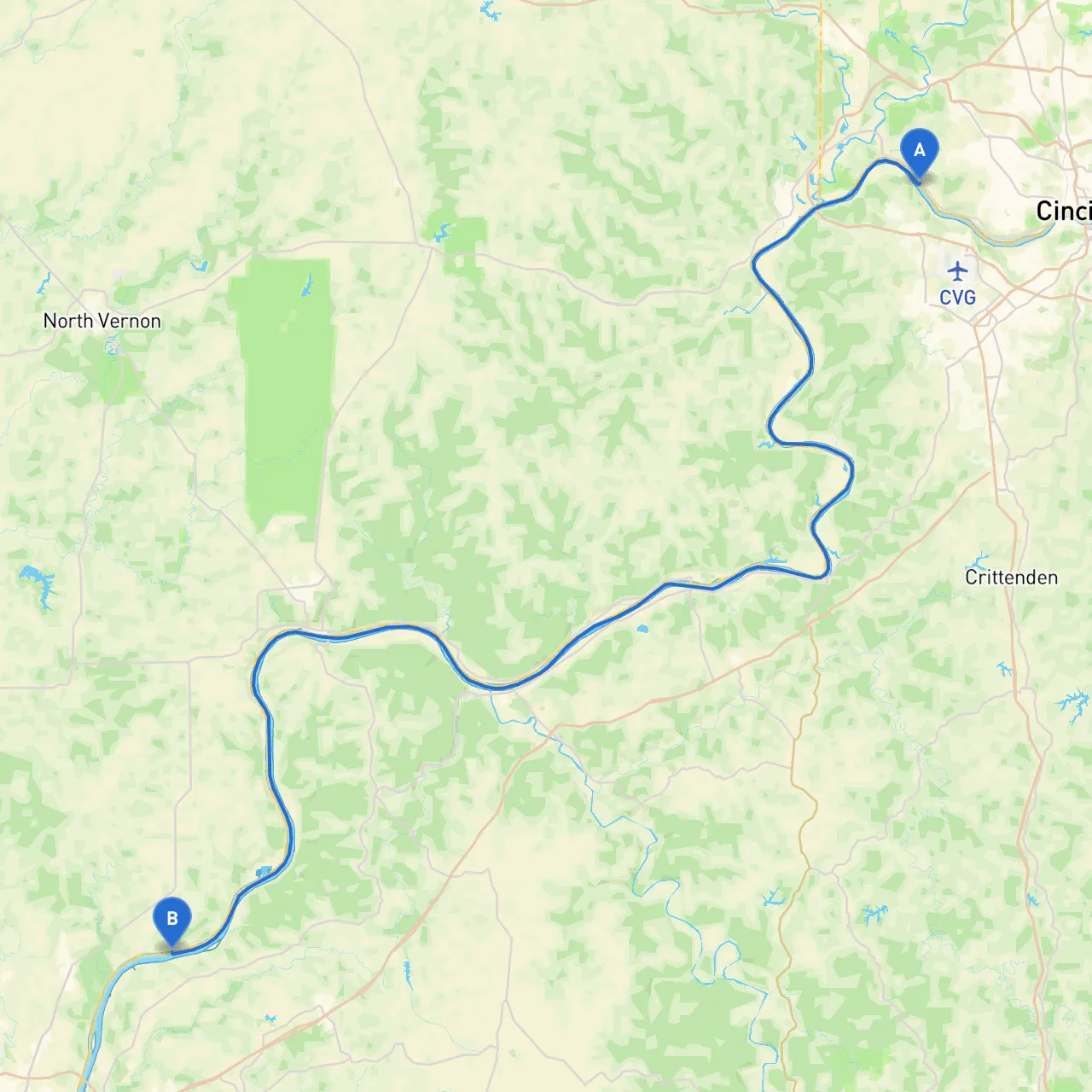
Route Overview Your journey begins in the bustling city of Cincinnati, nestled on the banks of the Ohio River. The end of your voyage will be Charlestown, Indiana—an equally charming locale. This route is primarily navigable via the Ohio River, which is an iconic waterway with diverse scenery and recreational opportunities.
Starting Point: Cincinnati, OH As you depart Cincinnati, ensure that your vessel is in top condition. Check your navigation systems and safety equipment, including life jackets, flares, and a first-aid kit. The Ohio River is a busy commercial thoroughfare, so maintaining a vigilant watch and adhering to navigation rules is essential.
Notable Hazards and Navigation Considerations
Shelter Points and Points of Interest Along the Route 1. Miami Whitewater Forest: This is an excellent first stop. With beautiful nature trails and picnic areas, it's a perfect way to enjoy the outdoors before continuing your journey. Some sheltered coves can provide respite from wind and waves here.
2. Lawrenceburg: A small town with a charming waterfront that offers transient docks. It could be an excellent place to refuel or grab a bite to eat. The historic Lawrenceburg area features quaint shops and local eateries, making it a pleasant break from cruising.
3. Rising Sun: This town is a great stop for visitors looking for a bit of leisure. The Rising Sun Riverboat Casino can provide entertainment, and the nearby parks offer nice areas for a stroll or a picnic.
4. Shelter Points: Should the weather take a turn for the worse, focus on finding squeezes in the river where pockets of calm water exist. The areas around Lawrenceburg and Rising Sun can provide anchorage as they have both shallow spots and a few secluded bays for emergency docking.
Important Navigational Aids While navigating, keep your eye on the following aids:
Local Regulations and Conditions
Ending Point: Charlestown, IN Upon arriving in Charlestown, you'll find welcoming docks, local cuisine, and parks to explore. Check out Charlestown State Park, which provides trails and scenic views of the Ohio River. This peaceful town closure is a fitting end to your river journey.
Recommended Boating Apps To enhance your navigation experience, consider downloading savvy navvy, which provides excellent routing along with real-time weather updates, making it a valuable tool for safe cruising. Other apps such as Navionics and Windy can also provide additional insights about current conditions.
This route from Cincinnati to Charlestown offers a mix of adventure with moments of leisure, all while ensuring safety remains paramount. Get ready to make unforgettable memories as you navigate this historic river! Happy boating!