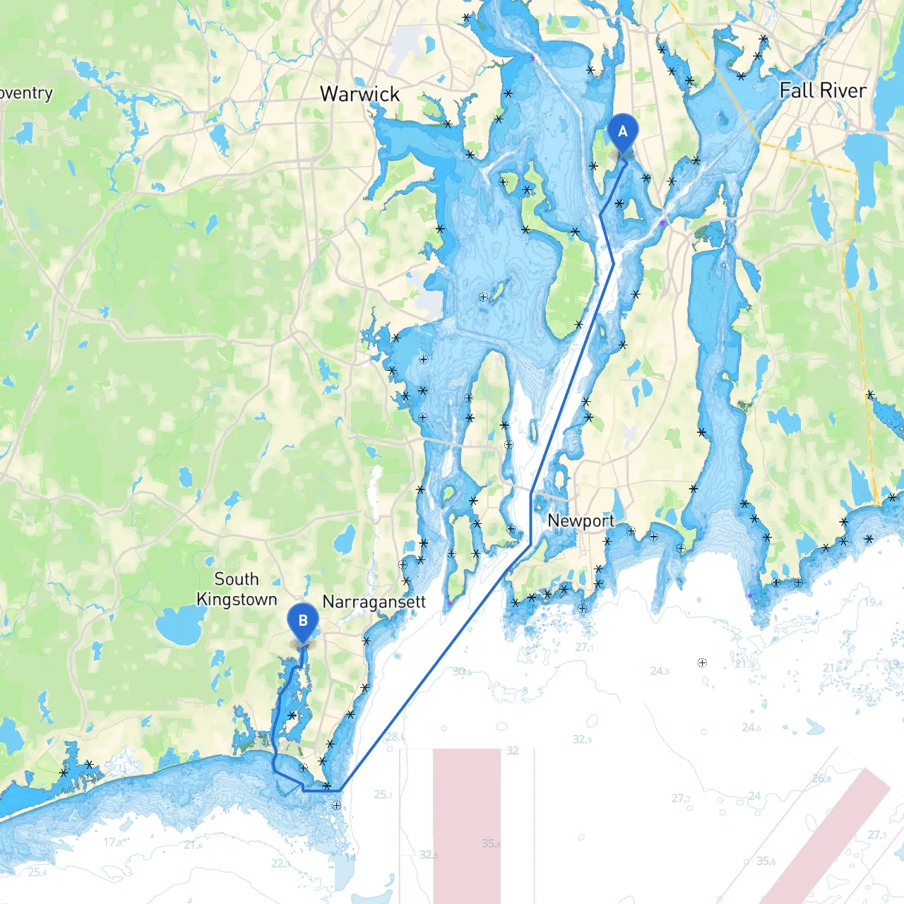
Pilotage Plan: Bristol, Rhode Island to Wakefield, Rhode Island
Departure Port: Bristol, RI Destination Port: Wakefield, RI Total Distance: Approximately 13 nautical miles
Overview
This journey from Bristol to Wakefield offers a splendid blend of natural beauty, navigational challenges, and local flavor. The route is particularly suitable for recreational boaters and those seeking calmer waters, making it a great choice for both novice and seasoned sailors. Keep a vigilant eye on the weather and navigational aids to ensure a safe and enjoyable trip.
Route Details
1. Departure from Bristol, RI:
- Coordinates: Long -71.2861666667, Lat 41.6675
- Navigational Aids: Look for the Bristol Harbor Light (Fl W 4s) at the entrance of the harbor, marking the channel out to the East Passage of Narragansett Bay.
- Nearby Shelter: If weather conditions deteriorate, consider seeking refuge at Bullock Cove, just a short detour to the east.
2. Navigating the East Passage:
- As you exit Bristol Harbor, head southeast toward the East Passage of Narragansett Bay.
- Hazards: Be mindful of underwater cables and the traffic from larger vessels, particularly ferries and commercial fishing boats.
- Navigational Tips: Use your chartplotter to stay clear of the shallow areas along the way; the marked channel is your best route. Meanwhile, keep an eye on the weather updates as winds can shift unexpectedly.
3. Passing Through Mount Hope Bay:
- Points of Interest: To starboard, you’ll catch a glimpse of the stunning Mount Hope Bridge—which is simply picturesque. If time allows, consider dropping anchor near Prudence Island for a quick excursion ashore.
- Shelter Option: If conditions worsen, Prudence Island offers protected waters where you can safely reassess the situation.
4. Heading Towards the Narrow River:
- As you continue toward the Narrow River, navigate carefully. Watch out for moored boats and fishing gear in this area.
- The river can be narrow in places, so be prepared for some tidal flow to aid your journey.
5. Approaching Wakefield, RI:
- Coordinates: Long -71.496, Lat 41.4271666667
- Wakefield’s entrance can be obscured by the marshes, so slow your pace as you approach.
- Final Navigational Aids: You’ll spot the buoy marking the entrance to the Saugatucket River, guiding you to your final destination. Keep your eyes peeled for local wildlife along the banks as you take this serene route.
Important Navigational Aids & Local Regulations
1. Navigational Aids: Be attentive to channel markers and buoys particularly around Bristol Harbor and the entrances to the Narrow River. Using electronic navigation tools like savvy navvy can simplify this process and provide up-to-date traffic and hazard information.
2. Local Restrictions: Pay attention to speed limits in the Narrow River area, as there are zones with low wake requirements to protect shore wildlife and property.
3. Weather Considerations: Always check the forecast before departure, as conditions can change rapidly in coastal regions. Heed any small craft advisories, particularly in summer months when storms can develop quickly.
Points of Interest & Activities
- Prudence Island: Great for a picnic and some exploring. Enjoy beach combing or a stroll through local trails.
- Mount Hope Bridge: An iconic sight. You can pause to enjoy the views or even take some photographs from your boat.
- Wakefield Area: Once you arrive, check out the eclectic shops and dining options available. As you cruise in, you may even spot kayakers and fishermen enjoying the beautiful scenery.
Conclusion
This trip from Bristol to Wakefield, Rhode Island, offers an excellent blend of safety, scenic wonders, and local attractions. By adhering to navigational best practices and remaining aware of your surroundings, you’ll ensure a delightful journey. As always, consider equipping your vessel with tools such as savvy navvy to keep your navigation both safe and efficient. Enjoy your time on the water!