
Overview:
Embarking on a boat trip from Antioch to Redwood City is not just a journey; it's an exploration of the enchanting waterways of the San Francisco Bay Area. This route offers a rich blend of vistas, landmarks, and potential shelters nestled along the way. It's especially suitable for intermediate to experienced recreational boaters, who appreciate the beauty and challenge of cruising through varied waterways, while also being mindful of safety and navigational hazards.
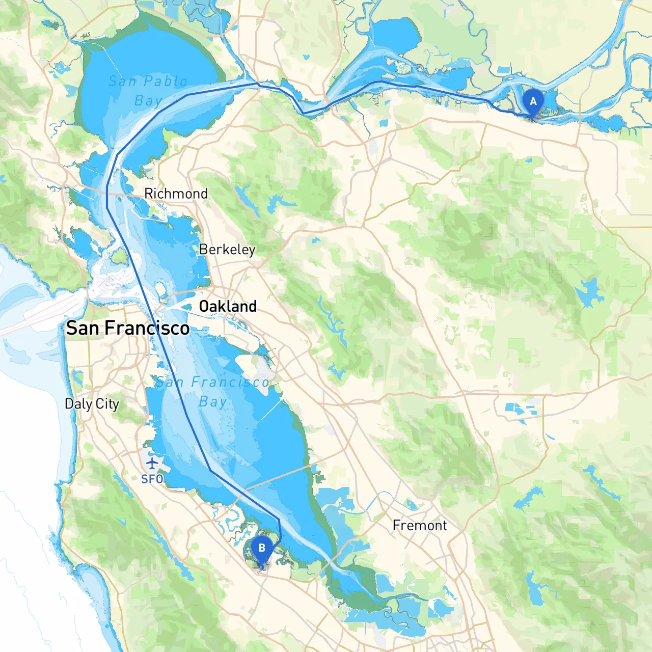
Starting Point: Antioch, CA
Your journey begins in the tranquil waters of Antioch, where the Sacramento and San Joaquin Rivers converge. Before you set off, it's advisable to fuel up at one of the local marinas and check your vessel's emergency gear. As you leave Antioch, you’ll be introduced to the expansive Delta waters, with plenty of possibilities for both adventure and discovery.
First Leg: Antioch to Pittsburg
Distance: Approximately 5 nautical miles
As you navigate south on the San Joaquin River towards Pittsburg, keep an eye out for commercial traffic, as this is a bustling area for shipping. You'll encounter navigational aids such as buoy markers, particularly important for maintaining your course away from shallow areas.
Notable Point of Interest: Pittsburg Marina offers a great resting point. Here, you can enjoy picturesque views, local dining options, and perhaps engage in a bit of fishing.
Hazards: Watch for fixed bridges and cattle boats, especially when visibility is low. Currents can also be stronger in this area, particularly during peak tidal changes.
Second Leg: Pittsburg to Martinez
Distance: Approximately 9 nautical miles
After leaving Pittsburg, you’ll continue your trek towards Martinez. This leg can be slightly challenging due to currents and a few narrow channels. As you approach Martinez, keep an eye out for the Martinez-Benicia Bridge and the adjacent shipping lanes.
Shelter Options: Martinez Marina is safe for harboring if weather conditions turn unfavorable. The area has amenities for transient boaters.
Navigation Considerations: Be mindful of the channel depth and avoid straying into unmarked shoals. You will want to follow the channel markers closely.
Third Leg: Martinez to San Pablo Bay
Distance: Approximately 8 nautical miles
Once you enter San Pablo Bay, the scenery opens up to expansive waters and striking views of the surrounding hills. Expect a bit of traffic here, especially from large vessels.
Shelter Spots: Point San Pablo offers good protection from wind if conditions start to deteriorate.
Caution: As this area is open to the Bay’s tides and winds, check local weather forecasts before crossing. Standby for cruise ships; they often travel this route.
Fourth Leg: San Pablo Bay to Richmond
Distance: Approximately 5 nautical miles
Heading towards Richmond, you'll navigate past industrial scenery and residential areas. Notable along this leg is the Richmond-San Rafael Bridge, which spans the bay.
Hazards: Strong tidal currents can affect your boat's handling. Maintain vigilance on your compass and speed.
Shelter Options: The Richmond Yacht Club provides amenities and a safe harbor.
Fifth Leg: Richmond to San Francisco Bay—Sausalito and Marin County
Distance: Approximately 7 nautical miles
Entering San Francisco Bay will offer a breathtaking view of the Golden Gate Bridge in the distance. Don't forget to check local lists for vessel traffic service regulations in this busy area.
Attractions: Stop by Sausalito, where you can enjoy charming shops, waterfront dining, and beautiful views of the city. It's a perfect spot for a break before your final leg.
Final Leg: Sausalito to Redwood City
Distance: Approximately 13 nautical miles
From Sausalito, begin your approach to Redwood City through the Redwood Creek channel. Watch for environmental conservation areas along the marshland.
Important Considerations: This channel can get narrow and shallow in parts. Familiarize yourself with local charts and follow confirmed waypoints. Observe the cycling of tides closely as it can considerably alter navigability.
Arrival at Redwood City: The harbor is a lovely spot with plenty of services for transient boaters and an excellent base to explore the region from both land and sea.
Final Advice and Navigation Tools:
Utilize reliable navigation apps like Savvy Navvy, Navionics, or iNavX to assist with real-time charts, local information, and tidal data. Always keep your First Aid Kit, life jackets, and proper equipment onboard, and ensure your vessel is adequately maintained before departure.
This journey from Antioch to Redwood City can provide a mix of leisure and adventures, showcasing the remarkable Northern California coastline while keeping boaters safe and entertained throughout. Happy cruising!