
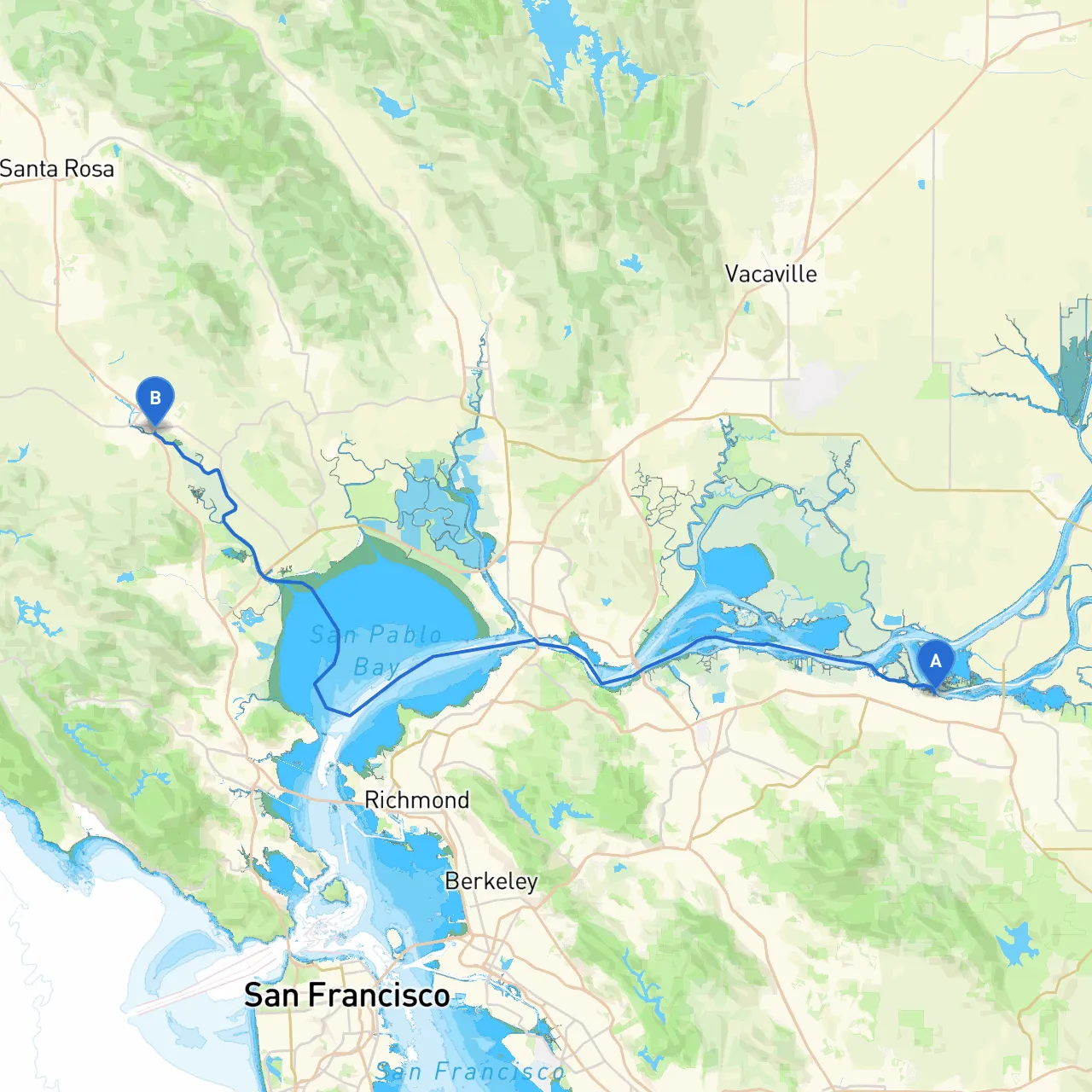
Pilotage Plan from Antioch, CA to Petaluma, CA
Starting Point: Antioch, CAAntioch serves as the launching point of this beautiful trip through the northern San Francisco Bay area. Located where the Sacramento and San Joaquin Rivers converge, this point offers a unique access route through diverse waterways. Before setting out, ensure your vessel is equipped with essential safety gear, including life jackets, flares, a VHF radio, and a first aid kit.
Route OverviewThis voyage will take you along the Sacramento-San Joaquin Delta before making your way through San Pablo and across to the Petaluma River. It’s a journey that promises both scenic views and interesting land features, making it suitable for recreational boaters who appreciate a blend of relaxation and light adventure.
Bays and SheltersAs you venture down from Antioch, several sheltered spaces provide safe havens if the weather takes a turn for the worse:
Point of Interest StopsWhile safety is paramount, don’t forget to enjoy some fun activities along the way:
Navigational Aids and ConsiderationsAs you navigate along this route, pay close attention to several navigational aids and markers:
Navigational RegulationsAdhering to local regulations is crucial for a safe journey. Familiarize yourself with any no-wake zones (especially near marinas and residential areas) and fishing restrictions in the waters you traverse. Be mindful of commercial traffic, particularly as you get closer to Petaluma, where various fishing vessels operate.
ConclusionThis cruise is perfect for boaters looking to appreciate the serene landscapes and calm waters of Northern California. It's particularly suited for intermediate-level boaters who have a bit of experience with tidal waters and the associated navigation. Equally, it allows for safe exploration and potential for memorable stops along the way.
For planning and navigation assistance, consider boating apps like Savvy Navvy, which will help you chart your course effectively, monitor the weather, and ensure safety throughout your adventure.
Prepare well, navigate wisely, and enjoy the beauty of the Californian waterways!