Pilotage Plan: Washington, D.C. to Fort Washington, MD
Introduction
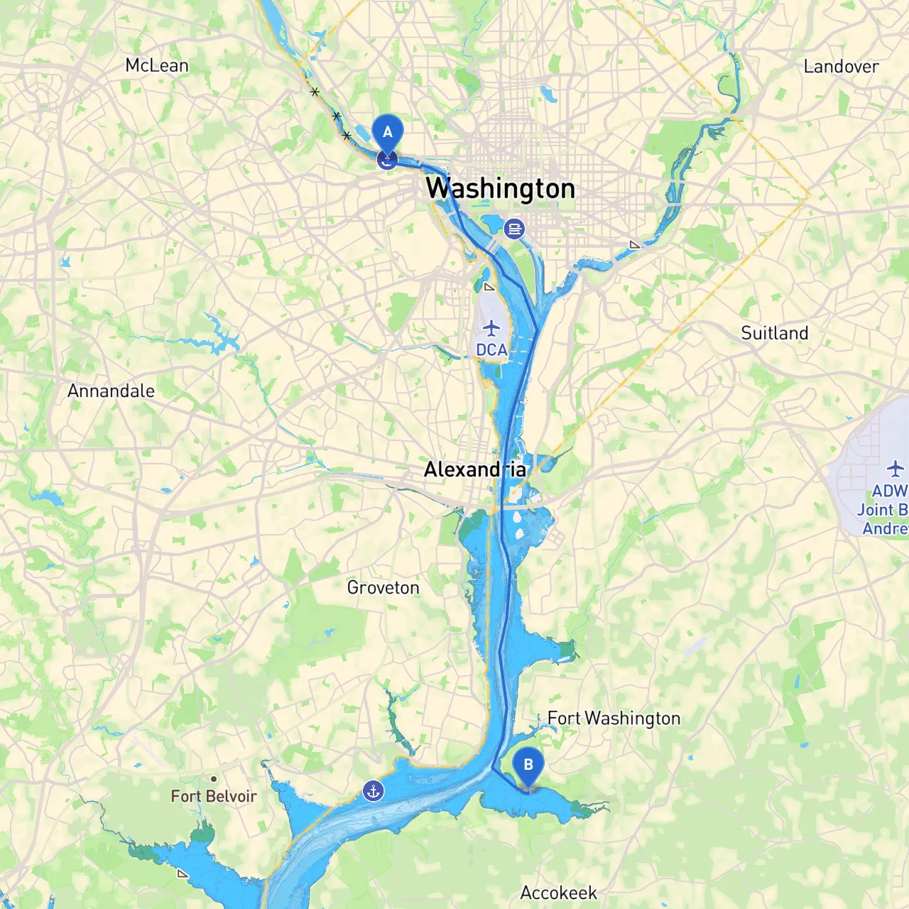
This trip from Washington, D.C. to Fort Washington, MD, spans approximately 10 nautical miles along the beautiful Potomac River. This route is perfect for recreational boaters and those looking for a leisurely cruise, offering an ideal mix of urban sightseeing and nature views.
Route Overview
Departure Point: Washington, D.C. Destination: Fort Washington, MD
Navigation Considerations and Points of Interest
1. Departing Washington, D.C.Begin your journey at the Washington Channel, just south of the National Mall. As you depart, enjoy views of iconic landmarks such as the Jefferson Memorial, the Washington Monument, and the U.S. Capitol.
2. Key Landmarks
- Hains Point: Just south, this park offers a picturesque backdrop and is a great first stop for those wishing to stretch their legs before heading further downriver.
- East Potomac Park: This large green space is ideal for a picnic or a quick stroll, making it a worthwhile excursion.
3. Navigational Aids and HazardsAs you navigate out of the city, pay attention to the following navigational markers:
- Buoys and Markers: Look for the green and red buoys delineating safe channels. Stick to the marked channels to avoid hazards like submerged rocks and shoals.
- Current Conditions: The Potomac can have strong currents, particularly during tidal changes. Be sure to monitor the tide tables and adjust your speed accordingly.
4. Notable Points of Interest Along the Way
- National Harbor: Before reaching Fort Washington, take time to visit this vibrant waterfront area in nearby Oxon Hill, MD. With shopping, dining, and entertainment options, it's a fantastic place to dock and explore.
- Woodrow Wilson Bridge: As you approach Fort Washington, you will pass under this large bridge, a significant navigational landmark.
Safety and Shelter
If conditions worsen or inclement weather arrives:- Bays for Shelter: There are several sheltered inlets along the route, particularly around the National Harbor area. The waters behind Hains Point may also serve as a temporary refuge. Consider the winds and current before seeking shelter.
Local Regulations and Restrictions
- Speed Limits: Observe local speed limits, which can vary in different sections of the river.
- Tidal Influence: Always check local tidal charts to calculate the best timing for your trip, especially if you are not familiar with the river’s characteristics.
Arrival at Fort Washington, MD
Upon arriving at the Fort Washington Marina, you’ll be perfectly positioned to explore Fort Washington Park, where the historical fort built in 1809 stands with stunning views of the river. The park is a great place for a leisurely walk or a historical look back into America’s coastal defenses.
Recommended Boating Apps
To ensure a safe and enjoyable trip, consider using the following apps on your phone:- Savvy Navvy: For real-time navigation information and routes.
- Navionics: For detailed charts that include depth markers and navigational hazards.
Conclusion
This route from Washington, D.C. to Fort Washington offers a wonderful balance of scenic beauty, historical landmarks, and opportunities for recreation. However, safety should always be your top priority. With proper planning and attention to local conditions, this trip promises to be both enjoyable and safe for boaters of all skill levels. Happy sailing!