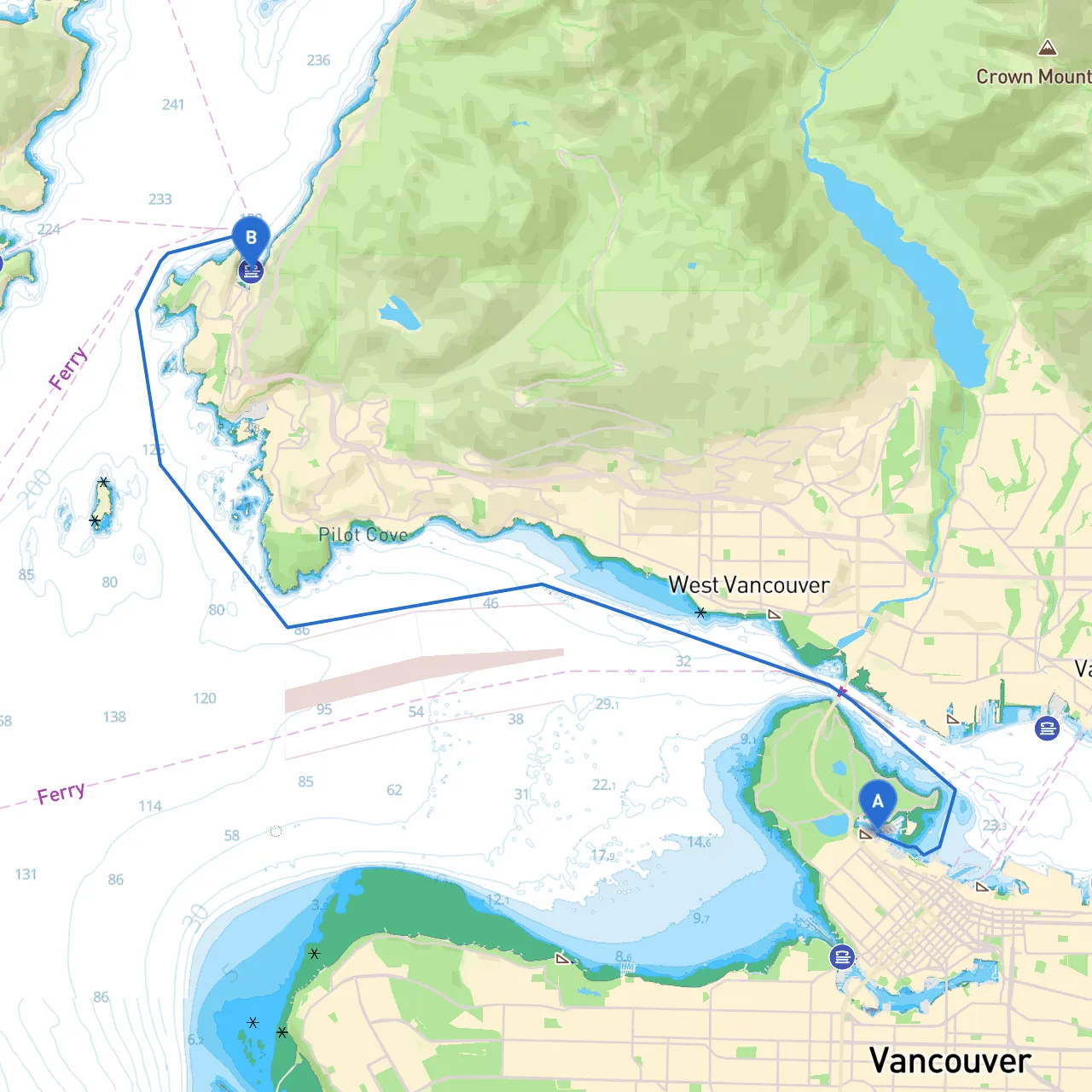
Pilotage Plan: Vancouver, BC to West Vancouver, BC
Overview
Embarking on this journey from Vancouver to West Vancouver offers an exciting yet safe passage through picturesque waters. This route is particularly suitable for leisure boaters and weekend cruisers, as it allows for stunning scenery, navigating through protected waters, and the opportunity to explore vibrant bays and landmarks. Remember to always prioritize safety, especially with the local marine conditions that can change rapidly.
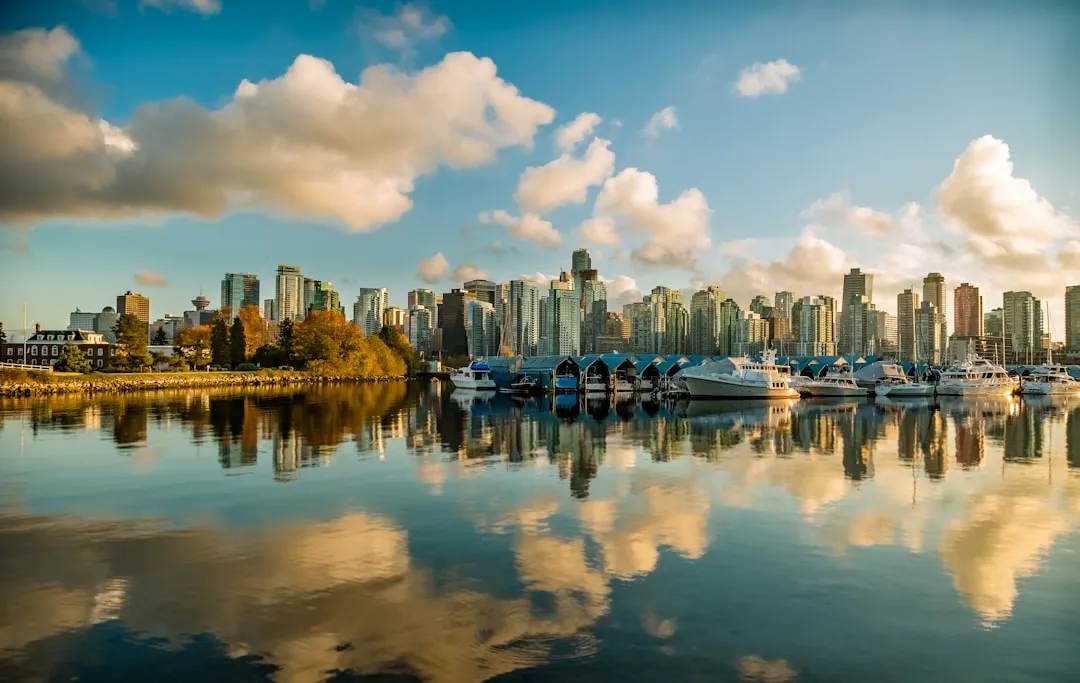
Starting Point: Vancouver, BC
Coordinates: 49.294222, -123.130335 Before setting off, ensure your vessel is fully stocked with safety gear including life jackets, flares, a first-aid kit, and a VHF radio. The bustling city of Vancouver also offers plenty of last-minute supplies and fuel for your journey.
The Route
Upon departure from Vancouver, navigate through False Creek, which is well-marked with navigation aids, ensuring safe passage. As you maneuver past Granville Island, take a moment to enjoy the vibrant market, patterning boats, and artisan shops available just off the waterfront.
Continue westward, passing the entrance to the Burrard Inlet. Be vigilant of the following navigation aids:
- Buoys and Markers: Look for the green and red channel markers signaling safe navigable waters.
- Vancouver Harbour Control: When passing through areas with significant marine traffic, like Burrard Inlet, maintain a watchful eye on other vessels and tune into the local VHF channel for communication with Harbour Control.
Significant Landmarks
As you cruise onward, you’ll be treated to the stunning sights of the North Shore Mountains flanking your route. Look for:- Lonsdale Quay: A great spot for a potential stop; you can dock briefly and explore the local cafes and market stalls.
- The Capilano Suspension Bridge: While not directly on the route, the views of this landmark from the water are impressive.
Sheltered Bays Along the Way
Should the weather take a turn, there are a couple of excellent options for sheltered bays:- Kitsilano Bay: A popular destination, Kitsilano (or "Kits" as locals call it) provides protection from northerly winds. It also gives you access to beaches and amenities to stretch your legs.
- Ambleside Park: This area offers a lovely view of the Vancouver skyline, a great place to wait out adverse weather and enjoy some nature.
Approach to West Vancouver
49.377340, -123.272256 As you near West Vancouver, be cautious of the coastline and check for depth changes. Here, you may encounter local boat traffic, so keep your eyes peeled for kayakers and fishermen, particularly around the shoreline near Lighthouse Park.
Local Restrictions and Regulations
Be aware of:- No-Wake Zones: Pay attention to signage around residential areas and park entrances.
- Marine Protected Areas: Some waters are designated for conservation, and fishing or anchoring may be restricted. Always check the latest guidelines from local marine authorities.
Navigation Aids
- Charts and Apps: Use updated nautical charts for your area. Savvy Navvy is highly recommended for real-time navigation, including the ability to lay out routes and see potential hazards.
- VHF Radio: Keep your VHF radio on channel 16 and monitor it for any broadcasts regarding weather warnings or emergencies.
Conclusion
This route from Vancouver to West Vancouver promises a delightful mix of natural beauty, local culture, and convenient shelter options should conditions change. It’s a journey perfect for leisure boaters, nature enthusiasts, and those looking to enjoy the best of British Columbia’s coastal waters. Always remember that safety is paramount—check the weather forecast continuously and keep communication lines open. Enjoy your adventure!