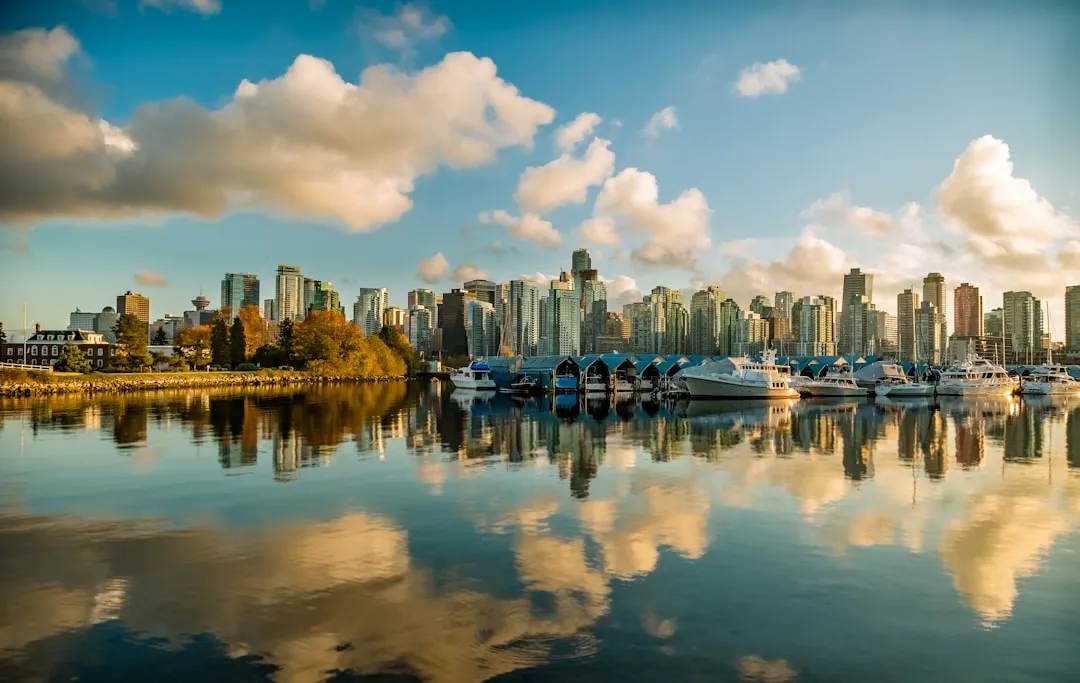
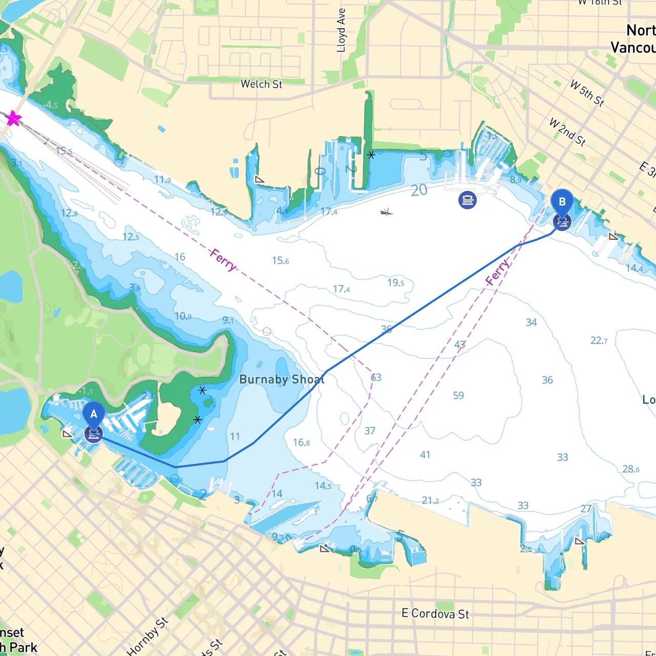
This beautiful journey from Vancouver, BC, Canada (starting point coordinates: -123.1303346, 49.2942221) to another location within Vancouver (destination coordinates: -123.0823231, 49.3083996) offers a fascinating exploratory experience through picturesque waterways, complete with urban beauty and intriguing natural highlights. Although the distance is not extensive, this route is suitable for day cruisers, weekend sailors, and those looking to take their time enjoying the sights.
1. False Creek: As you begin your journey, starting from the waters of False Creek, you’ll be enveloped by the vibrant atmosphere of downtown Vancouver. There are numerous points of interest such as: - Granville Island: A lively hub packed with artisan shops, markets, and eateries. A perfect stop for lunch or to explore local crafts. - Vancouver Aquarium: Located in Stanley Park, a bit further to the north; it can be reached by detouring a short distance.
2. English Bay: Continuing west, you’ll glide past beautiful beaches—this is a fantastic area for spotting wildlife, especially seals and seabirds. Make a quick stop at one of the beaches for some fresh air and relaxation.
3. Jericho Beach: As you navigate north toward the Point Grey area, Jericho Beach is another potential shelter point. It’s an excellent location for beachcombing and picnicking.
4. Spanish Banks: These expansive beaches stretch along the shore and offer great views of the North Shore Mountains. They can serve as alternative shelter points if conditions worsen.
5. Point Grey: As you eastward shift around Point Grey, keep an eye on the rocky shoreline. This point is known for its marine life, and the nearby University of British Columbia has beautiful gardens worth visiting.
This route showcases the best of Vancouver’s natural beauty blended with urban culture, making it ideal for boaters of various skill levels—from novices learning the ropes to seasoned sailors enjoying a leisurely day. With nearby attractions, ample shelter points, and plenty of navigational aids guiding your way, safety will be paramount, ensuring a rewarding and enjoyable experience on the water.
For additional safety and planning help, consider using boating apps such as savvy navvy alongside others like Navionics, which provide excellent marine charts and local weather data.
Embark on this adventure, relish in the breathtaking sights, and navigate safely!