Pilotage Plan: Treasure Island, Florida to Clearwater Beach, Florida
Overview Embarking on a boating trip from Treasure Island to Clearwater Beach offers a stunning journey along the Gulf Coast of Florida. This route is perfect for experienced leisure boaters who value safety while enjoying the splendor of the coastline. With picturesque views, quaint landmarks, and opportunities for exploration, this plan ensures you navigate safely and make the most of your trip.
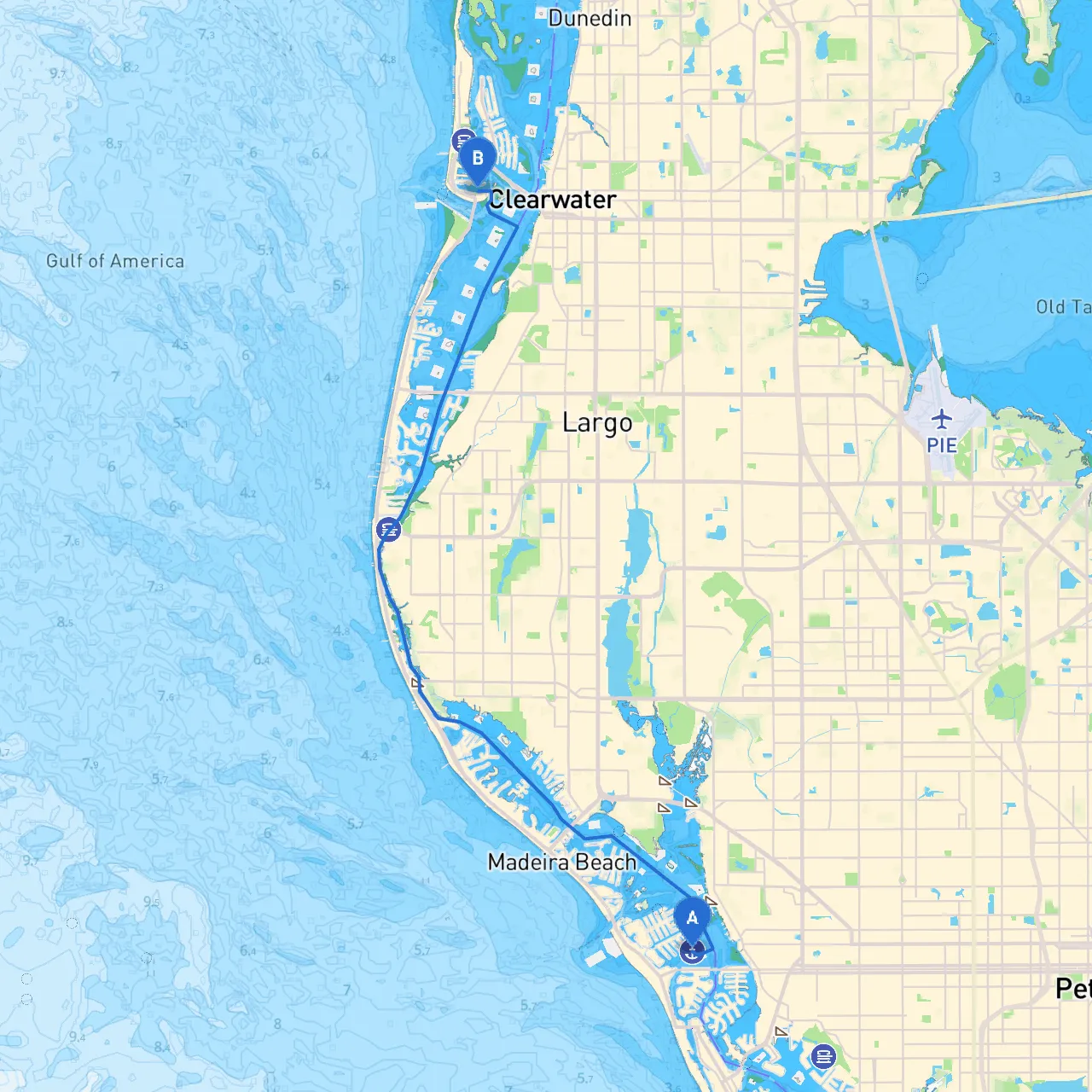
Starting Point: Treasure Island, FL Your adventure begins at Treasure Island. Before departure, check the local weather and tides. The currents can vary, potentially influencing your route.
Route Description:
1. Departure from Treasure Island Begin your journey by heading northwest out of Treasure Island. You will likely depart from the protected waters of Boca Ciega Bay, which provides natural shelter. Pay attention to the channel markers that guide you out toward the main waterway.
2. Navigating Boca Ciega Bay As you navigate the bay, look for the numerous mangrove-lined shorelines and small islands. This area is rich in wildlife, making it a delightful spot for a slow cruise. Ensure you mind your speed, as there are residential areas and local boat traffic.
3. Approaching Blind Pass Continue toward Blind Pass, taking note of the markers along the way. This area can be busy with fishing boats and recreational vessels. Slow down as you approach, which allows you to assess the traffic. Keep an eye on weather patterns, as storms can arise here unexpectedly.
4. Entering the Gulf of Mexico After you pass through Blind Pass, you will enter the Gulf of Mexico. Stay approximately one mile off the coast to avoid any shallow waters and potential hazards. It's crucial to continuously check your GPS and navigation instruments at this point, as visibility can change rapidly.
5. Navigating North along the Coast Cruise northwards, sticking close to the shoreline to enjoy views of the beautiful beaches and local habitats. Keep an eye out for navigational aids such as buoys and markers that guide you along the coastline. Pay special attention to the tides and currents in this area, as they can be deceptive.
Points of Interest Along the Route:
6. Shelter Options Should the weather turn unfavorable, the following spots offer shelter:
7. Final Approach to Clearwater Beach As you near Clearwater Beach, follow the markers directing you toward Clearwater Pass. This area can be populated with boat traffic, especially on weekends, so be alert. The entrance can be narrow with significant currents, so take care while entering.
Local Regulations and Safety Considerations:
Recommended Boating Apps:
By following this comprehensive pilotage plan, you ensure a safe and enjoyable boating experience along the stunning Gulf Coast. The combination of beautiful scenery, opportunities for exploration, and solid safety measures makes this journey a highly rewarding choice for the avid boater.