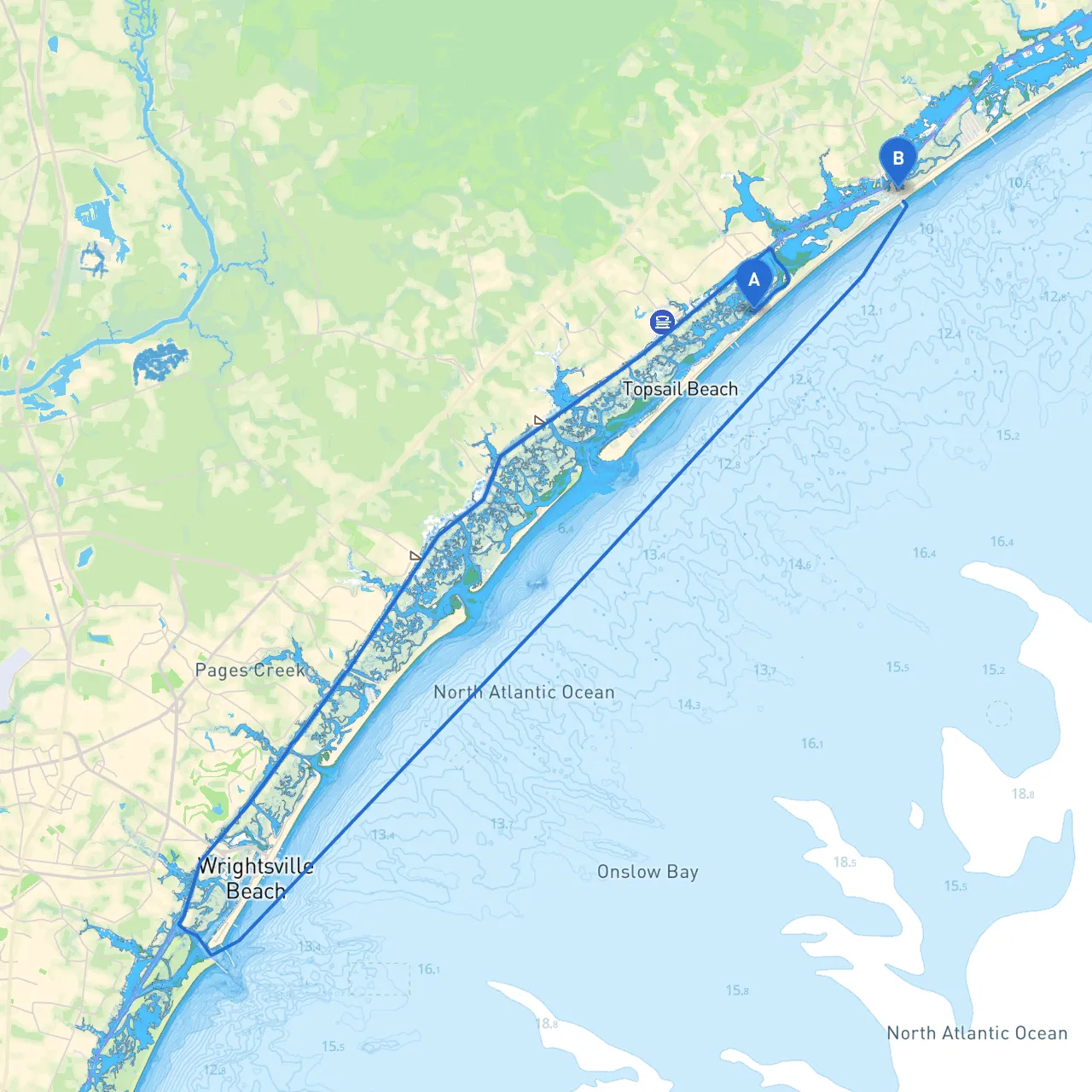
Pilotage Plan: Topsail Beach, North Carolina to Surf City, North Carolina
Embarking on a boat trip from Topsail Beach to Surf City is a delightful journey along the picturesque waters of North Carolina's Intracoastal Waterway (ICW). This route is great for both novice and experienced boaters, providing a safe and scenic passage with numerous opportunities for exploration while always keeping safety as a top priority.
Departure Point:
From Topsail Beach, you'll set out westward toward the ICW. As you begin your journey, be mindful of any weather forecasts, and always ensure your boat is ready and equipped with safety gear.
Arrival Point:
This route covers approximately 10 nautical miles, a manageable yet engaging distance that allows for a leisurely cruise and time to enjoy the scenery.
1. Hammocks Beach State Park Located just northwest of Topsail Beach, this beautiful park offers an abundance of wildlife viewing and shallow waters ideal for anchoring should the weather become unfriendly. Known for its beaches and maritime forest, you can explore uninhabited Bear Island.
2. Rich’s Inlet As you cruise along, you may decide to take a brief detour into Rich’s Inlet. It’s a great place to drop anchor, particularly if the wind picks up, providing shelter from rough seas. The inlet has a diverse ecosystem, making it excellent for wildlife watching.
3. Surf City Bridge As you approach Surf City, be aware of the Surf City Bridge. This structure may have restrictions depending on the time of day, so consult local schedules or VHF communication channels.
4. Soundside Park Once you arrive in Surf City, Soundside Park is a must-visit. It provides amenities for boaters, including a boat ramp and picnic areas. It's also an excellent spot for fishing and enjoying the local environment.
Before embarking:
Topsail Beach to Surf City is an enjoyable, relaxed trip that balances safety with stunning landscapes and rewarding experiences. This route not only offers beautiful views but also assures that you're navigating in a secure and welcoming marine environment. Prepare, stay vigilant, and enjoy your boating adventure!