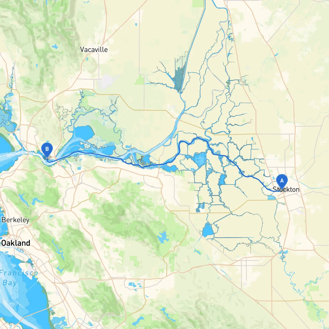
Pilotage Plan from Stockton, CA to Benicia, CA
Route OverviewEmbarking from Stockton, a bustling city situated on the San Joaquin River, and heading to Benicia, located on the shores of the Carquinez Strait, this trip offers a blend of breathtaking scenery, essential navigational landmarks, and safe harbor options. Suitable for various types of boaters, including those seeking a leisurely day cruise or experienced saltwater adventurers, this route is well within reach yet packed with opportunities for exploration and enjoyment.
1. Departure from Stockton
Starting Point
- Location: Stockton, CA
- Coordinates: -121.3059, 37.9540
- Key Landmarks: Head towards the Stockton Waterfront, adorned with delightful parks and marinas. The lovely views of the river as you depart set the tone for the journey ahead.
Safety Points
- Weather Check: Before departure, consult weather reports. The delta regions can be unpredictable; wind and fog can develop rapidly.
- Channel Awareness: Stay within marked channels to avoid shallow waters and potential hazards, especially near river bends.
2. Transition through the Delta
Navigating the DeltaAs you exit Stockton, you'll enter the Sacramento-San Joaquin Delta, which is a labyrinth of waterways. The delta offers a fascinating backdrop of wetlands and numerous islands.
Points of Interest
- Windmill Cove Resort: A picturesque stopover featuring a friendly marina and dining options.
- Franks Tract State Recreation Area: An ideal place for a quick swim or a picnic, surrounded by stunning views of nature.
Safety Aspects
- Local Regulations: Be mindful of slow speed zones and no-wake areas to protect wildlife and local residents.
- Anchorage Options: Good areas to anchor or shelter include the disused areas of Franks Tract, should weather conditions worsen.
3. Cortina Channel to Suisun Bay
Navigational RouteFrom the Delta, follow the marked channels leading toward Suisun Bay. This journey offers a mix of natural beauty with an opportunity to view various bird species and wildlife.
Landmarks
- Morrow Island: A significant landmark on your way. It’s a wildlife preserve, and while landing is prohibited, observe the area for an abundance of birdlife.
Safety Tips
- Tidal Considerations: Be aware of the tides, especially pushing through the channel, as strong currents can affect smaller vessels.
- Navigational Aids: Pay attention to buoys and markers along the way, as they're essential in avoiding shallow areas. Use your depth sounder to monitor changes in depth closely.
4. Entering San Pablo Bay
As you approach San Pablo Bay, the momentum shifts from the rustic channels to broader open water, preparing you for the final leg to Benicia.
Points of Interest
- Point Pinole Regional Shoreline: A worthwhile stop and a scenic picnic area with trails and beaches if the weather cooperates.
- Richmond-San Rafael Bridge: An impressive engineering marvel that provides a dramatic backdrop for your scenery.
Safety Precautions
- Current Awareness: The waters here can be influenced by winds and changing tides; remain cautious and adjust your course as needed.
- Vessel Traffic: Keep an eye on commercial shipping vessels; maintain a safe distance and be prepared to alter course to avoid crossings.
5. Arrival at Benicia
Final Approach
- Location: Benicia, CA
- Coordinates: -122.1577, 38.0446
- Marina: Utilize the Benicia Marina, which offers amenities for docking and supplies, making it an excellent spot for the conclusion of your journey.
Points of Note
- Historical Benicia: Take time to explore the charming downtown area, rich with history and waterfront parks.
- Local Attractions: Consider visiting the Benicia State Recreation Area for hiking or fishing once moored.
Weather Considerations
- Final Checks: Upon arrival, monitor weather conditions for your return trip, as conditions can change swiftly in this area.
Navigational Aids and Technology
To ensure safe travels, consider utilizing navigational apps such as:
- Savvy Navvy: A comprehensive app for route planning that includes up-to-date charts.
- Navionics: For detailed marine maps and depth contours.
- Garmin ActiveCaptain: For real-time information on anchorages and marinas.
This journey from Stockton to Benicia is a perfect mix of adventure, safety, and beauty, offering boaters a chance to connect with nature, learn about local history, and enjoy the myriad of experiences life on the water has to offer. Document your journey, respect the waterway regulations, and have a splendid time exploring the heart of California's Delta and Bay regions!