
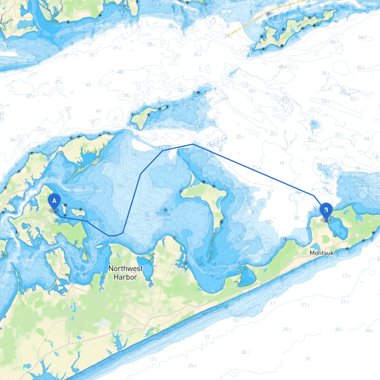
Overview:This route from Shelter Island to Montauk is a captivating journey through some of the most picturesque waters of Long Island. Ideal for experienced boaters, this trip not only offers beautiful vistas but also has necessary precautions for navigating local hazards, making safety a top priority.
Coordinates: Long/Lat -72.32027 / 41.07793
Start your adventure from Shelter Island, known for its serene atmosphere and beautiful landscapes. The island is well-protected and offers excellent facilities to prepare your vessel before departure. Before you leave, check the local weather conditions; the waters can be subject to sudden changes, particularly with summer storms.
1. Start towards West Neck Bay: Depart north towards the entrance of West Neck Bay. This area is mostly sheltered and perfect for a calm start. Look out for the Shelter Island Lighthouse, a prominent landmark that’s ideal for a photo op.
2. Navigating to Sag Harbor: After exiting West Neck Bay, set a course toward Sag Harbor. This charming village offers a variety of dining options and shops, making it a great spot for a break. The harbor itself is safe and has mooring facilities. Keep an eye on Red and Green Buoys along this stretch of water – they will guide your path into Sag Harbor.
3. Heading East towards Noyack Bay: Leaving Sag Harbor, follow the coastline to Noyack Bay, which provides further shelter if weather conditions turn unfavorable. Engage your navigation aids here, as this area can have busy boat traffic, particularly during weekends.
4. Long Beach Point: Continuing East, Long Beach Point is a natural barrier that extends into the waters. Be cautious of shoals that can appear, especially during low tide. Use a reputable nautical chart or electronic navigation aids, and maintain a northward course to avoid any hazards in shallow waters.
5. Entering Block Island Sound: Once safely past Long Beach Point, head northeast towards Block Island Sound. This area can present challenges due to currents and waves, so ensure your vessel is equipped for offshore navigation. Pay attention to the Montauk Point Lighthouse, visible from a distance, as you approach your destination.
Coordinates: Long/Lat -71.938 / 41.06767
As you arrive at Montauk, the waters open up with stunning views. Montauk is famous for its fishing, surfing, and beautiful beaches. Before anchoring, check in with local marina guidelines, as they often have seasonal regulations. The Montauk Harbor is a safe place to dock and offers various facilities.
This pilotage plan focuses on a safe yet scenic journey from Shelter Island to Montauk. It highlights the beauty and potential fun along the route while prioritizing safety with regulations and navigational advice. Enjoy your trip with confidence knowing you’re well-prepared for the journey ahead!