
Embarking on a boat trip from Shelter Island to East Hampton is a delightful journey for those seeking both safety and beauty on the water. This route showcases some of the loveliest views of the Hamptons, punctuated by quaint towns, hidden beaches, and charming marinas. Ideal for seasoned boaters and novice families alike, it blends the thrill of exploration with the comfort of laid-back cruising.
Set sail from the picturesque Shelter Island, renowned for its stunning landscapes and natural beauty. Before you leave, ensure you're equipped for the journey—check your navigation tools, safety gear, and communication devices.
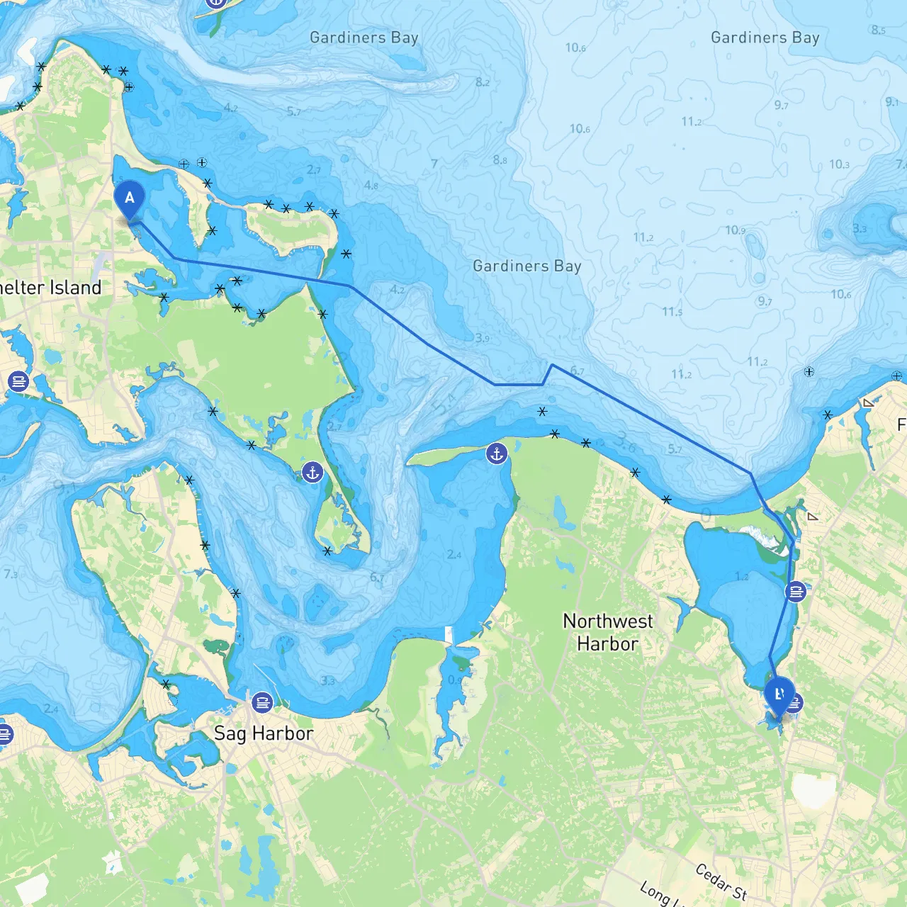
1. Approaching the Great Peconic Bay: As you head west from Shelter Island, you’ll navigate out of the harbor past a significant navigational aid: Shelter Island Lighthouse (Lat/Long: 41.0745, -72.362), which serves as a great point of reference. Be attentive to boat traffic, especially larger vessels that frequent this waterway.
2. Hazards: Watch for shallows, especially south of Shelter Island and around the entrance to the Peconic Bay. The shallow areas can be misleading, so having updated charts or an app like Savvy Navvy will greatly assist your navigation.
As you cruise through the Great Peconic Bay, consider these nearby points of interest:
From Sag Harbor, proceed eastwards:1. Navigational Aids: Follow the marks leading out of the Sag Harbor Bay. Pay attention to the buoyage marking shallow areas. 2. Environment: The waters deepen as you round the point towards East Hampton. Ensure you remain within marked channels, avoiding natural hazards such as rocks and sandbars.
As you near East Hampton, you’ll enter the waters around Georgica Pond. Be mindful of restrictions in this area, as it’s a delicate ecological zone.
East Hampton boasts wonderful charm, with opportunities for shopping, dining, and relaxing at a trendy beach. Visit the East Hampton Main Street for local boutiques or the Guild Hall for cultural insights.
This route from Shelter Island to East Hampton strikes an excellent balance between adventure and safety, addressing the needs of recreational boaters. Navigation can be straightforward with the proper tools, and the landmarks along the way add to the richness of the experience. Just remember to heed local regulations and keep an eye on the weather.
Don't forget to use helpful boating apps like Savvy Navvy for navigation and weather updates. Enjoy your journey and make the most of every moment on the water!