
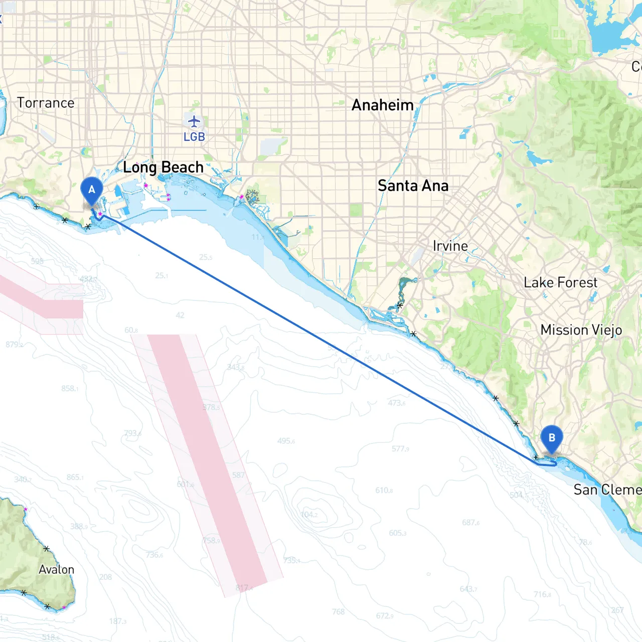
This pilotage plan outlines a scenic and safe boating trip from San Pedro, California, to Dana Point, California. The journey is approximately 40 nautical miles along the stunning Southern California coastline, making it ideal for experienced or moderate recreational boaters looking for a mix of adventure and enjoyment.
Starting Point: San Pedro, CA Ending Point: Dana Point, CA
San Pedro is a bustling port area, but just outside the harbor, you’ll find the enchanting views of the Pacific. Before you depart, ensure you review the local sailing regulations, as commercial vessel traffic is significant in the area. It’s best to leave early in the morning to enjoy calmer waters and enhance visibility. Pay special attention to the marine traffic as you exit the breakwater.
Notable Hazards:
1. Catalina Island Ranges – On clear days, you’ll have a stunning view of Cataline Island in the distance. It serves as a reminder of how coastal weather may feign tranquility.
2. Long Beach Harbor – Look out for the busy traffic of yachts and commercial vessels here, especially near the entrance. If conditions change, Long Beach Harbor provides an excellent sheltering spot to wait for calmer weather. It has various amenities for refueling and relaxing.
3. Point Vincente – A notable navigational aid, this point is also home to the historic lighthouse. If time allows, you might want to anchor and take a quick tour ashore, but always assess the weather conditions before proceeding.
4. Los Angeles County Beaches – The coastline offers several pockets where you can anchor for a swim or lunch, like the scenic beaches at Palos Verdes. Make sure to be cautious of any active swimmers and beachgoers.
5. Huntington Beach – Another great stop if the weather permits. This area has a vibrant beach scene and various dining options for you to explore, ensuring you're well-fed and rested.
6. Newport Beach – Newport Harbor can offer excellent protection if conditions become rough. The harbor provides opportunities to stock up on supplies or enjoy a meal at one of the waterfront restaurants.
Important Navigational Aids:
Local Regulations: Dana Point is a protected area for marine life, and certain zones have restrictions on anchoring and fishing. Always check the latest regulations before planning activities.
1. Weather Awareness: Regularly check weather updates, including wind speeds and potential storms.2. VHF Radio Channels: Monitor Channel 16 for emergency communications and channel 9 for non-emergency traffic.3. Navigation Apps: Utilize apps such as Savvy Navvy, Navionics, or other boating applications for real-time navigation assistance.
This route proves to be an enjoyable and safe passage for recreational boaters. With careful planning, regular weather checks, and adequate knowledge of local regulations, you will be set for an exciting and fulfilling boating adventure along the California coastline. Safe travels!