Pilotage Plan for Boat Trip from Red Bank, NJ to Brooklyn, NY
Overview
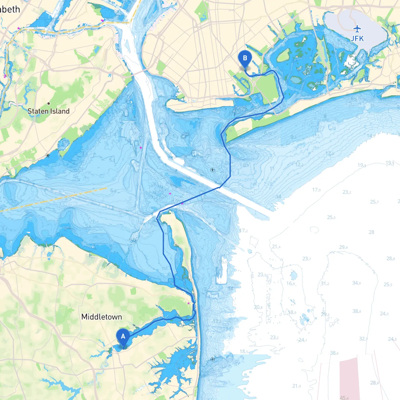
This boat trip from Red Bank, New Jersey, to Brooklyn, New York, spans approximately 24 nautical miles along the Shrewsbury and Raritan rivers, navigating through scenic bays and notable landmarks. It is well-suited for intermediate to advanced boaters due to the varied navigation challenges and the need for keen attention to weather and traffic conditions.
Starting Point: Red Bank, NJ
: 40.3553° N, 74.0642° W Begin your journey at the vibrant and historic town of Red Bank. Known for its arts scene and riverfront parks, it provides plenty of amenities for boaters. Before you head out, check the weather and ensure that you have all necessary safety equipment on board.
Notable Shelter Stops
- Approx. 8 nautical miles from Red Bank. - This protected bay offers refuge from rough waters. The sandy shorelines provide opportunities for beach outings or just a relaxing moment on the water.
2. Raritan Bay - Continuing another 8 nautical miles will lead you to Raritan Bay. It provides ample room to maneuver with fewer hazards. Should conditions change, this is an ideal area for anchoring.
3. Pier 13, Hoboken - A vibrant spot about 2 nautical miles from Brooklyn, where boaters can enjoy food trucks and the scenic waterfront park. An excellent area to recharge before entering Brooklyn’s busy waters.
Route Description
Starting from Red Bank, follow the Shrewsbury River northward, staying aware of the local fishing spots and recreational boats often in this region. Pay close attention to the local waterway signs indicating speed zones to prevent unnecessary wakes and protect the environment.
As you exit into Sandy Hook Bay, keep an eye out for the Sandy Hook Lighthouse, a significant historical landmark. This area can also be quite busy, especially on weekends, with boats coming and going, so remain vigilant.
Transitioning to Raritan Bay will require navigation past the Hope and Glory Bridges. These structures are low-profile, so ensure your mast height is within safe limits for clearance.
Navigational aids in this section include:
- Raritan River Light (Fl R 4s, 77)
- Sandy Hook Light (Fl W 28s, 125)
Make sure to reference your charts to keep track of any submerged obstacles.
Points of Interest
Throughout your journey, consider taking a side trip to:- Sandy Hook National Park, where you can explore pristine beaches, trails, and historical sites.
- Highlands, a picturesque town on the other side of Sandy Hook Bay, known for its scenic views and marina facilities.
Upon reaching Brooklyn, the sight of the skyline is a rewarding end to your trip. Ensure you approach the Brooklyn area cautiously, as it is often crowded with commercial traffic. Watch for the Fishers Island and Elberon Lighthouses and respect local traffic patterns.
Local Regulations and Considerations
- Maintain a safe operating speed, especially in crowded areas.
- Observe no-wake zones, particularly near marinas and residential areas.
- Monitor VHF Channel 16 for any emergency communications.
- It’s always wise to check for any local advisories before your trip as navigation hazards can arise due to weather or ongoing construction activities on waterways.
Recommended Apps
Before setting out, consider using navigation and weather applications like:- Savvy Navvy – offering detailed charts and route planning capabilities.
- Navionics – for detailed marine charts and navigation assistance.
- Windy – to keep an eye on wind and weather conditions for safe passage.
Conclusion
This trip provides a splendid mix of natural beauty, landmarks, and urban exploration. By planning adequately and prioritizing safety while remaining flexible with your plans, you’re set for an exhilarating boating experience ideal for adventurers seeking both tranquility and excitement. Safe travels on the water!