
Pilotage Plan from Portovenere, SP, IT to Portofino, GE, IT
Start Point: Portovenere, SP, IT (Coordinates: 9.836041, 44.065816) End Point: Portofino, GE, IT (Coordinates: 9.209972, 44.302720)
Introduction to the Route
Embarking on this coastal adventure from the picturesque village of Portovenere to the glamorous Portofino provides a unique blend of stunning scenery, tranquil bays, and vibrant marine life. This route, suitable for experienced sailors and leisurely cruise enthusiasts alike, allows open-water navigation amid the charming landscapes of the Italian Riviera.
Whether you're seasoned in seamanship or a leisurely boater seeking a scenic getaway, this trip promises awe-inspiring views while emphasizing safety and local regulations.
Leg 1: Portovenere to Lerici (Approx. 3 nautical miles)
As you set sail from Portovenere, steer clear of the rocky shoals by navigating southwest towards Lerici. Keep Castello di Lerici, a stunning historical fortress, to your starboard.
Notable Shelters: Lerici’s harbor offers excellent shelter in rough weather, with plenty of local dining and cultural attractions. It’s a perfect stop for lunch or a swim.
Navigational Consideration: Monitor the depths around Lerici, particularly near the marina entrance, and keep an eye on local fisherman’s activity.
Leg 2: Lerici to Fiascherino and Tellaro (Approx. 2 nautical miles)
Continue your journey by rounding the tip of the peninsula towards Fiascherino, where you can appreciate its lovely beaches. Here, gliding into Tellaro, a quaint fishing village, brings another opportunity to experience local café atmospheres and stunning views.
Notable Shelters: Fiascherino’s small bay offers a safe harbor for overnight stays should weather conditions change.
Navigational Consideration: This stretch features rocky outcrops; ensure adequate lookout as you cruise alongside the coast.
Leg 3: Tellaro to La Spezia Bay (Approx. 5 nautical miles)
Heading northwest, brace yourself for the sweep into La Spezia Bay. The bay acts as a strategic jump-off point with access to amenities and further shelters. The city’s naval past is evident, with the impressive waterfront and marine museums acting as perfect distractions.
Notable Shelters: The La Spezia Marina provides substantial facilities for refueling, provisioning, and repairs should the need arise.
Navigational Consideration: Pay attention to commercial shipping routes in La Spezia. Utilizing radar and ensuring communication via VHF can aid in safe navigation through heavier traffic.
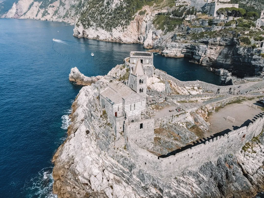
Leg 4: La Spezia to Porto Venere (Approx. 5 nautical miles)
Returning past Palmaria Island, consider circling around for some of the best views and swimming opportunities, particularly at the beaches along the shore.
Notable Shelters: Porto Venere itself is your anchor point, with adequate amenities. Worth exploring is San Pietro Church, and don’t miss a peek at the waterside restaurants serving up fresh seafood.
Navigational Consideration: Watch for boat traffic approaching the entrance; the depth remains favorable, but careful observation guards against sudden changes.
Leg 5: Porto Venere to Cinque Terre National Park (Approx. 12 nautical miles)
Leaving the sheltered waters, navigate towards the enchanting landscape of Cinque Terre. This World Heritage site showcases colorful cliffside villages (such as Manarola and Riomaggiore) accessible by water transport.
Notable Shelters: Monterosso al Mare is an excellent resting point. Anchor in the bay relatively close, ensuring to maintain appropriate distances from local fishermen.
Navigational Consideration: Recognize the prevailing winds and currents; the nearer you get to the cliffs of Cinque Terre, gusts can be fierce, particularly in late afternoon.
Leg 6: Cinque Terre to Portofino (Approx. 12 nautical miles)
As you approach the final leg heading southeast to Portofino, enjoy the strait between Panarea Island and the mainland, a peaceful and scenic stretch. Watch for daytime excursions, as this is a popular route for boats and ferries.
Notable Shelters: Portofino’s harbor is iconic and vibrant, rich with cafes and shops, yet check before entering for mooring regulations, as it can get busy.
Navigational Consideration: Be cautious around the entrance to Portofino, with many boats coming in and out. Watch for buoys that guide mooring sectors.
Safety Recommendations & Navigational Aids
This voyage from Portovenere to Portofino isn’t just about the destination; it’s about the stunning scenery, local flavors, and maritime culture that the Ligurian Sea has to offer. Preparing well ensures a safe, enjoyable trip that every boater will cherish.