
Pilotage Plan: Pompano Beach, Florida to Bimini, Bahamas
IntroductionEmbarking on a boat trip from Pompano Beach to Bimini is not only a rewarding experience but also a journey rich in stunning coastal landscapes, marine life, and potential adventures. This route is ideal for intermediate to experienced boaters given the open waters of the Gulf Stream and the careful navigation required across international waters. Here’s a comprehensive pilotage plan to ensure you enjoy every moment while staying safe.
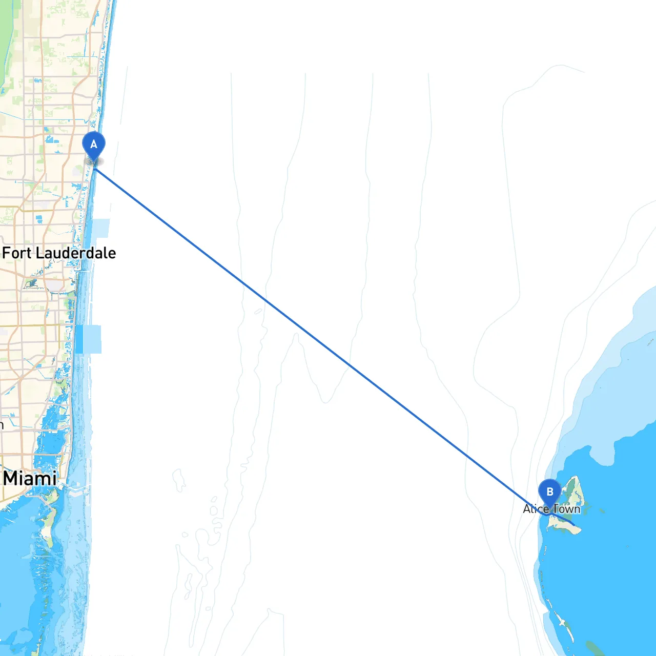
Route Overview
Points of Interest and Safe Havens1. Boca Raton Inlet: - Just south of Pompano Beach, Boca Raton Inlet offers good shelter in case of sudden weather changes. The nearby beaches and parks provide a great coastal stop for both exploration and relaxation.
2. Lake Worth Inlet: - Further south, this inlet serves as a potential refuge from severe conditions. You’ll find the serene Lake Worth Lagoon where you can anchor and perhaps enjoy some fishing or wildlife observing.
3. The Bahamas Bank: - As you venture towards Bimini, be aware that you’ll be transitioning into the shallow waters of the Bahamas Bank. The stunning turquoise waters are mesmerizing, but navigation must be done carefully due to sandbars and shoal areas.
4. Bimini Fowl Cay: - Before reaching Bimini, a stop at Bimini Fowl Cay is recommended. This small, uninhabited island is perfect for a swim or exploration, offering a peaceful break before approaching your final destination.
Navigational Considerations
Safety Recommendations1. Vessel Readiness: Check all safety equipment before departure, including life jackets, fire extinguishers, and first aid kits. It may be wise to consider carrying an EPIRB (Emergency Position Indicating Radio Beacon).
2. Communications: Ensure your VHF radio is operational for constant communication with the Coast Guard and other vessels. Monitor Channel 16 for emergencies.
3. Travel Time: Aim to leave early in the morning; this allows for ample time to navigate towards Bimini while providing a buffer against any unexpected changes in weather.
Additional Useful Apps
ConclusionThis passage to Bimini from Pompano Beach is a blend of relaxation, exploration, and the thrill of ocean navigation. While the trip does focus on safety as the utmost priority, the route also offers beautiful destinations, rich in marine life and cultural experiences, making it a memorable journey. Prepare well, navigate carefully, and enjoy the breathtaking beauty of this route. Safe travels!