
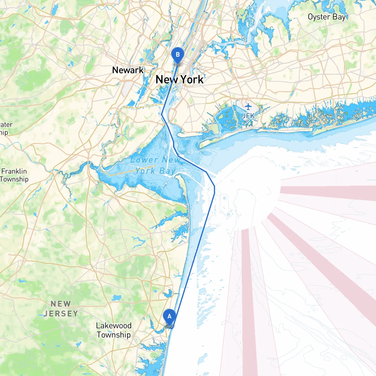
Starting Point: Location: Point Pleasant Beach, NJ Coordinates: Longitude -74.0385, Latitude 40.1031
Ending Point: Location: New York, NY Coordinates: Longitude -74.0117, Latitude 40.7453
Overview:
Embarking on this trip from Point Pleasant Beach to New York City offers a wonderful blend of scenic beauty, fascinating landmarks, and the thrill of navigating through populated yet picturesque waters. This route is particularly suited for experienced boaters who are comfortable in open waters and capable of adapting to changing conditions. While focusing on safety, this journey also highlights various opportunities for enjoyment and exploration along the way.
Route Breakdown:
1. Point Pleasant Beach to Manasquan Inlet: - Distance: Approximately 5 nautical miles - Navigational Aids: Look for the Point Pleasant Canal Entrance Buoys guiding you through the inlet. Keep a close watch for fishing vessels and local water traffic. - Hazards: Be cautious of shoaling areas, particularly near the inlet, and adhere to local speed limits to avoid dangerous wakes. - Shelter Options: Manasquan Inlet offers a safe harbor if weather conditions deteriorate.
2. Manasquan Inlet to Barnegat Bay: - Distance: Approximately 10 nautical miles - Navigational Aids: Utilize the Barnegat Bay navigational markers and pay attention to the channel depths marked along the way. - Local Points of Interest: Various marinas and waterfront dining spots can be found, perfect for a lunch break or stretch.
3. Barnegat Bay to Little Egg Inlet: - Distance: Approximately 11 nautical miles - Navigational Aids: Continue to monitor channel markers. The bay is relatively straightforward, but heavy fog can create visibility issues at times. - Hazards: Shallow areas just outside of the designated channel. Maintain situational awareness.
4. Little Egg Inlet to Atlantic City: - Distance: Approximately 15 nautical miles - Navigational Aids: The inlet is well-marked, yet busy with commercial traffic. Watch for casino cruise ships and fishing vessels. - Local Attractions: Stop in Atlantic City for a chance to explore the famous Boardwalk, casinos, and dining.
5. Atlantic City to Sandy Hook Bay: - Distance: Approximately 30 nautical miles - Navigational Aids: Keep an eye on marine traffic, as this stretch is popular with both commercial and recreational vessels. - Shelter Options: Sandy Hook Bay offers excellent anchorage and would be a great refuge if conditions become unfavorable.
6. Sandy Hook Bay to New York Harbor: - Distance: Approximately 12 nautical miles - Navigational Aids: Focus on the Verrazzano-Narrows Bridge as a prominent landmark. Follow the approach guides into the harbor, being cautious of ferries and cargo ships. - Local Points of Interest: The iconic Statue of Liberty and Ellis Island are visible from the water, and surely worth a closer look if conditions permit.
Safety Considerations:
This trip is a match for adventurous yet cautious boaters who appreciate a blend of natural beauty, historic landmarks, and vibrant coastal towns. Whether you’re seeking a temporary getaway or a grand adventure, this route promises an unforgettable journey, filled with experiences on the water while keeping you and your crew safe and sound.