
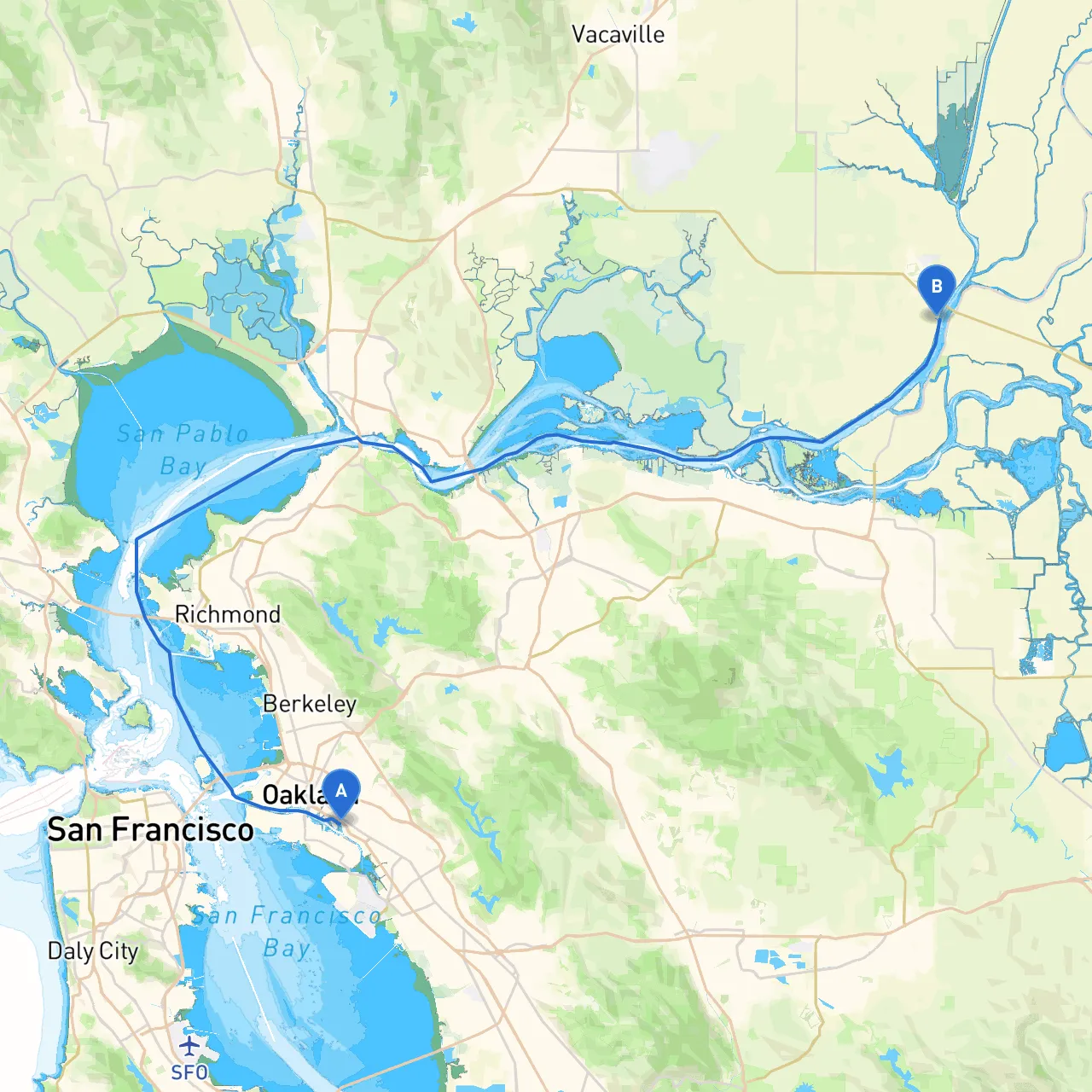
Pilotage Plan from Oakland, CA to Rio Vista, CA
Departure: Oakland, CA Coordinates: Latitude 37.7833, Longitude -122.2434 Starting your journey in Oakland offers a bustling city backdrop with the scenic views of the San Francisco Bay. Before heading out, take a moment to enjoy the iconic waterfront and prepare your vessel. Ensuring all safety equipment is aboard (life jackets, flares, fire extinguishers, etc.) is paramount.
Route Overview The journey from Oakland to Rio Vista spans approximately 45 nautical miles through dynamic waters, with a mix of urban and natural landscapes. This route suits both experienced boaters and those looking for a leisurely day on the water. As you navigate primarily through the San Francisco Estuary, expect a relatively sheltered environment that’s well-loved by anglers and nature enthusiasts alike.
As you depart from Oakland, you'll cruise under the San Francisco-Oakland Bay Bridge towards Alcatraz Island, about 5 nautical miles away. Look out for Baker Beach to your starboard as you approach the entrance to the Golden Gate.
Navigational Aids: Be attentive to the shipping lanes and buoy markers. The Red and Green Buoy system is crucial, particularly near the bridge and the cliffs of San Francisco. Maintain a safe distance from larger vessels as they transit these busy waters.
Leaving Alcatraz, head north toward Richmond. This leg is approximately 11 nautical miles, ideal for leisurely navigation while soaking in views of the Marin Headlands on one side and the restored shipyards of Richmond on the other.
Navigational Notes: Pay attention to the Richmond-San Rafael Bridge; it has marked clearance heights, so ensure your mast height complies with the obstructions.
Continuing along your route brings you to Martinez, roughly 10 nautical miles from Richmond. This section offers a glimpse into the salt marshes that characterize the northern San Francisco Bay.
Important Considerations: Monitor tidal changes as this area can experience significant current flows. Consult the local tide charts for safe navigating times.
Your final leg takes you from Martinez to Rio Vista—a distance of about 17 nautical miles. This stretch of water leads you through the Sacramento-San Joaquin River Delta, a treasure trove of natural beauty.
Coordinates: Latitude 38.1498, Longitude -121.6938 Upon arriving at Rio Vista, you’ll find a charming town with local shops and eateries perfect for unwinding after your journey. Before you dock, be aware of local regulations regarding mooring and park your boat accordingly.
As you cruise along this beautiful route, ensure you are well-prepared for changing weather conditions and be alert for other watercraft. Utilizing a reliable app like Savvy Navvy can greatly enhance your navigational experience, alongside good old-fashioned charts and local knowledge. Other helpful apps include Marinas.com and NOAA Weather to monitor both tides and weather changes.
This journey from Oakland to Rio Vista captures the unique essence of the Bay and Delta; it's perfect for those who appreciate the beauty of nature and the thrill of cruising in a relatively safe environment. Enjoy the serenity of the water as much as the camaraderie often found among fellow boaters on this popular path!