
Coordinates: Latitude 25.9341, Longitude -80.1460
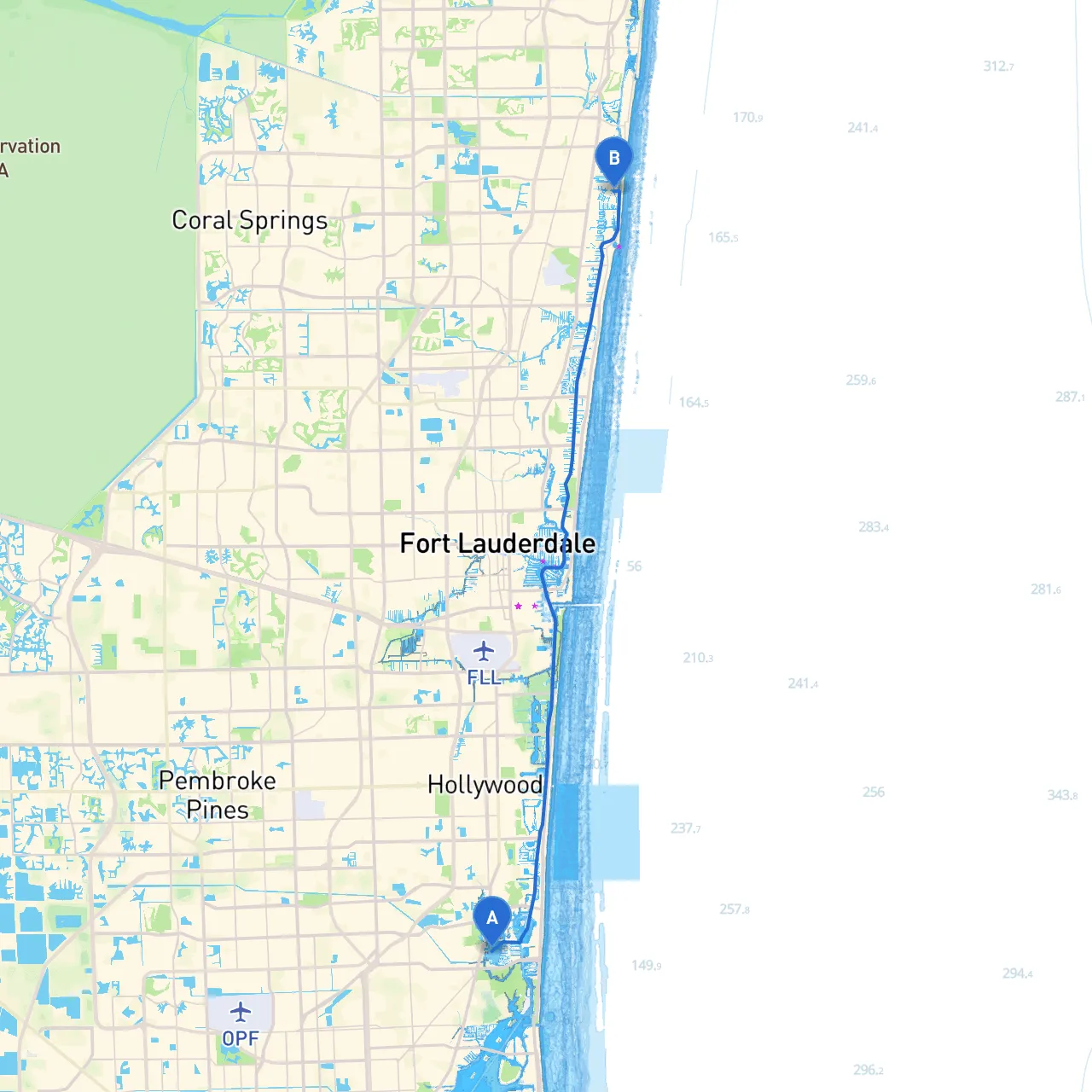
Your journey begins on the stunning waters off North Miami Beach. Before you set sail, make sure you check the latest weather forecasts and tide charts. Given the proximity to bustling urban areas, be prepared for some traffic as you navigate the water.
Aventura Mall: As you cruise out, consider a quick stop at Aventura Mall if you need provisions or a last-minute snack. While this isn’t directly on the water, it's just a short distance off the route.
Distance: Approximately 5 nautical miles
Leave the beach and make your way southwest towards the Intracoastal Waterway (ICW). As you navigate through this area, keep a lookout for local fisherman and yachts. The waters might be quite busy; adherently follow the navigational aids, buoys, and markers, ensuring you maintain a safe distance from marked shallows and private docks.
Once on the ICW, you’ll experience a slice of Floridian paradise where the shoreline is dotted with stunning luxury homes and mangrove areas. Remember to keep a solid lookout for other vessels and particularly heed the speed limits as you pass through residential sections.
Biscayne Bay: Should the skies darken or winds pick up, Biscayne Bay provides a wide open area for shelter. This large bay offers plenty of space to anchor down and ride out weather changes.
As you proceed, pay special attention to the markers and lights:
Continuing north on the ICW towards Lighthouse Point, route planning becomes necessary for strategic safety. The shore will shift to beautiful parks and inlets, offering diversions for wildlife watching, especially in the Dania Beach area where you may spot manatees and different bird species.
Coordinates: Latitude 26.2843, Longitude -80.0833
As you approach the Lighthouse Point area, you'll be greeted by a beautiful waterfront community. You can anchor securely, located just off the Intracoastal. Look for local marinas if you intend to fuel up or need additional amenities. This area is a boater's haven with restaurants and spots for relaxation and recreation.
Before embarking on your journey, equip your vessel with safety gear—life jackets, flares, and a first aid kit are essential. Additionally, take note of local regulations, including quiet zones and no-wake areas along the ICW.
For navigation assistance on the water, consider using savvy navvy along with other recommended boating apps such as Navionics and OpenCPN to chart your course efficiently.
This route not only offers a beautiful cruising experience but also ensures you remain within safe harbors along the way. Perfect for seasoned boaters and those looking to enjoy a delightful day on the water without compromising safety. Enjoy the ride!