
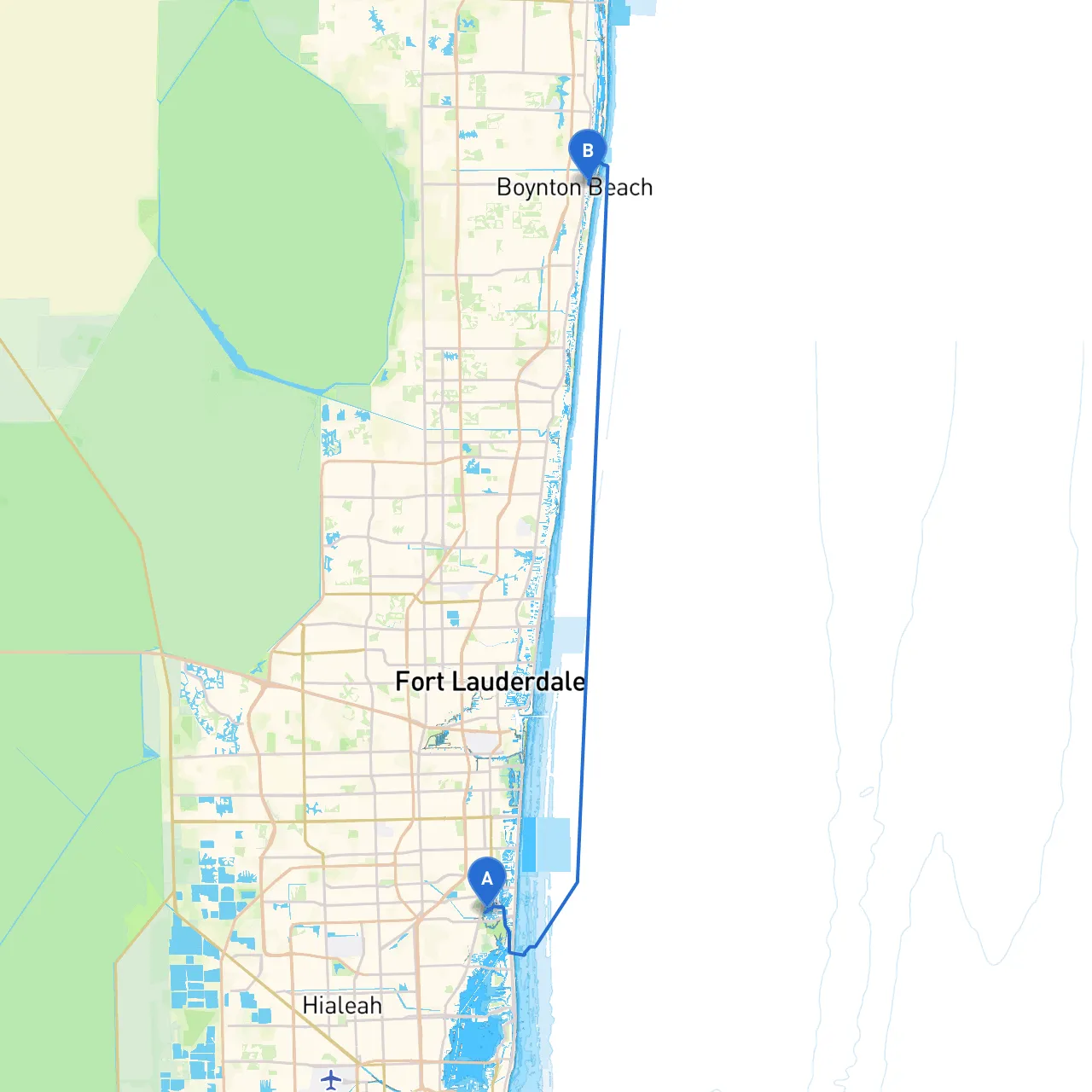
Route Overview
This journey from North Miami Beach to Boynton Beach offers a wonderful mix of serene coastal cruising with opportunities to explore picturesque bays, unique landmarks, and vital navigational aids. Suitable for a range of boaters—from day-trippers to seasoned cruisers—this route provides the thrill of adventure while keeping safety paramount.
Departure Point: North Miami Beach
Set off from North Miami Beach, located on the eastern coast of Florida. Ensure your vessel is fueled up and all safety equipment—like life jackets, flares, and navigational tools—are prepared before leaving the dock. Before departure, listen to the latest marine weather reports.
Key Points of Interest Along the Route:
1. Haulover Park: Just a few nautical miles south, this is an excellent first stop. The park has designated safe anchorage areas and sandy beaches where families can enjoy a beach day. Be mindful of recreational boating traffic in this area.
2. Bal Harbour: This upscale community offers stunning views of luxurious waterfront properties. While it's not a formal stop, the scenery is ideal for cruising slowly and soaking in the environment.
3. Sunny Isles Beach: As you cruise along, consider stopping at the inlet here. It provides sheltered areas if the weather changes quickly. The waterfront restaurants are perfect for a lunch break or a quick snack.
4. Oleta River State Park: This is an outstanding natural preserve with extensive mangroves. It’s great for a slow cruise or kayak rental if you want to explore its waterways. Watch for wildlife, including manatees and various bird species.
5. Biscayne Bay: The eastern part of your route leading into Biscayne Bay features deeper waters and stunning views of the Miami skyline. The bay is known for its significant marine life, so be cautious of local regulations regarding fishing and boating.
6. North Miami Canal: As you round the point, head toward the North Miami Canal for some gentle cruising before reaching the open waters again. The canal can be a protected path in case of inclement weather.
Navigational Considerations:
Bays and Shelters:
Should inclement weather arise during your journey, there are several sheltered areas you can utilize:
Arrival Point: Boynton Beach
As you approach Boynton Beach, take time to relax and enjoy the transitions of sunset over the Atlantic. Boynton Beach boasts recreational options, including the Boynton Inlet, where you can access further facilities, fuel, and dining with a waterfront view.
This route navigates both the coastal waters and bays while prioritizing safety at every turn. As a boater on this mission, you will appreciate the balance between adventure, natural beauty, and the necessary diligence for safe navigation.
For additional navigation help on your journey, consider using boating apps, including savvy navvy, which provide real-time data on tides, weather, and a clear outline of navigational aids along your route. Enjoy your trip with the assurance that you are prioritizing safety while enjoying the stunning Florida coastline!