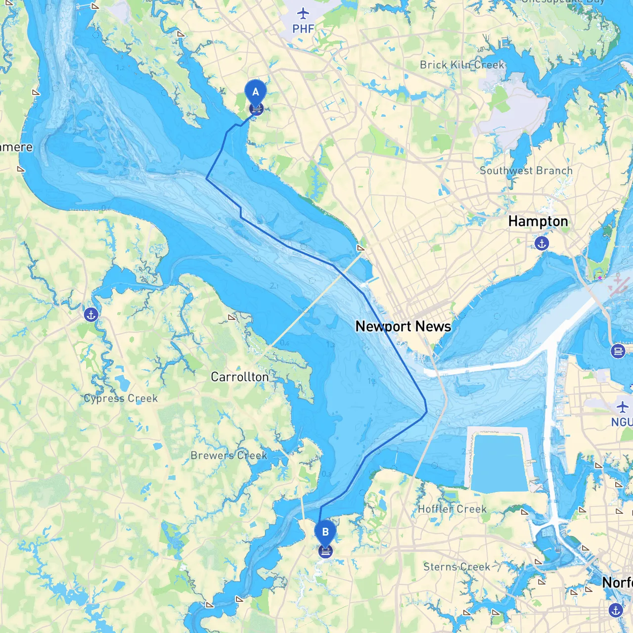
Pilotage Plan: Newport News, VA to Suffolk, VA
Embarking on a journey from Newport News to Suffolk is a delightful way to explore the waterways of Virginia. The route offers a blend of scenic views, historical landmarks, and safe harbors, making it suitable for both novice and experienced boaters. Safety will be your priority, but with the right preparations and attention to conditions, this trip promises to be enjoyable and memorable.
Route Overview
The trip covers approximately 20 nautical miles and leads you through key navigational points, natural beauty, and areas rich with history. You’ll follow the waterways of the James River and the Nansemond River, making for a scenic and serene journey.
Starting Point: Newport News, VA
- Coordinates: Longitude -76.5219, Latitude 37.0849
- Start your journey from one of the local marinas. Ensure your vessel is equipped with life jackets, flares, a first-Aid kit, and have plenty of fuel onboard.
Route Regulations
As you depart from Newport News:- Pay attention to local navigation rules and any seasonal restrictions in the area.
- Be mindful of vessel speed limits, especially when approaching marinas and residential areas.
- The James River carries commercial traffic, so keep an eye out for large vessels and respect the navigational channels.
Navigational Aids
- Look for markers outlining the deep water channels. The buoys and day markers will guide you, especially when navigating near the mouths of the rivers.
- The Hampton Roads Bridge-Tunnel can be particularly busy. Maintain a safe distance and be aware of the changing tides in this region.
Shelters and Bays Along the Route
: This large body of water provides ample opportunities for shelter should inclement weather arise. With multiple marinas on the south side, it's a great stop if conditions worsen.2.
: As you enter this river section, expect tranquility. There are protected waters that reduce the effects of wind and waves. Look for local docks and spots to tie up if needed.
Points of Interest
- Historic Fort Monroe: This national historic landmark boasts rich history, perfect for a brief stop. Its scenic grounds allow for short trips inland for exploration.
- Portsmouth Waterfront: A charming area that’s accessible via the Elizabeth River should you want to make a detour. Consider stopping here for food or cultural experiences.
Final Stretch: Navigating to Suffolk
Once you turn up the Nansemond River:- Watch for local fishermen and smaller recreational vessels. Maintain a slow speed and keep clear of their lines.
- There are few commercial navigational hazards in this stretch, but always keep an eye on the weather, as the weather can change rapidly, especially in the late afternoon.
Arrival Point: Suffolk, VA
- Coordinates: Longitude -76.4781, Latitude 36.8649
- Arrive at one of the local docks or marinas. Ensure that you secure your boat properly and follow local marina guidelines.
Safety and Resources
As always, safety is paramount. Ensure your boating skills are up-to-date and familiarize yourself with the current weather forecasts. Consider using the following apps for navigation and safety:- Savvy Navvy: Great for route planning and real-time weather updates.
- Navionics: For detailed charts and local navigation updates.
- WeatherBug: For real-time weather conditions and alerts.
Before you set sail, double-check your equipment, stay informed of the weather, and maintain a watchful eye on navigational markers and local traffic. This carefully planned route offers a splendid combination of safety, visual enjoyment, and exploration potential. Happy cruising!