
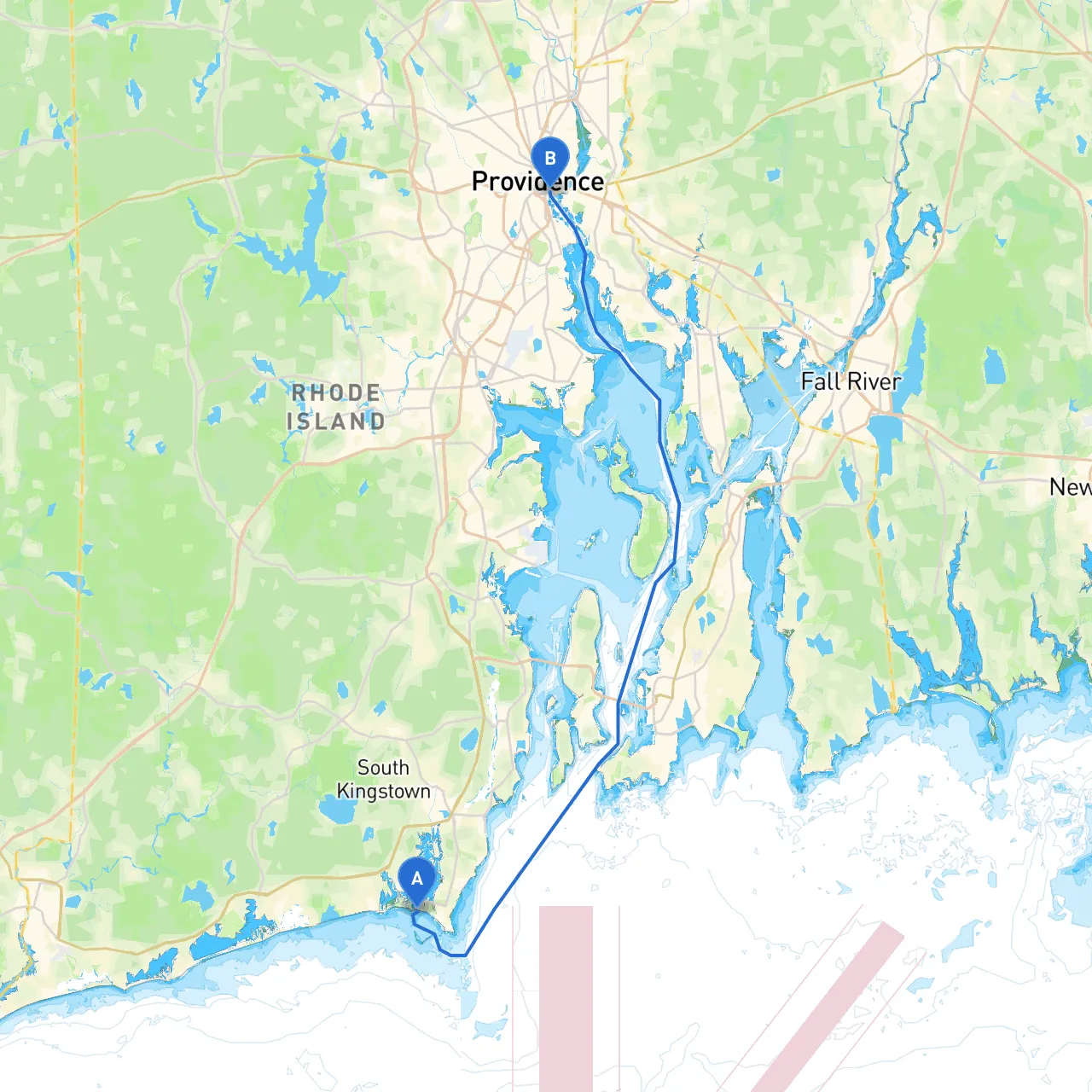
Pilotage Plan: Narragansett, Rhode Island to Providence, Rhode Island
Embarking on this journey from Narragansett to Providence offers a blend of safe navigation with the thrill of being on the water while enjoying the scenic beauty of Rhode Island's coastline. The distance between these two points is roughly 12 nautical miles, making for a perfect day trip, suitable for both seasoned sailors and less experienced boaters.
Starting Point: Narragansett, Rhode Island Coordinates: -71.5115, 41.374 Ending Point: Providence, Rhode Island Coordinates: -71.4023, 41.8175
This route primarily traverses Narragansett Bay, a large and sheltered body of water that is ideal for a variety of vessels. The journey takes you through stunning coastal views, rich maritime history, and the opportunity for interesting stops along the way.
1. Narragansett Bay: As you depart from Narragansett, you will find yourself surrounded by the beauty of the bay. The water is generally calm, making it an excellent place for beginners and families. Keep your eyes peeled for local wildlife, including seabirds and potentially even dolphins.
2. Bays and Harbors: - Jamestown: About halfway along your route, consider a stop at Jamestown. Its harbor provides excellent shelter should the weather take a turn. The quaint town is rich with history and offers lovely waterfront parks, walking trails, and fresh seafood restaurants. The Jamestown bridge is also a picturesque landmark to admire.
- Cove on the East Side of Conanicut Island: If you need to seek further shelter, this cove is well known and offers great protection from winds, making it an ideal retreat in inclement weather.
3. Providence Waterfront: As you approach Providence, the scenic waterfront provides numerous options for docking. Here you’ll find parks, walkable promenades, and attractions like the Rhode Island State House and WaterFire events, which can make for a delightful ending to your journey.
1. Chart Coverage: Make sure to utilize navigational charts of Narragansett Bay. The NOAA paper charts or electronic navigation tools such as Navionics and savvy navvy can enhance your situational awareness and assist in course plotting.
2. Navigational Aids: Pay close attention to buoys, lights, and markers. The prominent structures include: - The Point Judith Lighthouse: A historical landmark that assists in marking your exit from Narragansett. - Marker R “2” and G “1” at the entrance of the Providence River to ensure you’re within safe channels as you navigate.
3. Local Regulations: Be mindful of speed limits as you approach the urban areas of Providence. The upper reaches of the Bay leading into the city have designated slow zones, particularly near mooring fields and crowded urban waters.
This pilotage plan encapsulates a fantastic boating opportunity from Narragansett to Providence, beautifully balancing safety with the chance to explore. The sheltered waters of Narragansett Bay provide an enriching environment for boaters of all types, ensuring a memorable journey filled with stunning views and stops at charming locations. Embrace the adventure, navigate wisely, and relish each moment on the water!