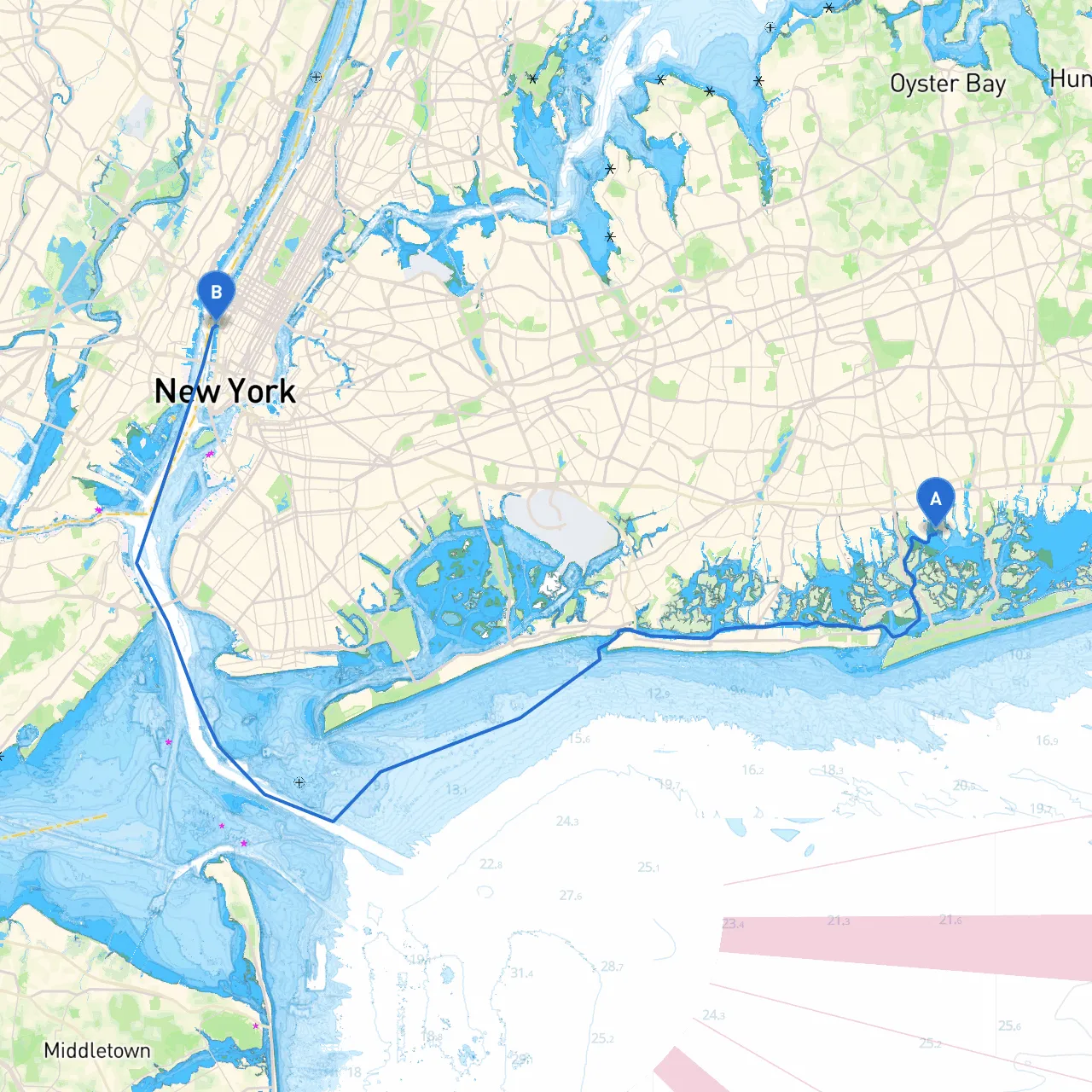
Pilotage Plan from Merrick, NY to New York, NY
Overview
Embarking on this journey from Merrick, NY, to New York City is not just an exciting day on the water; it's also a chance to explore the beauty and vibrant culture of the region. This trip, suitable for experienced and adventure-seeking boaters, traverses various waterways, offering opportunities for shelter and fascination along the way.
Starting Point: Merrick, NY
Longitude -73.5396666667, Latitude 40.6426666667
Merrick is a charming start, nestled within the narrow channels of Nassau County. Ensure that your vessel is equipped for any navigation challenges you may encounter along the way.
Leg 1: Merrick to Wantagh State Parkway Bridge
Approximately 4 nautical miles.
Head west through Merrick Creek. Pay special attention to narrow channels and local traffic. The Wantagh Parkway bridge can be a key navigational marker; it has a clearance of around 10 feet at high tide, so plan your passage accordingly.
Safety Considerations: The creek can have strong currents, especially during tidal changes. Monitoring tide charts is crucial for avoiding unexpected challenges.
Points of Interest:
- Jones Beach State Park: A fresh stop for recreational activities, beach access, or simply indulging in a picnic while enjoying the coastal views.
Leg 2: Wantagh to Bellmore
Approximately 2 nautical miles.
After passing beneath the bridge, set a course towards Bellmore. The South Shore waterways provide open spaces and ample opportunities for safe navigation, but maintain a lookout for recreational craft and crabbers, who often populate the waters here.
Shelter Spot: The Bellmore River offers a respite from choppy waters. In the event of unfavorable weather conditions, this is a secure bay area where you can drop anchor and wait for the storm to pass.
Points of Interest:
- Bellmore Village: A quaint spot to refuel, grab supplies, or enjoy a meal at local eateries.
Leg 3: Bellmore to Freeport
Approximately 4 nautical miles.
Continue northeast towards Freeport. Be vigilant of shallow areas near the mouth of the river and make use of the navigation aids, like the Freeport Channel buoys, which will guide you safely to your destination.
Safety Considerations: The Freeport area can experience busy commercial traffic. Keep an eye out for larger vessels and adhere to all local navigational rules.
Points of Interest:
- Freeport Nautical Mile: This bustling area features a mix of shops, eateries, and the opportunity to engage in waterfront activities.
Leg 4: Freeport to Hempstead Bay
Approximately 3 nautical miles.
Transitioning into Hempstead Bay offers wider waters and increased visibility. Look for the buoy markers as you make your way into the bay; they provide vital information on safe navigation through this bustling area.
Shelter Spot: Hempstead Bay has several anchorages that provide good protection from prevailing winds, where you can wait out a passing storm.
Points of Interest:
- Hempstead Lake State Park: A short detour that provides beautiful trails and a peaceful environment for hiking or picnicking.
Leg 5: Hempstead Bay to New York Harbor
Approximately 10 nautical miles.
As you make your way towards New York Harbor, this section requires careful attention. The waters can become congested with ferries and large shipping traffic. The navigation aids are crucial in this area where you may encounter larger vessels.
Safety Considerations: Adhere to the navigational markers and be aware of the tidal currents that can influence your progress.
Points of Interest:
- Statue of Liberty: A magnificent sight as you approach New York City. Consider a brief stop (if permitted) for a closer look while ensuring compliance with local regulations.
Arrival Point: New York City, NY
Longitude -74.0116666667, Latitude 40.7453333333
Your destination is at the heart of New York. Upon arrival, the iconic skyline will welcome you alongside numerous mooring options. Remember to review local harbor regulations and be respectful of the bustling maritime environment.
Recommended Apps for Navigation:
- Savvy Navvy: A fantastic tool for planning and tracking your route, providing live weather updates and tidal information.
- Navionics: Useful for chart plotting and understanding local navigational hazards.
- Weather4D: Great for checking real-time weather conditions.
Be well-prepared, remain vigilant, and embrace the adventure that lies ahead. This carefully planned route not only prioritizes your safety but also encapsulates the charming allure of New York's coastal waters. Enjoy your journey!