
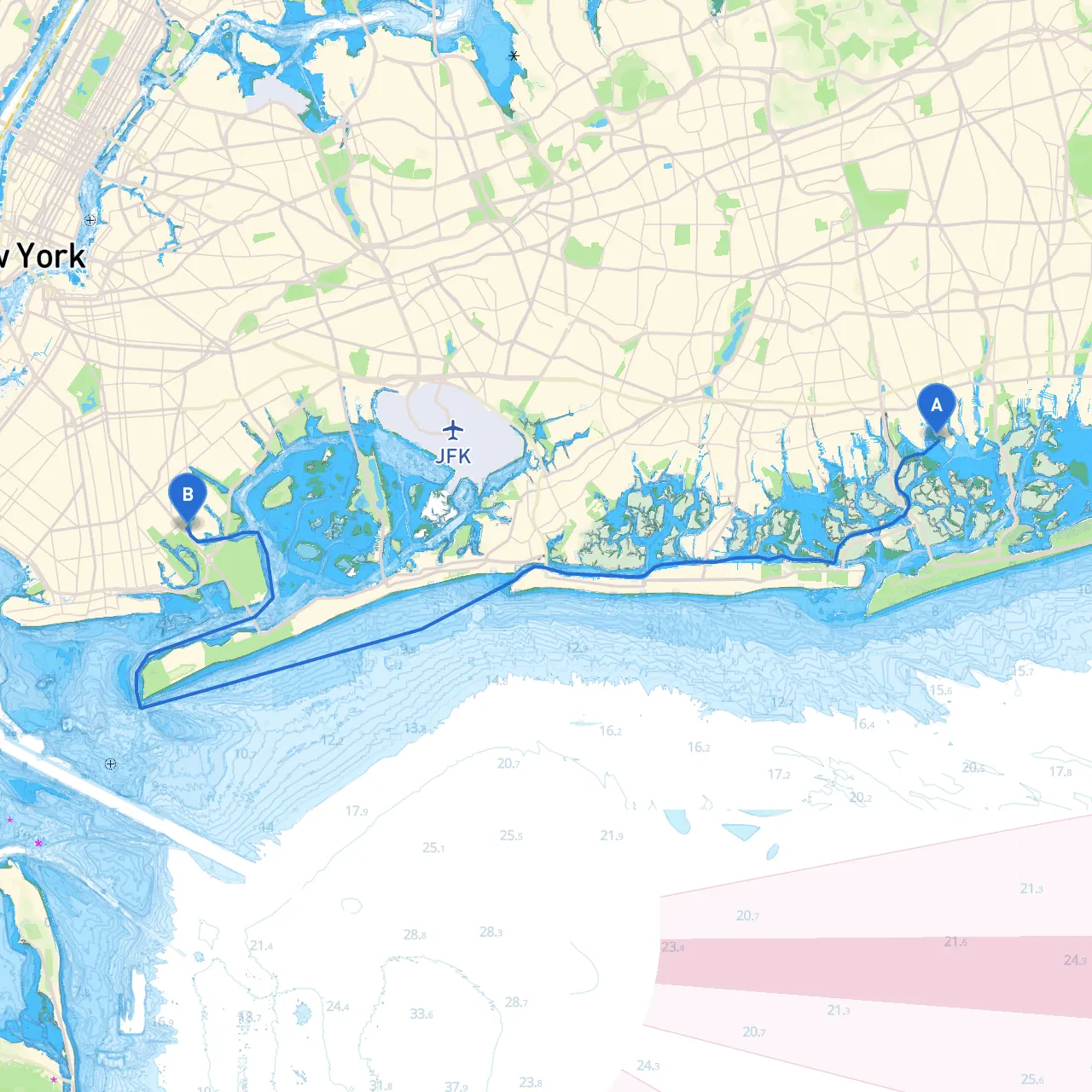
Embarking on a voyage from Merrick, NY to Brooklyn, NY promises to be a delightful experience for any boater eager to explore the waters of Long Island, navigating through urban and natural landscapes. This route is particularly suitable for that adventurous boater with some experience who is comfortable in coastal waters. Safety is paramount, and this plan carefully considers potential hazards, navigational aids, and options for shelter should conditions change.
Starting Point: Merrick Bay As you set sail from Merrick (coordinates -73.53967, 40.64267), begin your journey by heading south into Merrick Bay. The first stretch features tranquil waters, making it ideal for a straightforward departure. Pay attention to marked navigation aids, including buoys indicating channels and shallow areas.
Points of Interest: As you set off, you may want to take a moment to enjoy the local wildlife around the bay, especially birds and marine life.
Heading into South Oyster Bay From Merrick Bay, steer towards the entrance of South Oyster Bay. The key navigational aid here is the buoy marking the channel entrance. The waters can be tricky with changing tides, so keep your speed reasonable to avoid waking and swamping smaller vessels.
Shelter Options: Should the weather take a turn, South Oyster Bay has several marinas and nooks where you can safely dock. Oceanside Marina is a recommended shelter with excellent amenities.
Cruising across the Great South Bay As you enter the Great South Bay, you'll have the opportunity to enjoy its expansive waters. Navigate towards the Great South Bay Bridge, marking key points where you should adhere to local regulations regarding speed limits, especially in the vicinity of the bridge.
Notable Landmarks: Take a moment to appreciate the views of Fire Island and the lighthouse along the bay. This area is also renowned for its fishing opportunities, providing a chance for a quick cast if you’re so inclined.
Carving a Path through Jamaica Bay Leaving the Great South Bay, you'll head towards the historic Jamaica Bay. Keep a watchful eye for the multiple navigation buoys that define the marked channels. Here, the waterways narrow significantly, and maintaining awareness of your surroundings is crucial.
Hazards to Note: Be mindful of the increased boat traffic, as this area is popular for both recreational and commercial fishing. Additionally, be aware of shallow areas that can be revealed at low tide.
Local Attractions: Within Jamaica Bay, take notice of the wildlife sanctuary, perfect for birdwatching. The surrounding parklands offer public access for a short break on land if desired.
Navigating the Channels into Brooklyn Your final stretch will take you through the bustling channels leading into Brooklyn. As you approach the coastline, be alert for the fast ferries and commuter boats. Follow the marked channels for safe passage alongside the poetry of the New York City skyline.
Important Navigation Aids: Pay close attention to the navigational lights and buoys indicating shipping lanes. These waterways are heavily trafficked, and proper signaling when changing course is essential.
Destination: Brooklyn As you arrive in Brooklyn (coordinates -73.91817, 40.60850), you have a variety of marinas to choose from for docking. The Brooklyn Bridge Marina or Red Hook is recommended for its proximity to local attractions.
Final Note on Safety: Ensure that your communication lines are open, either through VHF radio or your boating apps (recommended: savvy navvy) for updates on weather and local regulations.
This route from Merrick to Brooklyn is not just a straightforward journey; it paints a picturesque view of Long Island's coastline and offers the opportunity for spontaneous exploration. With careful planning and attention to safety, you can look forward to an enriching boating adventure filled with potential memorable stops and safe harbors along the way. Safe travels, and enjoy the exhilarating experience of cruising through one of New York's beautiful marine landscapes!