
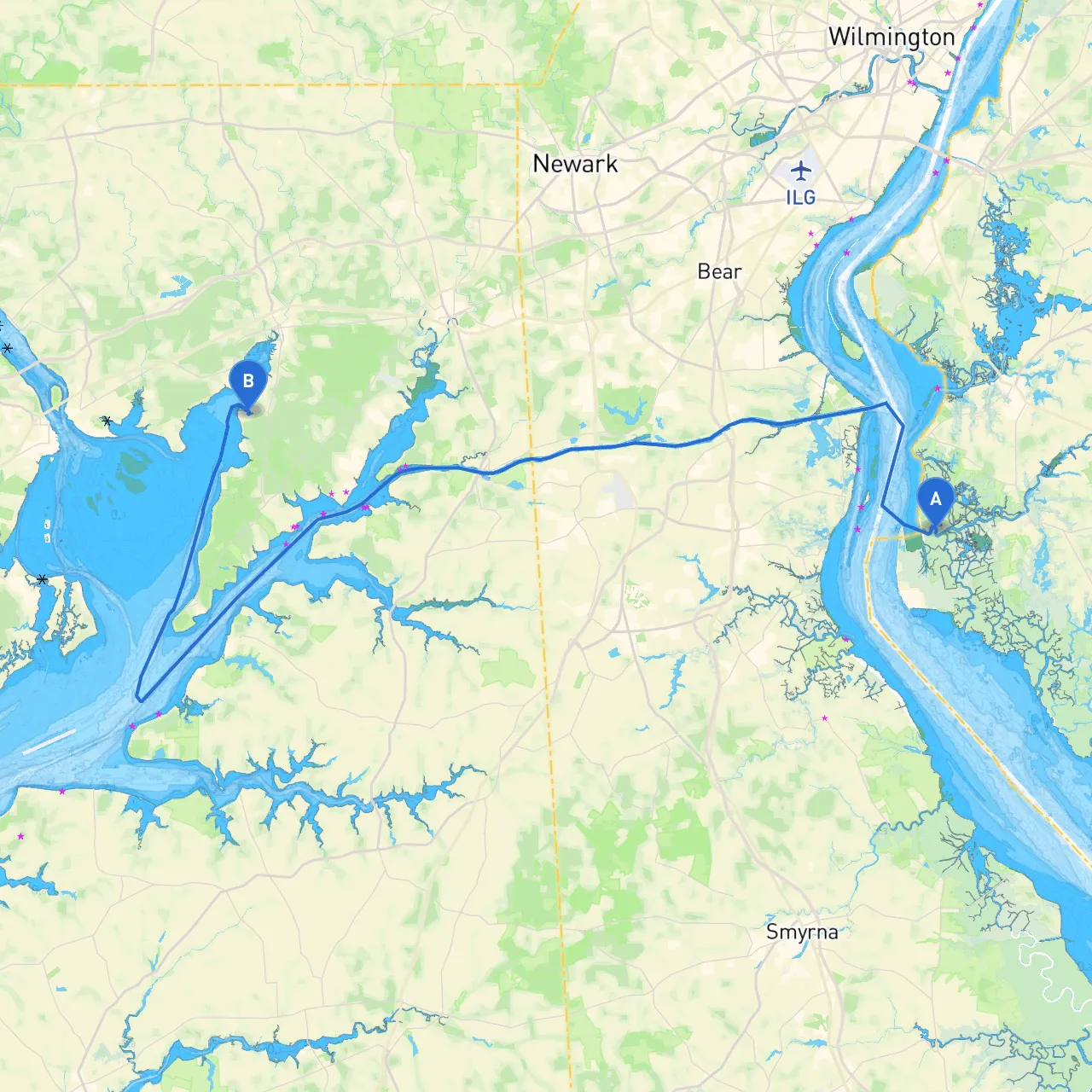
This journey promises both the thrill of exploration and the serenity of nature, with included safety considerations to ensure a smooth and secure passage. The route from Lower Alloways Creek Township, New Jersey, to North East, Maryland, takes you through the beautiful waters of the Delaware Bay and parts of the Chesapeake Bay, offering stunning landscapes, interesting landmarks, and the chance to enjoy peaceful bays in case of unexpected weather changes.
Start Point: Lower Alloways Creek Township, NJ Coordinates: (Long: -75.518228320861, Lat: 39.499233089081)
Begin your journey at the local marina. Before setting off, check your vessel's equipment, ensuring safety gear is in order—life jackets, flares, a first-aid kit, and a working VHF radio are essential. Familiarize yourself with the vessel and review any pertinent charts of the area.
As you leave Lower Alloways Creek, you will head southward towards the Delaware Bay. This part of the route requires attention to tidal currents, which can be strong in this area. Always keep the local tide table handy; it can turn a pleasant day on the water into a challenging one if conditions change.
Upon entering the Delaware Bay, navigate towards the Chesapeake and Delaware Canal. This canal is pivotal in saving time and distance to reach the Chesapeake Bay.
After the canal, you will reach the Chesapeake Bay. This is one of the most scenic parts of your trip, with expansive views and striking shorelines.
As you near your destination, take care to keep the North East River entrance in view.
Destination: North East, MD Coordinates: (Long: -75.9627833333, Lat: 39.55805) Upon arrival, you’ll find various amenities in North East including restaurants and local shops. This is a great opportunity to unwind after your voyage and reflect on your journey while exploring the area.
This trip from Lower Alloways Creek Township to North East, MD is particularly suited for recreational boaters and cruising enthusiasts who appreciate the beauty of nature and local history. It’s a wonderful journey accentuated with multiple points for safe harbor along the way, striking landscapes, and cultural sites for those looking to enhance their experience. Always ensure to check weather forecasts before departure, keep your navigation systems updated, and enjoy the unique charm of the Delaware Bay and Chesapeake regions.
Stay safe, enjoy your trip, and may the winds be at your back!