
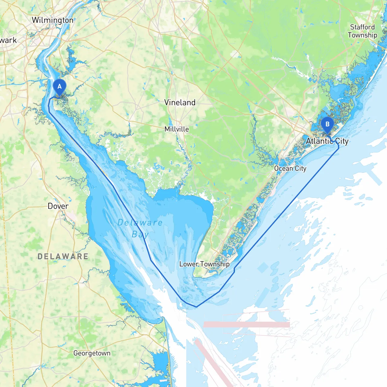
Departure Point: Lower Alloways Creek Township, New Jersey (Coordinates: -75.5182, 39.4992) Arrival Point: Atlantic City, New Jersey (Coordinates: -74.4213, 39.3796)
This route from Lower Alloways Creek Township to Atlantic City is an enriching boating experience perfect for cruisers looking to blend scenic navigation with safety. The journey spans approximately 30 nautical miles and offers the chance to explore diverse waterways while encountering a variety of navigational features and local attractions. The predominant waterway for this stretch is the Delaware River to the Atlantic Intracoastal Waterway, ensuring relatively smooth conditions while facilitating access to several quaint anchorages and bustling areas.
1. Departure and Initial Navigation: - Begin your journey by navigating through Lower Alloways Creek, a protected inlet that offers calm waters ideal for exiting. Keep a watchful eye on the opening and any shallows or submerged hazards as you make your way towards the mouth of the creek.
2. Along the Delaware River: - Once you're on the Delaware River, be prepared for wider channels, but remain cautious of the tugboats and barges that frequent these waters. Maintain a safe distance and adhere to the 1,200-foot channels marked by navigation aids like buoys and beacons. - Points of interest along this stretch include Finns Point Rear Range Light, which is visible and serves as a good navigational landmark.
3. Enter the Salty Waters of the Chesapeake and Delaware Canal: - After a few nautical miles, you'll want to check local tides, as currents can be tricky, especially approaching the canal. The C&D Canal connects directly to the more extensive coastal waterways, where your course will lean southeast toward Atlantic City.
4. Shelter Options: - If the weather takes a turn for the worse, you can divert into Cohanzick Zoo within Bridgeton or seek refuge in Murray's Marina at Salem or Reedy Point — both of which provide excellent shelter from tough conditions.
5. Navigational Aids and Safety Considerations: - As you proceed toward Atlantic City, keep a steady lookout for the Cape May-Lewes Ferry. The ferry’s operational schedule could complicate your route, so stay clear until it docks. - Consult your nautical charts for multiple buoy postings and adjust your course accordingly. Ensure you monitor local VHF channels for traffic updates, special announcements, and any weather advisories.
As you approach Atlantic City, the skyline offers a vibrant sight. You’ll be entering a busy harbor with various marinas available for overnight docking or fueling. Look for Absecon Inlet; it is well marked and provides a safe entry point. Be especially careful of the shifting sands in the inlet, which can cause unexpected shoals.
This pilotage plan is crafted for avid cruisers and families alike, focused on safety and enjoyment. The route from Lower Alloways Creek Township to Atlantic City promises not only breathtaking sights and smooth sailing but also ample opportunity for shelter and exploration. With careful planning, keen navigational awareness, and the right tools at your disposal, your voyage will be safe, enjoyable, and unforgettable.