
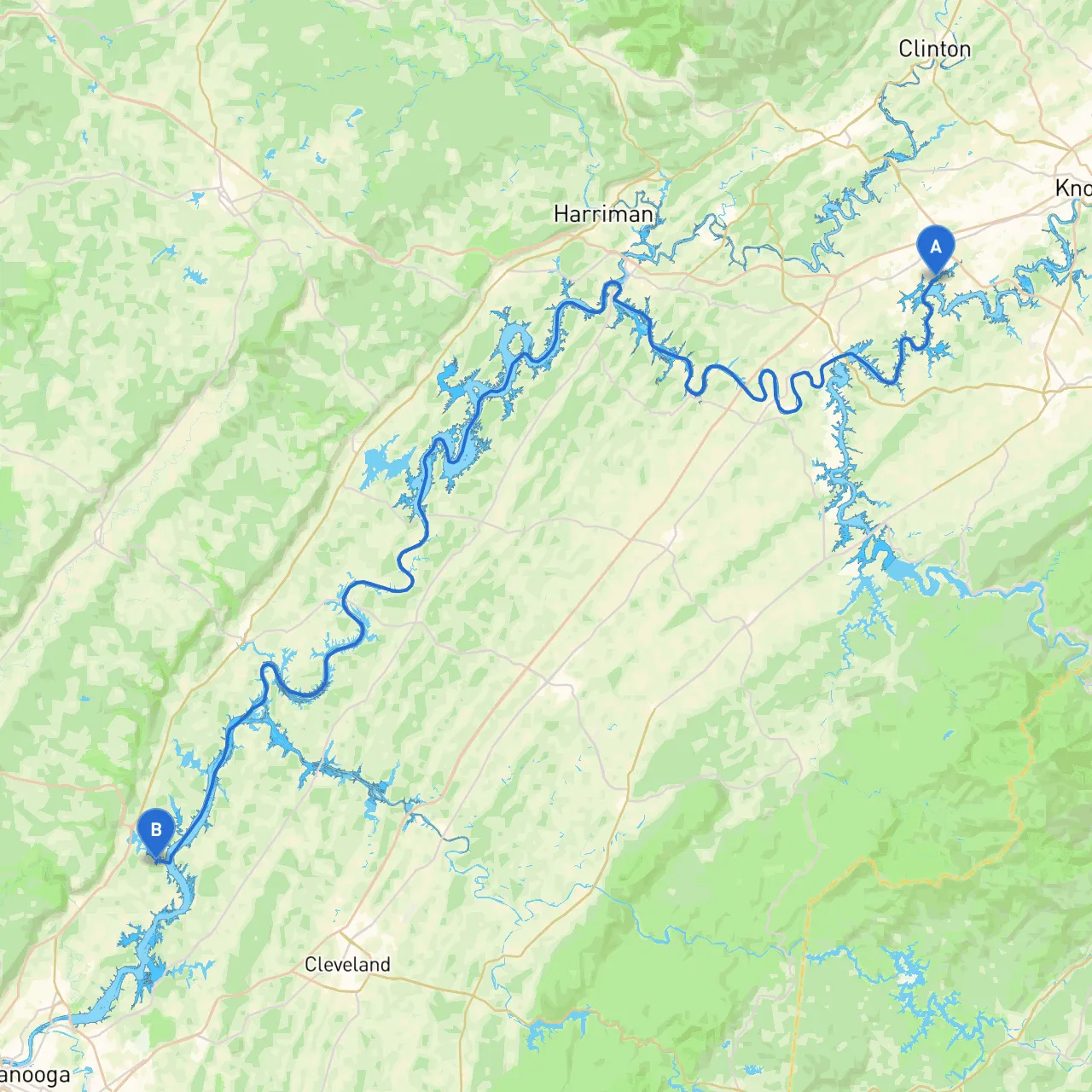
Route Overview:This trip takes you through the scenic waters of the Tennessee River, connecting two charming locations, Knoxville and Soddy Daisy. The journey is approximately 70 miles and offers a mix of natural beauty and local attractions that will enhance your boating experience. This route is particularly suited for recreational boaters, families, and those looking for an enjoyable mix of sight-seeing and relaxation.
Starting Point: Knoxville, TN Latitude: 35.865815 Longitude: -84.130607
Kick off your adventure in Knoxville, a city rich in history and natural beauty. Before you set sail, take a moment to explore the local attractions like the Knoxville Museum of Art or the scenic Knoxville Zoo. Once you’re ready to launch, ensure you check your boat and equipment for safety, adhering to all local regulations.
Leg 1: Knoxville to Fort Loudoun State Park Distance: ~20 miles Navigation Points:
Points of Interest:Fort Loudoun State Park is a great place to pause your journey. Here, you can enjoy hiking trails, historical reenactments, and beautiful picnic spots along the river. It’s an ideal location to shelter in case of inclement weather, thanks to its well-protected coves.
Leg 2: Fort Loudoun to Lenoir City Distance: ~15 miles Navigation Points:
Points of Interest:Once in Lenoir City, you can take a break at a local marina or waterfront park. Stop by the Lenoir City Park for a stroll or enjoy a meal at a local restaurant. Both options provide easy access to shelter in case of changing weather conditions.
Leg 3: Lenoir City to Watts Bar Lake Distance: ~18 miles Navigation Points:
Points of Interest:Watts Bar Lake is a huge, serene body of water renowned for its fishing, boating, and water sports. It’s a fantastic spot for a longer stop, complete with various amenities and a chance to explore nearby nature trails. The lake also provides ample opportunities to find sheltered spots like islands or sheltered bays.
Leg 4: Watts Bar to Chickamauga Lake Distance: ~15 miles Navigation Points:
Points of Interest:Chickamauga Lake is another beautiful stretch where you can enjoy fishing, picnicking, or swimming. Consider visiting the nearby parks, such as TVA Chickamauga Dam Park. This area has plenty of spots to anchor in case of bad weather.
Leg 5: Chickamauga to Soddy Daisy, TN Distance: ~12 miles Final Navigation Points:
Destination: Soddy Daisy, TN Latitude: 35.210780 Longitude: -85.118544
Congratulations on reaching Soddy Daisy! Just like Knoxville, this area is embedded with natural beauty. Within reach is the Chester Frost Park, a great place for some last-minute exploration, fishing, or simply unwinding.
Safety Considerations and Local Regulations:1. Ensure life jackets are readily available for all passengers.2. Adhere to the speed limits enforced in different areas along the river.3. Stay up-to-date with local weather conditions before and during your trip, particularly as the weather can change rapidly in southern regions.4. Familiarize yourself with the boating regulations specific to each locality as they can vary.
As you embark on this delightful journey through East Tennessee’s waterways, don’t forget to leverage technology for safety and navigation. I highly recommend using Savvy Navvy, along with other boating apps, to reinforce your journey’s planning and ensure that you’re always aware of your surroundings. Safe travels and enjoy your boating adventure!