
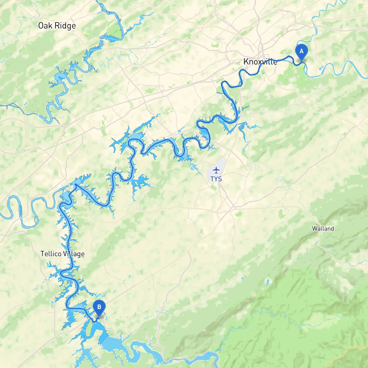
This boating trip from Knoxville to Maryville offers a unique blend of scenic views, navigational challenges, and opportunities to enjoy the great outdoors. Suitable for novice to intermediate boaters, this route follows the Tennessee River and navigates through stunning landscapes and charming towns. The overall journey is approximately 35 nautical miles, making it a perfect day trip or a weekend getaway.
Starting at the coordinates (Long: -83.849934, Lat: 35.959327), you'll find yourself in the heart of Knoxville, with the Knoxville Convention Center and the historic Sunsphere nearby. Before you set off, check weather conditions and ensure your boat is in good working order. Make sure you have your life jackets, navigation equipment, and emergency supplies.
As you depart, head downstream on the Tennessee River towards Pulaski Bay (about 10 nautical miles). This scenic bay not only provides stunning views but also serves as a great shelter if the weather turns unpredictable. The bay is relatively shallow, so take care while navigating, but it’s a perfect spot to anchor and relax, with opportunities for fishing or simply enjoying the tranquility of the water.
As you move along the river, watch for the navigational aids including buoys and markers that help delineate the channel, especially near the confluence with tributaries. Pay attention to the Tennessee River charts as you will encounter several points where the river widens and narrows, and bends may require adjusting your speed to prevent too much wash.
Continuing your journey, consider stopping at the Fort Loudoun Dam. This site has historical significance and offers views of the dam's power generation facilities. It’s also a fantastic area for shoreline activities or taking a short hike if you want to stretch your legs before continuing on to Maryville.
A special mention should be made of the state parks dotted along the route, such as the Fort Loudoun State Park. Here, you could dock and explore the nature trails or enjoy a picnic by the water.
As you approach your destination, navigate toward Maryville (Long: -84.197369, Lat: 35.603060). The area is known for its beautiful waterfront parks, where you can moored and enjoy local eateries and shops. Make sure to take a moment to appreciate the scenic beauty of the area, which is especially resplendent in the autumn when the leaves change color.
Before you embark on your journey, consider using navigation apps like savvy navvy, which provides comprehensive charts and useful information about the route and surrounding areas. Alongside savvy navvy, other apps like Navionics and MarineTraffic can enhance your navigational accuracy and situational awareness.
This route is an exceptional way to experience the beauty of East Tennessee while ensuring your safety and enjoyment. Whether you're a seasoned boater or new to the waters, the blend of natural beauty and accessibility makes this trip essential for your boating adventures. Happy cruising!