
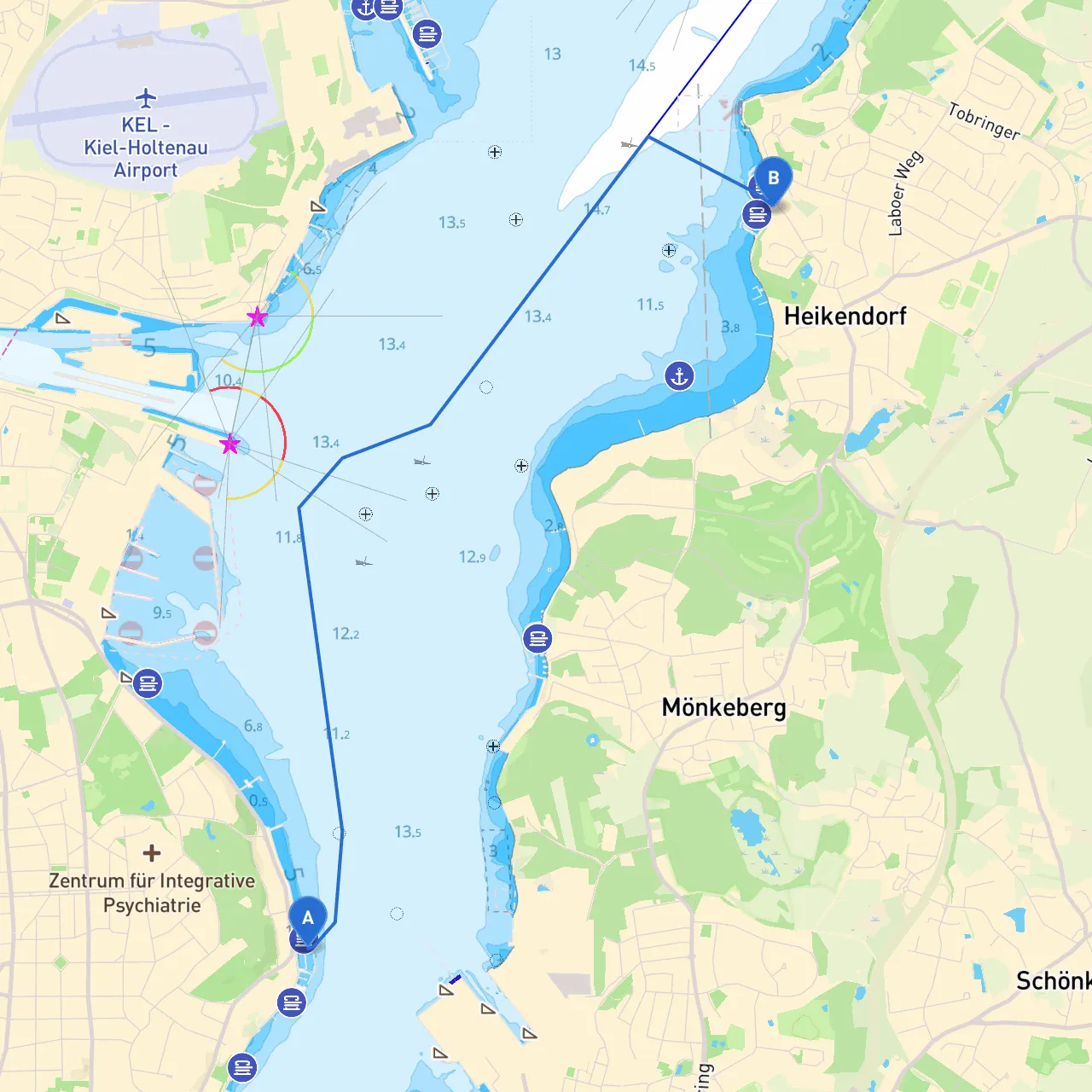
Pilotage Plan: Kiel, DE to Heikendorf, DE
Overview:This planned route from Kiel to Heikendorf offers a charming glimpse of the beautiful Kiel fjord, making it suitable for both experienced and leisurely cruisers seeking a mix of safety and enjoyment. This area is well-marked with navigational aids, and it boasts various points of interest along the way, as well as sheltered bays for a safe haven if the weather should turn inclement.
Start Point: Kiel, DE
Kiel, located at coordinates 54.339° N, 10.158° E, serves as an excellent launch site. It is a vibrant city with a rich maritime history. Before setting off, ensure that your vessel is ready by checking all safety equipment, fuel levels, and communication devices, including your VHF radio, which is crucial for navigation and emergency communication.
Route Overview:
The journey is approximately 6 nautical miles and should take around 1.5 to 2 hours, depending on your cruising speed. The route primarily follows the channels within the fjord to minimize exposure to open waters and strong currents.
Section 1: Departing Kiel
As you leave Kiel, pay close attention to the port's traffic and adhere to local harbor regulations. The Kiel Canal is highly trafficked, and large vessels may be present, so keep a vigilant lookout. For safety, stay within designated navigation channels and maintain a safe distance from large commercial shipping.
Navigational Aids:
Points of Interest:
Section 2: Approaching the Laboe Naval Memorial
As you navigate towards Heikendorf, you will pass the Laboe Naval Memorial, an iconic landmark. The sight of this towering structure is a remarkable reminder of the region's naval history.
Shelter Options:
Hazards:
Section 3: Final Approach to Heikendorf
Continue your journey along the fjord, taking in the scenic views of the coast and the lush landscapes on either side.
Navigation Considerations:
Arrival at Heikendorf:As you approach Heikendorf, located at coordinates 54.374° N, 10.197° E, you will find easy access to a small marina. This charming locale is known for its friendly atmosphere and local seafood eateries, making it a delightful spot to unwind.
Local Regulations:
Conclusion:This route from Kiel to Heikendorf is perfect for day sailing enthusiasts and those looking for safe, navigable waters combined with cultural and historical charm. By following the outlined suggestions and remaining aware of your surroundings, your trip will be both enjoyable and safe.
Recommended Apps:For an enhanced navigation experience, consider using boating apps such as Navionics, Weather4D, and Savvy Navvy, which provide crucial weather forecasts, charts, and route planning tools.
Safe sailing, and enjoy the journey!