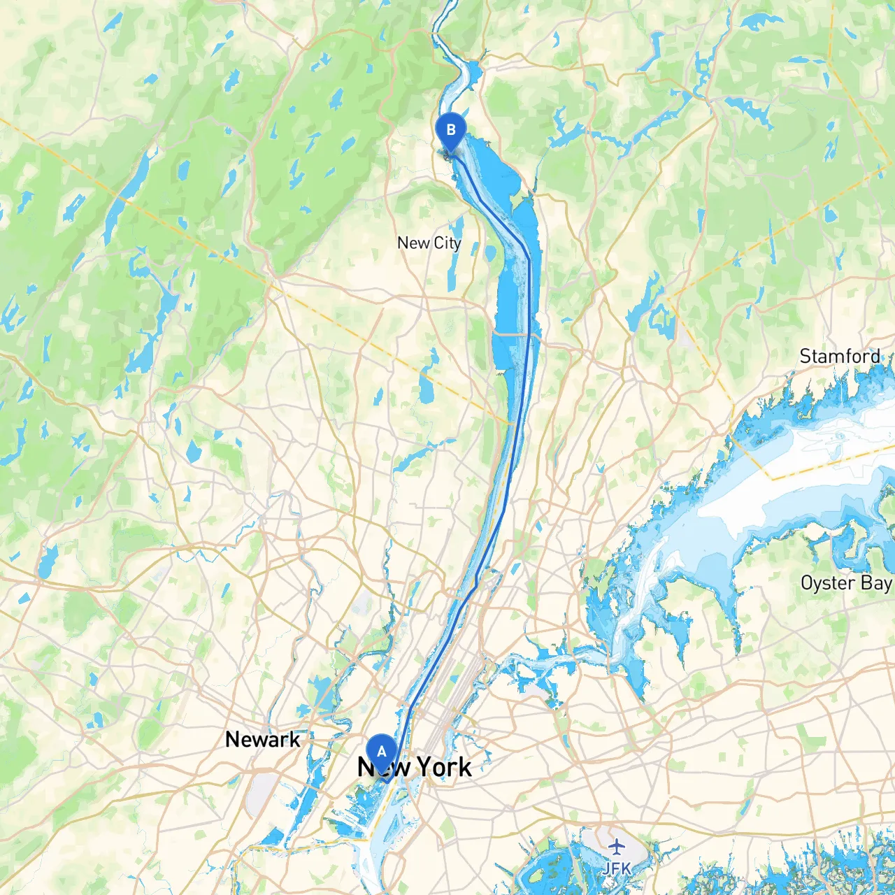
Pilotage Plan from Jersey City, NJ to West Haverstraw, NY
Starting Point: Jersey City, NJ Coordinates: Longitude -74.041634, Latitude 40.702606
Begin your adventure from the bustling hub of Jersey City, situated right across the Hudson River from Lower Manhattan. As you embark on your journey, be mindful of the busy traffic in the Hudson River. The waterway is popular with ferries, commercial vessels, and pleasure craft, so maintain a vigilant watch.
1. Liberty State Park: Just to the north of your departure point, take a moment to soak in the breathtaking views of the Statue of Liberty and Ellis Island—a perfect backdrop for a photo-op.
2. Hoboken Waterfront: As you cruise upstream, you’ll pass by Hoboken, noted for its scenic waterfront park and lively dining options. It’s an excellent spot to dock for a coffee or a meal before continuing onward.
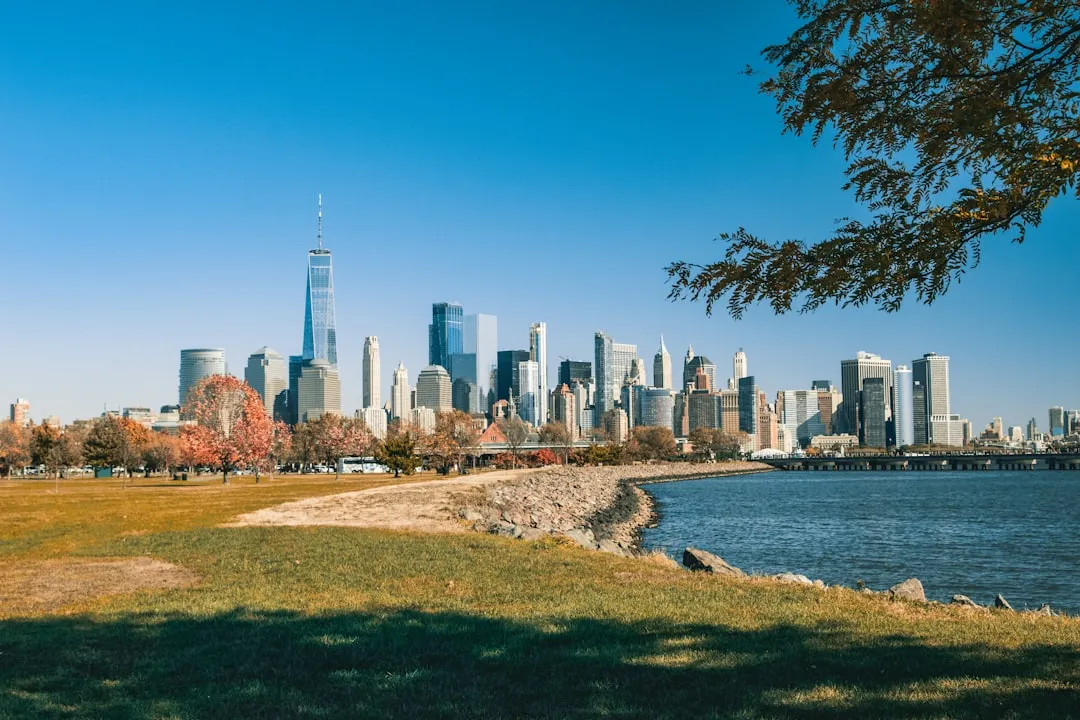
3. Manhattan Skyline: Enjoy the iconic skyline as you navigate north. The visual spectacle of towering skyscrapers makes this route incredibly picturesque.
As you approach the northern part of Manhattan, be aware of the George Washington Bridge and its surrounding area. This section of the Hudson is narrower and busier, so it’s imperative to adhere to navigation rules and keep a close eye on any floating debris, especially after storms.
If the weather worsens, a couple of solid harbor options include:
As you traverse this picturesque waterway, pay attention to these navigational aids:
Familiarize yourself with local regulations, particularly regarding speed limits near marinas and residential areas. These regulations help ensure the safety and enjoyment of all waterway users. Remember that some parts of the river, especially closer to the NYC area, may have no-wake zones.
From Tarrytown, navigate toward the Saw Mill River inlet, which leads to West Haverstraw. The final leg of your journey offers a calm and serene setting against the backdrop of the Palisades. Look out for Haverstraw Bay, and make sure to watch for sailing vessels and other recreational boats.
Coordinates: Longitude -73.965833, Latitude 41.217917
Upon arrival, West Haverstraw offers a quaint town atmosphere, perfect for stretching your legs after your trip. You can explore local parks or even partake in some fishing if the mood strikes.
For a smooth journey, consider using navigation apps such as:
This route from Jersey City to West Haverstraw is best suited for experienced boaters familiar with busy waterways but can also be enjoyable for those ready to take on a new challenge. With beautiful views, strategic stopping points, and safe harbor options, it's a perfect combination of practical navigation and scenic exploration. Stay vigilant, respect the local regulations, and enjoy the journey!