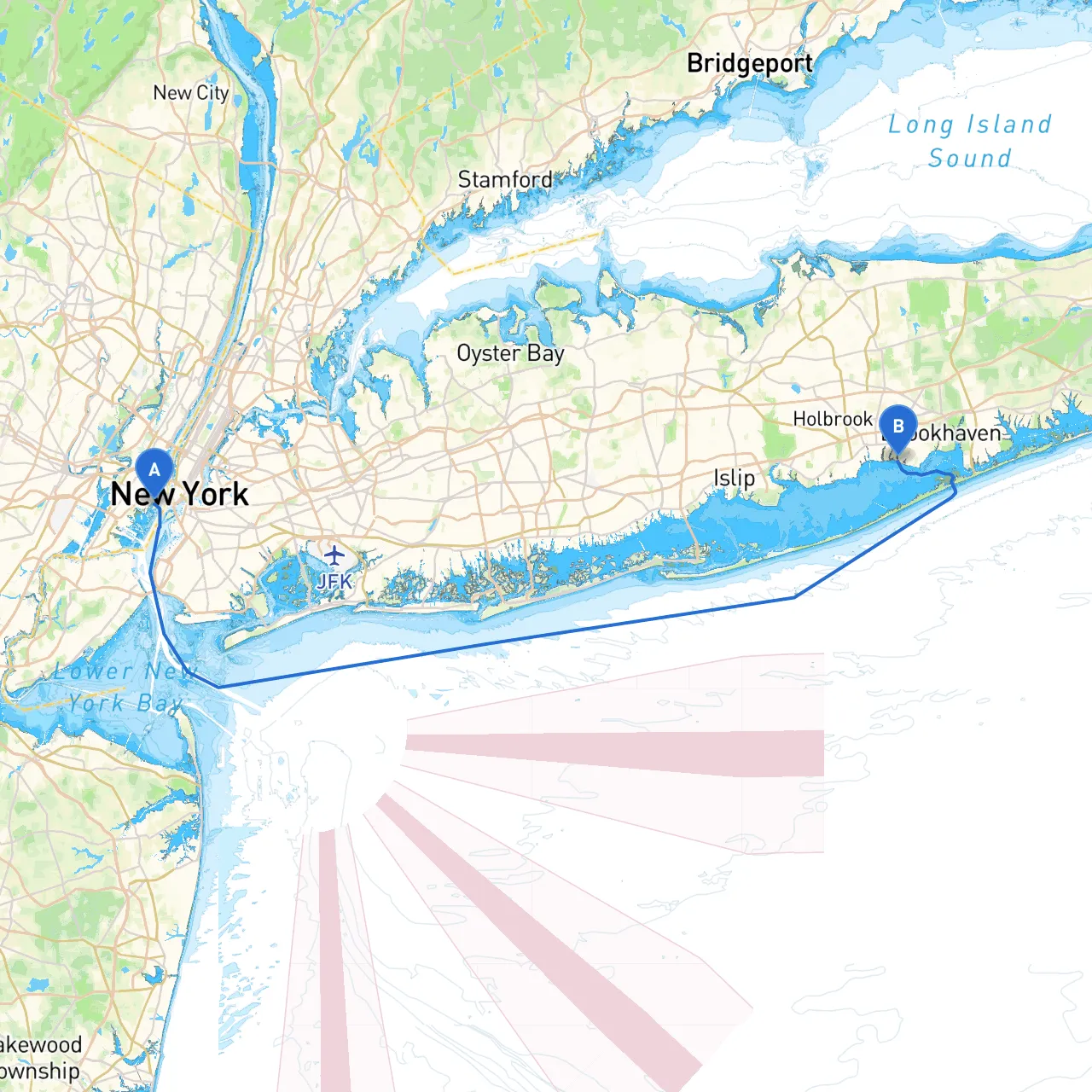
Pilotage Plan: Jersey City, NJ to East Patchogue, NY
Route Overview
This route from Jersey City to East Patchogue offers a blend of picturesque views, intriguing landmarks, and favorable conditions for a safe voyage. It’s particularly suitable for experienced cruising boaters looking for a combination of scenic exploration and safe navigational routes, keeping in mind potential hazards and areas for shelter if storms arise.
Starting Point: Jersey City, NJ
You’ll begin your trip in the bustling waters of the Hudson River. Before departure, ensure that your vessel is equipped for the journey, with all safety equipment checked, a fully stocked first aid kit, and navigation gear at the ready.
Key Navigational Aids and Considerations
- Navigational Beacons: As you make your way southward along the Hudson, keep an eye out for various lighted buoys and markers crucial for avoiding shallow waters. The Statue of Liberty and Ellis Island are both grand landmarks you will pass early on this route.
- Tides and Currents: Be aware that the Hudson River is known for strong currents, especially around the confluences and narrow points. Plan your departure to take advantage of the tides; an outgoing tide can assist your travel southward.
Notable Landmarks and Points of Interest
- The Statue of Liberty and Ellis Island: A must-see! Consider a quick stop for photographs and some sightseeing.
- Verrazzano-Narrows Bridge: As you exit the harbor, the bridge offers a stunning backdrop.
- Sandy Hook Bay: This is a nice open area to take a break if needed. Shelter is available here if weather conditions turn poor.
Transitioning to the Atlantic Intracoastal Waterway (AIWW)
After passing the mouth of the Hudson and entering the Raritan Bay, you may consider entering the AIWW for a more sheltered route along the coast. Avoid fishing boats and be mindful of speed limits in this area to adhere to local regulations.
Hazard Awareness
- Rocky Shoals and Shallow Areas: As you move toward the southern bays, be advised of shallow spots near Great Kills Harbor. Consult your charts frequently and do not hesitate to utilize depth finders.
- Limited Visibility: Fog can roll off of the coast unexpectedly. Ensure your navigation lights are working and always carry a reliable foghorn.
Ideal Stopping Points
- Great Kills Harbor: This offers excellent shelter and amenities for boaters. There’s plenty of space to anchor if you find the weather undesirable or wish to have a leisurely meal.
- Fire Island: A great recreational area for curious boaters. Beaches and trails await for those looking to stretch their legs.
Final Approach: East Patchogue, NY
As you near your destination, keep in mind the
and the corresponding currents. Your approach into East Patchogue can be marked by several prominent landmarks, including local marinas.
Arrival Considerations
- Docking: Be mindful of marina regulations and check for available slips ahead of time.
- Safety Post-Arrival: Once docked, ensure your lights and safety equipment are stowed properly.
Recommended Apps for Navigation
- Savvy Navvy: An excellent app for marine navigation, it provides detailed charts and real-time weather conditions, ensuring a smooth journey.
- Navionics: Another strong option, great for planning routes and recognizing hazards.
This route is perfect for those who cherish both the excitement of navigating busy waters and the peace of sheltered bays. With ample opportunities for stops and vivid landmarks, it promises to be a memorable adventure, all while prioritizing your safety on the water. Enjoy your journey!